Elafonisos [1] ( Greek Ελαφόνησος [2] ) is a small island in the Lakonikos Gulf of the Aegean Sea . It is located at the southeastern tip of the Peloponnese west of the Elos Peninsula and Cape Malea . To the south is the Strait of Elafonisos, an important sea route and the island of Kythira [3] . The population of 1041 is 2011 census resident [4] . The area of the island is 17.859 square kilometers [5] , the coastline is 30 kilometers [6] . The main occupations of the residents are tourist services and fishing.
| Elafonisos | |
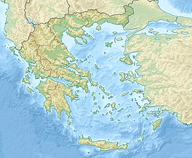
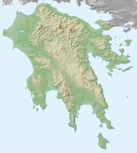
|---|---|
| Greek Ελαφόνησος | |
 View of Simos beach from Sarakiniko peninsula | |
| Specifications | |
| Square | 17.859 km² |
| Highest point | 276 m |
| Population | 1041 people (2011) |
| Population density | 58.29 people / km² |
| Location | |
| Archipelago | Ionian Islands |
| Water area | Laconicos |
| A country |
|
| Periphery | Peloponnese |
| Peripheral unit | Laconia |
The village of Elafonisos is located 8 kilometers west of Neapolis , 35 kilometers south of Molai , 4 nautical miles from Kitira and 25 nautical miles from Yithion [3] .
In the Roman period - the peninsula and Cape Onagnaphone (Donkey jaw, other Greek: Ὄνου γνάθος ) [7] [8] or Onagnat [9] .
The main church on the island is the church of St. Spyridon . Also here are the churches of St. Patapius , Holy Trinity, St. Andrew and St. John [10] .
There is a ferry service with the island [11] .
Content
Elafonisos Community
The community (dim) Elafonisos ( Δήμος Ελαφονήσου [4] ) is part of the peripheral unit of Laconia in the periphery of the Peloponnese . The community of Elafonisos includes five settlements. The area is 19,992 square kilometers [12] . The density of 52.07 people per square kilometer [4] . The administrative center is Elafonisos [4] . Charalambos Llaros ( Χαράλαμπος Λιάρος ) was elected Dimarch in the local elections of 2014.
Created since 2011 under the Kallikratis program [13] .
The community includes 2,033 square kilometers of land on the mainland, where the main agricultural land of the inhabitants of the island is located [3] . There is Lake Strongili ( Λίμνη Στρργγγλη ) and the village of Punda ( Πούντα ) [3] .
One kilometer northeast of the village of Elafonisos and one kilometer from the village of Punda at Cape Punda is the island of Pavlopetri ( Παυλοπέτρι ). Off the coast of Pavlopetri at a depth of 3-4 meters were discovered the ruins of a sunken city that flourished in the 2000s BC. e. [14]
The community also includes the islands of Panayiya ( Νησιά Παναγίας ) near the village of Kato Nisi on the west coast of Elafonisos: Kasela ( Παναγίας Κασέλλα ), Lepto ( Λεπτό ) and Prasonisi ( Πρασονήσι ) [3] . The community also includes the island of Agliftis ( Αγλύφτης ) [3] .
| Locality | Population (2011) [2] , people |
|---|---|
| Capari | 37 |
| Kato Nishi | 156 |
| Lefki | 15 |
| Punda | 17 |
| Elafonisos | 816 |
Population
| Year | Population |
|---|---|
| 1991 | 647 [15] |
| 2001 | 746 [12] |
| 2011 | ↗ 1041 [4] |
Notes
- ↑ Greece: Reference card: Scale 1: 1,000,000 / hl ed. Y. A. Topchiyan ; Ed .: G. A. Skachkova , N. N. Ryumin . - M .: Roskartografiya, Omsk Cartographic Factory , 2001. - (The countries of the world "Europe"). - 2000 copies.
- ↑ 1 2 Πίνακας αποτελεσμάάων Μόνιμου Πληθυσμού-Απογραφής 2011 (Greek) . Ελληνική Στατιστική Αρχή (20 Μαρτίου 2014). Date of treatment October 22, 2017.
- ↑ 1 2 3 4 5 6 Γεωγραφικά στοιχεία (Greek) . Δήμος Ελαφονήσου. Date of appeal October 25, 2017.
- ↑ 1 2 3 4 5 Δελτίο τύπου. Ανακοίνωση των αποτελεσμάτων της Απογραφής Πληθυσμού-Κατοικιών 2011 για το Μόνιμο Πληθυσμό της Χώρας (Greek) . Ελληνική Στατιστική Αρχή (28 Δεκεμβρίου 2012). Date of treatment June 4, 2017.
- ↑ Eπιφάνεια, πραγματικός μόνιμος πληθυσμός και των κατοικημένων νήσων tes Eλλάδος (. Greek) // Σtatiσtikh eπethpiδa τησ Eλλαδοσ 2009 2010. & - Πειραιάς: Ελληνική Στατιστική Αρχή , 2011. - Σ. 46 . - ISSN 0081-5071 .
- ↑ Eπιφάνεια ελληνικών εδαφών και μήκος ακτών (Greek) // Σtatiσtikh eπethpiδa τησ Eλλαδοσ 2009 & 2010. - Πειραιάς: Ελληνική Σττ 28 . - ISSN 0081-5071 .
- ↑ Pausanias . Description of Hellas. III.XXII.10
- ↑ Laconica // The Real Dictionary of Classical Antiquities / ed. F. Lubker ; Edited by members of the Society of Classical Philology and Pedagogy F. Gelbke , L. Georgievsky , F. Zelinsky , V. Kansky , M. Kutorgi and P. Nikitin . - SPb. , 1885.
- ↑ Strabo . Geography , p. 345
- ↑ Αξιοθέατα & Eναλλακτικές (Greek) . Δήμος Ελαφονήσου. Date of appeal October 25, 2017.
- ↑ Συγκοινωνίες & Πρόσβαση (Greek) . Δήμος Ελαφονήσου. Date of appeal October 25, 2017.
- ↑ 1 2 Απογραφή πληθυσμού - κατοικιών της 18ης μαρτίου 2001 (μόνιμος πληθυσμός) (Greek) . - Πειραιάς: Εθνική στατιστική υπηρεσία της Ελλάδας , 2009. - Τ. I. - Σ. 366 . - ISSN 1106-5761 .
- ↑ Αρ. Φύλλου 1292 (Greek) // Εφημερισ τησ κυβερνησεωσ. - 2010. - 11 Αυγούστου. - Σ. 17372 .
- ↑ Παυλοπέτρι Ελαφονήσου (Greek) . Δήμος Ελαφονήσου. Date of appeal October 25, 2017.
- ↑ Μόνιμος και Πραγματικός Πληθυσμός της Ελλάδος. Σύνολο Ελλάδος, νομοί, δήμοι / κοινότητες, δημοτικα / κοινοτικά διαμερίσμα και οικισμοί. Απογραφές πληθυσμού 2001 και 1991 (Greek) (unavailable link) . Ελληνική Στατιστική Αρχή . Date of treatment June 22, 2017. Archived July 16, 2006.
Links
- elafonisos.gov.gr - official site of the Elafonisos community