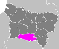
Senlis ( French Senlis ) - a county ( French Arrondissement ) in France , one of the counties in the Picardy region. District Department - Oise . Suprefecture - Senlis . The population of the district for 2012 was 277,038 people. The population density is 206 people / km². The area of the district is 1344 km².
| Senlis | |
|---|---|
| Senlis | |
| A country | France |
| Region | Picardy |
| The Department | Oise |
| Suprefecture | Senlis |
| Number of cantons | 9 |
| Number of Communes | 133 |
| Population ( 2012 ) | 277,038 |
| Density | 206 people / km² |
| Square | 1344 km² |
 | |
Senlis County Cantons (until March 22, 2015):
- Demon
- Crey-Nogent-sur-Oise
- Crey Sud
- Crepe-en-Valois
- Montater
- Nantoy-le-Auduin
- Neuilly en Tel
- Pont Saint Maxans
- Senlis
- Chantilly
Senlis County Cantons (after March 22, 2015):
- Kray
- Crepe-en-Valois
- Meru (partially)
- Montater (partially)
- Nantoy-le-Auduin
- Nogent-sur-Oise (partially)
- Pont Saint Maxans (partially)
- Senlis
- Chantilly
See also
- Department of Oise
- Oise Departments
- List of counties in France
- List of prefectures and suprefectures of France
Links
- National Institute of Statistics - Senlis County (French)