Kurai ridge [1] - a mountain range in the Eastern Altai [2] , Kosh-Agach district , Altai Republic , the watershed of the Bashkaus and Chuya rivers. The length of the ridge is about 140 km, the maximum height is 3446 m, the peak of the Upper Ortolyk. In the south, the ridge borders on the Chui and Kurai steppes. In the east it adjoins the Chikhachev ridge , from the west it is separated from the Aigulak ridge by the valley of the Chibit river. Composed by metamorphic rocks. On the southern slope, continental loose sediments of Paleogene and Neogene emerge. The northern slope below the alpine zone is covered by subalpine meadows and larch forests, and the southern slope is covered by steppe vegetation.
| Kurai ridge | |
|---|---|
 Northern face of the Kurai ridge | |
| Characteristics | |
| Length | 140 km |
| Highest point | |
| Highest peak | Upper Ortolyka |
| Absolute height | 3446 m |
| Location | |
| A country |
|
| Mountain system | Altai mountains |
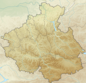
Kurai ridge on a map of the Altai Republic | |


Content
- 1 Etymology
- 2 main peaks
- 3 Gallery
- 4 notes
- 5 Literature
- 6 References
Etymology
Reliably derived from ( Mong. Huray ) - dry, dry earth [3]
Top Peaks
- Upper Ortolyka - 3446 m.
- Tydtuyaryk - 3367 m.
- Yanterek - 3402 m.
- Tobogg - 3201 m. [4]
Gallery
Notes
- ↑ Kuraisky ( No. 0154241 ) / Register of names of geographical objects on the territory of the Altai Republic as of 11/22/2016 // State catalog of geographical names. rosreestr.ru.
- ↑ Map sheet M-45-70 . Scale: 1: 100,000. Status of the area in 1955. 1961 Edition
- ↑ Molchanova, 1979 , p. 243.
- ↑ Map sheet M45-17
Literature
Links
- Toponymic Dictionary of the Altai Mountains . - (scan in PDF format, see page 243) . Date of treatment February 24, 2017.