Kunya is the middle river in the north-west of the European part of the Russian Federation , a tributary of the Lovat river.
| Kunya | |
|---|---|
 The confluence of Kunya (left) in Lovat ( Hill ) The confluence of Kunya (left) in Lovat ( Hill ) | |
| Characteristic | |
| Length | 236 km |
| Swimming pool | 5143 km² |
| Water consumption | 44.8 m³ / s (at the mouth) |
| Watercourse | |
| Source | Vsteselevo |
| • Location | v. Vsteselovo ( Kuninsky district ) |
| • Height | 168.3 m |
| • Coordinates | |
| Mouth | Lovat |
| • Location | Hill |
| • Height | 46 m |
| • Coordinates | |
| Location | |
| Water system | Lovat → Volkhov → Neva → Baltic Sea |
| A country |
|
| Regions | Pskov region , Tver region , Novgorod region |
| HWR code | |
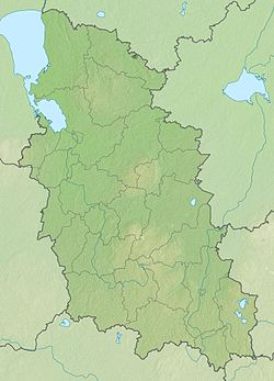
The height of the mouth is 46 m above sea level. The height of the source is 168.3 m above sea level. Length - 236 [2] km, basin area - 5143 [2] km², average discharge at the mouth - 44.8 m³ / s. Belongs to the basin of the Baltic Sea , the largest settlement on the river is the town of Kholm (at the mouth). The village of Kunya in the Pskov region is located 13 km from the river on the tributary of Lusne . The largest tributaries are Usvyata , Seryozha , Bolshoi Tuder , Maly Tuder . Almost all of the Kunya tributaries are right-handed, as Lovat flows almost parallel to the west. The largest tributary is Seryozha .
Kunya originates from the lake. Vsteselevo in the Pskov region , then flows from south to north along the territory of the Tver and Novgorod regions , flows into Lovat in the city of Holm 192 km from the mouth of Lovati.
In the upper reaches the river is meandering, the banks are very boggy. Beyond the mouth of the Usvyata river enters a wooded valley, the width is 30 - 40 meters. In this section, the river forms numerous rapids and rifts. After the confluence of Seryozha, the width of the river increases to 80 m.
The river is of interest to water tourists.
Tributaries (km from the mouth)
- 2.9 km: Bolshoi Tuder River (Tuder, Guben)
- 5.2 km: Small Tuder River (Guben)
- 13 km: Aleshnia river
- 33 km: Seryozha River
- 48 km: River Rubezhnitsa
- 91 km: Oka River
- 95 km: Bolshaya Nosha river
- 101 km: Gubenka river
- 109 km: Sviritsa river
- 120 km: Dobsha River (Dopsha)
- 121 km: Black River
- 132 km: Usvyata river (Usvyazha, Svyataya)
- 162 km: Lusnya river
- 177 km: Maryata River
Notes
- ↑ Surface Water Resources of the USSR: Hydrological Understanding. T. 2. Karelia and the North-West / ed. E.N. Tarakanova. - L .: Gidrometeoizdat, 1965 .-- 700 p.
- ↑ 1 2 State Water Register . Kunya River . textual.ru . Ministry of Natural Resources of Russia (March 29, 2009). Date of treatment December 20, 2018. Archived March 29, 2009.
Links
- Kunya (river) - an article from the Great Soviet Encyclopedia .