Hebrides ( English Hebrides [ˈhɛbrɨˌdiːz] , Gaelic. Innse Gall ) - an archipelago in the Atlantic Ocean off the western coast of Scotland . Included in the group of the British Isles . Two island chains of the archipelago - the Inner and Outer Hebrides , separated by the straits of Little Mintch and North Mintch , as well as the inland Hebri Sea .
| Hebrides | |
|---|---|
| English Hebrides , Gaelic. Innse gall | |
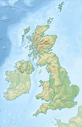
 Hebrides. Pink - Internal , Orange - External Hebrides | |
| Specifications | |
| Number of islands | about 500 |
| Largest island | Lewis & Harris |
| total area | 7200 km² |
| Highest point | 1009 m |
| Population | 44 759 people (2001) |
| Population density | 6.22 people / km² |
| Location | |
| Water area | Atlantic Ocean |
| A country |
|
| Region | Scotland |

Content
Description
The Hebrides are a widely scattered group of about 500 rocky, mostly tall islands, of which about 100 are inhabited. [1] The surface is about 7.2 thousand km², of which about 1.6 thousand km² are occupied by lakes. Most of the surface is rocky or swampy plains ( peat bogs ). There are low mountains up to 1009 m high (Cullin Hills Mountain on the Isle of Skye ), as well as lava fields and traces of ancient glaciation ( trogs , carras ).
Humid marine climate , the average January temperature is 4-6 ° C, July - 12-14 ° C. There is a lot of precipitation, up to 2000 mm per year. From the vegetation - meadows on soddy-coarse humus and sod-peaty soils, heaths , and occasionally groves of undersized birch . [2] The increased humidity has contributed to the formation of island landscapes, where lakes alternate with swampy meadows and peat bogs, and coastal cliffs, centuries blown by the winds and sanded by ocean waters, are distinguished by their bizarre shapes and outlines. [3]
Inner Hebrides
The Inner Hebrides include the Isles of Skye , Mull , Islay , Jura , Ram and others. The northern islands are part of Highland County, and the southern islands are Argyll and Butte County.
Outer Hebrides
The Outer Hebrides include the Lewis and Harris Islands (consisting of two historical parts of Lewis and Harris , often referred to as the “islands”), North Uist , Benbekyula , South Uist , Barra, and others. The Outer Hebrides administratively form the Nah's County Elanan Shyar (formerly called Western Isles).
History
The very first inhabitants of these islands were, apparently, the Picts , who had been considered subjects of the Scottish kings since 843 , and by the 12th century they were practically assimilated by the Scots . For centuries, the islands were in fact ruled by Scottish foremen. The Parliamentary Act of 1748 stripped these latter of their rights, but even now, most of the land is the property of the chiefs of the Scottish tribes (clans) .
Economics
Residents are mainly engaged in fishing and animal husbandry . Established production of woolen fabrics ( tweed ); tourism. [1] The largest city is Stornoway on Lewis.
Notes
- ↑ 1 2 Dictionary of modern geographical names / Rus. geo about . Mosk. Centre; Under the total. ed. Acad. V.M. Kotlyakova . Institute of Geography RAS . - Yekaterinburg: U-Factoria, 2006.
- ↑ Hebrides // Great Soviet Encyclopedia : [in 30 vol.] / Ch. ed. A.M. Prokhorov . - 3rd ed. - M .: Soviet Encyclopedia, 1969-1978.
- ↑ Hebrides: a journey into the realm of waves, winds and fogs . proboating.ru. Date of appeal September 21, 2016.