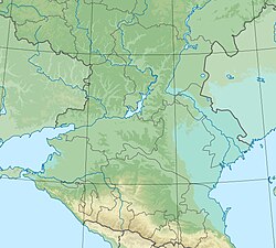
Sal (in the upper reaches of Dzhurak-Sal ; Kalm. Sal is a raft [3] ) is a river in the Rostov region , the left tributary of the Don River . Length - 776 [4] km, basin area - 21.3 thousand [4] km².
| Sal | |
|---|---|
| Calm Sal | |
| Characteristic | |
| Length | 776 km |
| Swimming pool | 21 300 km² |
| Water consumption | 15 [1] m³ / s ( Batlaevskaya ) |
| Watercourse | |
| Source | |
| • Location | Dzhurak beam, Tselinny district of Kalmykia |
| • Height | 171 m |
| • Coordinates | |
| Mouth | Don |
| • Location | Semikarakorsk ( Rostov region ) |
| • Coordinates | |
| Location | |
| Water system | Don → Sea of Azov |
| A country |
|
| Regions | Kalmykia , Rostov Region |
| HWR code | |

Content
- 1 Name
- 2 General physical and geographical characteristics
- 3 Riverbed
- 4 Pool
- 5 tributaries
- 6 Hydrology
- 7 notes
- 8 Literature
Title
According to one version, the name of the river is derived from the Turkic "sal" - "tributary of the river, its sleeve, branch, branching; intermountain hollow ” [5] . On the other, comes from calms. Sala or Sal . The word “sala” in Kalmyk means “beam, ravine”, and the word “sal” means “raft” [3] and is associated with rafts, with the help of which Kalmyks crossed the once-deep river during roaming.
General physical and geographical characteristics
The river originates under the name Dzhurak-Sal on the western slopes of the Ergeni hill in the Dzhurak beam in the Republic of Kalmykia , near the border with the Rostov region . After 180 km, at the confluence of the Kara-Sal river, it changes its name to Sal.
Kara-Sal and Dzhurak-Sal have a low flow rate, some areas are swampy [6] .
Sal is tortuous throughout, resulting in a more than 2.5-fold increase in length against length in a straight line. The meanders of the river wear the most bizarre form of complex loops, bending in different directions. These loops, often breaking through, secede from the channel, forming elders , bearing the local name "estuaries." Usually they dry out quickly, but due to abundant moisture during high water, fresh green vegetation is kept on them.
On the steppe arid areas of the valleys of the Sal and Dzhurak-Sal rivers, chestnut-type soils, often solonetzic and saline, as well as complexes of these soils with solonetzes, are common [1] .
Riverbed
The Sala bed is laid among terrace deposits and rises somewhat above the surrounding valley . The shores are composed of loesslike loams [5] .
The channel is mostly shallow, especially in the middle reaches, between the Ilyinov farm and the village of Yuzhny . However, along with shallow water, deep streams are found in the channel, reaching 5-7 m at low water , such as, for example, above the Krepyanka farm. In the channel there are many outputs of powerful sources. This is due to the fact that groundwater lies 2-5 m above the low-water level of the river, due to which the river, as it were, drains the surrounding surface, sucking its water. Sometimes sources go out on the slopes of the channel and the valley, causing bogging. In the lower reaches, due to the lowered flat topography of the valley, the bogging is almost constant, since water, lingering in all small lowering of the topography besides old ladies, which have the local name “chigonaki”, densely overgrown with reeds, forms a significant water surface, and in the estuarine area the bogging occupies a dominant position. In many places, the riverbed is so overgrown with reeds that the water mirror is imperceptible even at close range. Waterlogging contributes to annual sediment deposition in the floodplain after high water spills, reaching 3 to 20 cm [7] .
- Channel Change
Until 1915, Sal flowed into the Don near the village of Razdorskaya . However, during the flood of 1915, Sal, having flooded the low banks, broke into the previously planned channel and now with a short sleeve it flows 2.0-2.5 km below the city of Semikarakorsk , having a narrow channel at the very mouth, with a width of about 14-18 m, despite the fact that the channel width in the lower reaches is 80-100 m [7] .
Pool
The catchment area is a fairly flat steppe (see Salskie steppes ), the upper, eastern part of which reaches a height of 120 m. The catchment area is 21,300 km². The catchment area is asymmetric and the left side of the basin is larger than the right. The Salo-Manych watershed is quite elevated, passing through Yergeny . The dividing line between Sal and Don runs much closer to Sal, especially in the lower reaches. Therefore, significant tributaries of the Sal are present only on the left, and on the right, in addition to a small tributary of the river. Eric , who flows into Sal, just below the Shcheglov farm, there are only short but very deep beams [7] .
Tributaries
According to the state water registry [4] , the following flows into Sal (from the mouth):
- Bolshaya Kuberle River (Kuberle beam)
- Malaya Kuberle River (Kuberle, bal. Mal. Kuberle)
- Mazanka River (Khujurta, Beam Big Mazanka)
- Eric River (Eric beam)
- Big Gashun River (Big Gashun beam)
- Kara-Sal river (Karasal, Hamkurka, Sal)
- Amta River
- Zagista River (Zegista)
- Bulukta River
Hydrology
The upper saline basin is characterized by the greatest aridity of the climate. Precipitation here is about 300 mm per year, and evaporation, due to the high summer temperature, prolonged dry winds and, therefore, low relative humidity, is extremely large. Due to these climate features, the role of summer precipitation in the river’s nutrition is small [1] . High water falls in March - April , in some years, after snowy winters, with a large rise in water level [6] . The average annual water flow at the mouth (near the village of Batlaevskaya ) is 15 m³ / s [1] , 205 km from the mouth - 9.9 m³ / s [7] .
Estimated maximum water flow in m³ / s, mouth [1]
The river is characterized by a summer-autumn low water, which is sometimes interrupted by rain floods. In the upper and middle reaches, it dries up in summer from 8 to 200 days in different years [7] . In the middle course, the river receives water from the Tsimlyansk reservoir along the Don main canal [6] . Sal freezes in mid-December, ice formation is unstable and lasts until the end of March, in rare harsh winters it freezes in the upper reaches.
Notes
- ↑ 1 2 3 4 5 Scheme of the integrated use and protection of water bodies of the Don river basin. Book 1. General characteristics of the pool (inaccessible link) . Archived June 26, 2015.
- ↑ Surface Water Resources of the USSR: Hydrological Understanding. T. 7. Donskoy district / ed. D. D. Mordukhai-Boltovsky. - L .: Gidrometeoizdat, 1964 .-- 267 p.
- ↑ 1 2 sal
- ↑ 1 2 3 State Water Register . Sal (Dzhurak-Sal, Dzhuryuk-Sal, Dzhuru) . textual.ru . Ministry of Natural Resources of Russia (March 29, 2009). Date of treatment December 20, 2018. Archived March 29, 2009.
- ↑ 1 2 Sal River
- ↑ 1 2 3 Inflow of the Don River - Sal River
- ↑ 1 2 3 4 5 Nature of the Rostov Region (Yatsuta K.Z.)
Literature
- Sal // Big Soviet Encyclopedia : [in 30 vol.] / Ch. ed. A.M. Prokhorov . - 3rd ed. - M .: Soviet Encyclopedia, 1969-1978.
- Sal // Dictionary of modern geographical names / Rus. geo about . Mosk. center; Under the total. ed. Acad. V.M. Kotlyakova . Institute of Geography RAS . - Yekaterinburg: U-Factoria, 2006.