Prokhladnensky district is an administrative-territorial unit and municipality ( municipal district ) as part of the Kabardino-Balkarian Republic of the Russian Federation .
| Municipal District | |||||
| Prokhladnensky district | |||||
|---|---|---|---|---|---|
| Kabard.-Cherk. Cool Kui / Cool District Karach.-balk. Cool area [1] | |||||
| |||||
| A country | |||||
| Included in | |||||
| Includes | 19 municipalities | ||||
| Adm. Centre | cool city | ||||
| Head of District Administration | Zhuravlev Andrey Ivanovich | ||||
| Chairman of Local Government | Biryukov Vladimir Ivanovich | ||||
| History and Geography | |||||
| Date of formation | 1937 year | ||||
| Square | 1342.02 [2] km² (10.76%, 5th place ) | ||||
Height
|
| ||||
| Timezone | MSK ( UTC + 3 ) | ||||
| Population | |||||
| Population | ↘ 45 168 [3] people ( 2019 ) (5.21%, 9th place ) | ||||
| Density | 33.66 people / km² (10th place) | ||||
| Nationalities | Russians , Kabardians , Turks | ||||
| Denominations | Orthodox , Sunni Muslims | ||||
| official languages | Kabardian , Balkar , Russian | ||||
| Digital identifiers | |||||
| Okato | 83,225,000,000 | ||||
| Telephone code | +7 86631 | ||||
| Official site | |||||
 | |||||
The administrative center is the city of Prokhladny ( not included in the district ).
Geography
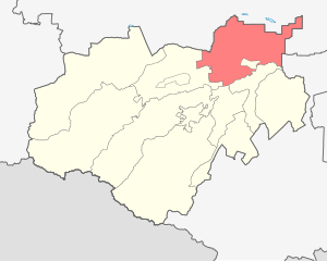
The Prokhladnensky municipal district is located in the northeastern part of Kabardino-Balkaria and borders the lands of Maisky and Urvan districts in the south, the Baksan region in the west, as well as the lands of the Kirov and Kursk districts of the Stavropol Territory in the north and the Mozdok region of North Ossetia in the east.
The area of the Prokhladnensky municipal district is - 1,341.97 km². The distance from the regional center ( Prokhladny ) to the capital of the republic ( Nalchik ) is 57 km.
- Relief
The relief of land in the region is represented by an accumulative sloping plain, which is weakly dissected and weakly wavy in nature, with a general decrease from northwest to southeast, in some places with a general gradual decrease from west to east. In some places, the microrelief is presented in the form of small oval closed depressions - saucers. The steepness of the slopes of the arable land ranges from 1 ° to 2 °. Among the arable lands, plots with an almost perfect square shape prevail. In geomorphological terms, the territory of the region belongs to the flat zone of the republic. The soil cover is heterogeneous and is represented by southern chernozems , heavy soils - loamy , chernozem-low humus, heavy loamy, carbonate, rarely meadow chernozem and others.
- Hydrology
Of the rivers flowing through the territory of the district, the largest are: Malka , Baksan , Kurkuzhin , Baksanenok , Geduko , Shakoy and many small branches and ducts, which are the main arteries for irrigation canals. Also in the district there is a developed network of irrigation canals and artificial reservoirs used to regulate canals. The largest canals in the district are - channel them. Lenin , Right Bank Canal and Prokhladnensky Canal.
- Climate
The climate of the region, as a whole on the flat zone of the republic, is humid and temperate . In summer, the temperature reaches + 27 ... + 35 ° C, in winter temperatures can drop to −25 ° C, but rarely drop below −10 ° C. The humidification coefficient is from 0.22 to 0.26, which is significantly lower than the optimum in the republic - 0.5. This is primarily due to the fact that the eastern part of the Prokhladnensky region is subject to warm winds and dry winds blowing from the Nogai steppes and the Caspian lowland than the rest of the more elevated territory of the republic.
In general, climatic conditions are favorable for the cultivation of all zonal crops and perennial plantings, subject to irrigation. The growing season lasts 175-187 days, the sum of the temperatures for this period is 3420 ° C. The prevailing winds are eastern rhombuses , accounting for approximately 50% of the total time of the winds.
- Minerals
In Prokhladnensky district there are deposits of clay, sand and gravel and construction sand, and there are also proven deposits of oil .
- Flora and fauna
The vegetation cover of the region consists of forests, meadows, steppes. The forested area throughout the district is 54.76 km². The composition of forests by species is characterized by the predominance of broadleaf species ( oak , ash , alder , maple , etc.). The fauna of the area is rich in a variety of animals and birds. Wild boar , hare , fox , and weasel are common here. The most valuable of the birds are pheasant , partridge , hazel grouse , quail , white swan . In the lakes of the region there are carp , carp , grass carp .
History
On March 22, 1924, by the decree of the Presidium of the KBAO as a result of the disaggregation of the Baksan District, the Primalka District was formed. 10 village councils were transferred to the newly formed district.
In 1931, the Primalka district was transformed into the Primalka district .
In March 1932, the Prokhladnensky district was abolished. Village councils of the Prokhladnensky district: Yekaterinograd, Priblizhnensky, Soldiersky and Prokhladnensky village councils were transferred to the Primalkinsky district of the Kabardino-Balkarian Autonomous Region. The Kanovsky, Rostov and Eigenheim village councils and the Baltic Worker grain farm plot were handed over to the Mozdok district . The Soviet village council was transferred to the Georgievsky district [4] .
By the Decree of the Presidium of the All-Russian Central Executive Committee of December 29, 1937 [5] and the Decree of the Presidium of the Executive Committee of the KBASSR on January 7, 1938, the Prokhladnensky District was restored as part of the KBASSR. It included the settlements previously included in the Primalka district , as well as the Proletarian village council and Primalka grain farm [6] .
In 1946, the Soldiers' Village Council was transferred to the Primalkinsky District, and the Primalkinsky and Novo-Poltava Village Councils from the Primalkinsky District to Prokhladnensky.
By the Decree and Decree of the Presidium of the Supreme Council of the KBASSR of September 29, 1959, the territory of the abolished Primalka district was transferred to Prokhladnensky District.
In 1963, the Prokhladnensky district was transformed into the Prokhladnensky rural area on the basis of the Prokhladnensky district and parts of the Baksansky and Maisky districts with the center in the city of Prokhladny.
In 1965, the Prokhladnensky rural area was transformed back into the Prokhladnensky district, and restored to its former borders. In the same year, the Prokhladnensky City Council was allocated from the district as an independent municipal formation within the republic. But at the same time, the city of Prokhladny was left by the administrative center of the Prokhladny district.
In 2005, rural administrations were abolished in the district and 19 municipalities with the status of rural settlements were formed.
Population
| Population | ||||||||
|---|---|---|---|---|---|---|---|---|
| 2002 [7] | 2010 [8] | 2011 [9] | 2012 [10] | 2013 [11] | 2014 [12] | 2015 [13] | 2016 [14] | 2017 [15] |
| 46,425 | ↘ 45 533 | ↗ 45 539 | ↘ 45 398 | ↗ 45 439 | ↘ 45 321 | ↘ 45 205 | ↘ 45 195 | ↘ 45 148 |
| 2018 [16] | 2019 [3] | |||||||
| ↗ 45 247 | ↘ 45 168 | |||||||

- National composition
According to the 2010 All-Russian Population Census [17] :
| People | Number people | Share from the whole population,% |
|---|---|---|
| Russians | 24,672 | 54.18% |
| Kabardinians ( Circassians ) | 12 792 | 28.10% |
| Turks | 2,488 | 5.46% |
| Balkarians | 1,196 | 2.63% |
| Ukrainians | 609 | 1.34% |
| gypsies | 538 | 1.18% |
| Ossetians | 478 | 1.05% |
| other | 2,445 | 5.39% |
| not indicated nationality | 305 | 0.67% |
| Total | 45 533 | 100.0% |
- Age and sex composition
According to the 2010 All-Russian Population Census [18] :
| Age | Men people | Women, people | Total number of people | Share of everything population% |
|---|---|---|---|---|
| 0-14 years old | 4766 | 4592 | 9358 | 20.55% |
| 15 - 59 years old | 14,260 | 14 852 | 29 112 | 63.94% |
| from 60 years | 2605 | 4458 | 7063 | 15.51% |
| Total | 21 631 | 23 902 | 45 533 | 100.0% |
Men - 21 631 people. (47.5%). Women - 23 902 people. (52.5%) [19] .
The average age of the population is 36.0 years. The average age of men is 33.9 years. The average age of women is 37.9 years.
The median age of the population is 34.0 years. The median age of men is 31.8 years. The median age of women is 36.2 years.
Municipal structure
District population distribution
with. Karagach (13.47%)
with. Altud (12.19%)
with. Primalka (10.26%)
Art. Soldier (9.62%)
Art. Ekaterinograd (7.41%)
The rest (47.05%)
In Prokhladnensky municipal district there are 41 settlements consisting of 19 rural settlements [20] [21] [22] :
| No. | Rural settlement | Administrative Centre | amount populated points | Population | Square, km² |
|---|---|---|---|---|---|
| one | Altud | village Altud | one | 5504 [3] | 77.63 [2] |
| 2 | Annunciation | Blagoveshchenka village | 7 | 1874 [3] | 66.75 [2] |
| 3 | Further | Dalnee village | 2 | 1035 [3] | 85.78 [2] |
| four | Zarechnoe | Zarechnoye village | 2 | 1242 [3] | 71.50 [2] |
| five | Elm | village of Karagach | one | 6083 [3] | 81.44 [2] |
| 6 | Krasnoselskoe | village Krasnoselskoye | four | 2195 [3] | 72.41 [2] |
| 7 | Malakanovskoe | village Malakanovskoe | one | 437 [3] | 21.53 [2] |
| eight | Novo-Poltava | the village of Novo-Poltava | one | 1185 [3] | 34.61 [2] |
| 9 | Primalka | Primalkinsky village | five | 6428 [3] | 52.12 [2] |
| ten | Proletarian | village of Proletarskoe | one | 2465 [3] | 95.43 [2] |
| eleven | Psynshoko | village Psynshoko | one | 693 [3] | 9.98 [2] |
| 12 | Soviet | Soviet village | one | 358 [3] | 6.95 [2] |
| 13 | village of Ekaterinograd | village of Ekaterinograd | one | 3345 [3] | 114.42 [2] |
| 14 | Priblizhnaya village | Priblizhnaya village | one | 1699 [3] | 52.35 [2] |
| 15 | Soldiers' Village | Soldiers' Village | 2 | 4994 [3] | 97.85 [2] |
| sixteen | Ulyanovsk | village Ulyanovsk | 3 | 1375 [3] | 67.64 [2] |
| 17 | Training | Educational village | 3 | 1893 [3] | 110.25 [2] |
| 18 | Chernihiv | Chernihiv village | 2 | 906 [3] | 30.82 [2] |
| nineteen | Amber | Yantarnoe village | 2 | 1457 [3] | 45.81 [2] |
- Settlements
In footnotes to the name of the settlement the municipal affiliation is indicated
|
|
|
Local government
Administration of the Prokhladnensky municipal district - the city of Prokhladny , ul. Gagarina, No. 47.
The structure of local government of the municipality is composed of:
- The local government council of the Prokhladnensky municipal district is an elected representative body of the district;
- Chairman of the local government council of the Prokhladnensky municipal district - the highest official of the district;
- The local administration of the Prokhladnensky municipal district is the executive and administrative body of the district;
- The head of the local administration of the Prokhladnensky municipal district is the head of the executive branch in the region.
- Head of local (district) administration
- Zhuravlev Andrey Ivanovich ( from September 29, 2017 )
- Chairman of the district council of local government
- Biryukov Vladimir Ivanovich ( since December 18, 2006 )
- Deputies of the Local Government Council of the Prokhladnensky municipal district of the VI convocation (2016-2020) [42] .
|
|
|
Economics
Prokhladnensky district is one of the leading agricultural regions of the republic. The basis of the industry of the region is food and processing industry.
Various minerals are extracted from the bowels of the earth, of which building sands, loams, oil, etc. are most intensively extracted [43] .
Transport
On the territory of the district there are junction railway stations Soldatskaya , Shardanovo , Prokhladnaya , as well as stopping points Nevolka , "1925 km", "4 km", "7 km" Priblizhny and Ekaterinogradsky North-Caucasian railways .
A federal highway “ Prokhladny - Baksan - Elbrus ” A-158 passes through the district, regional motorways: “ Stavropol - Prokhladny - Mozdok - Kizlyar - Krainovka ” R-262 , as well as national roads.
Rural settlements have a well-established route connection with the regional center - Prokhladny. There is also a direct bus connection between the district center and the cities of Nalchik , Pyatigorsk , Moscow , Krasnodar and Mozdok .
Media
- The regional newspaper Prokhladnenskie Izvestia is published, circulating in the region and consecrating the events taking place in it. Issued once a week.
- The official website of the administration of the municipal district.
- Official administration pages on popular social networks.
See also
- Administrative division of the Kabardino-Balkarian Republic
- Settlements of Kabardino-Balkaria
Links
Notes
- ↑ Official site of the Prokhladnensky municipal district of the Kabardino-Balkarian Republic. Rural settlements Archival copy of January 23, 2016 on the Wayback Machine See the official names of the municipality in the languages of the peoples of the CBD in the official documents of the authorities of rural settlements of the district
- ↑ 1 2 3 4 5 6 7 8 9 10 11 12 13 14 15 16 17 18 19 20 Kabardino-Balkarian Republic. The total land area of the municipality .
- ↑ 1 2 3 4 5 6 7 8 9 10 11 12 13 14 15 16 17 18 19 20 21 22 23 24 25 26 27 28 29 30 The population of the Russian Federation by municipalities as of January 1, 2019 . Date of treatment July 31, 2019.
- ↑ All-Russian Central Executive Committee of the Decree of March 10, 1932 “On Changes in the Administrative Territorial Division of the North Caucasus Region”
- ↑ On the formation of new districts in the Kabardino-Balkarian Autonomous Soviet Socialist Republic
- ↑ Administrative-territorial transformations in Kabardino-Balkaria. History and modernity. - Nalchik: El-Fa, 2000 .-- 730 s.
- ↑ 2002 All-Russian Population Census. Tom. 1, table 4. The population of Russia, federal districts, constituent entities of the Russian Federation, regions, urban settlements, rural settlements - district centers and rural settlements with a population of 3 thousand or more . Archived February 3, 2012.
- ↑ 1 2 3 4 5 6 7 8 9 10 11 12 13 14 15 16 17 18 19 20 21 22 23 24 25 26 27 28 29 30 31 32 The population of the CBD in the context of settlements according to the results of the 2010 All-Russian Population Census Date of treatment September 21, 2014. Archived September 21, 2014.
- ↑ Kabardino-Balkaria. Estimated resident population as of January 1, 2009-2014
- ↑ Population of the Russian Federation by municipalities. Table 35. Estimated resident population as of January 1, 2012 . Date of treatment May 31, 2014. Archived May 31, 2014.
- ↑ The population of the Russian Federation by municipalities as of January 1, 2013. - M.: Federal State Statistics Service of Rosstat, 2013. - 528 p. (Table 33. The population of urban districts, municipalities, urban and rural settlements, urban settlements, rural settlements) . Date of treatment November 16, 2013. Archived November 16, 2013.
- ↑ Table 33. The population of the Russian Federation by municipalities as of January 1, 2014 . Date of treatment August 2, 2014. Archived on August 2, 2014.
- ↑ The population of the Russian Federation by municipalities as of January 1, 2015 . Date of treatment August 6, 2015. Archived on August 6, 2015.
- ↑ Population of the Russian Federation by municipalities as of January 1, 2016
- ↑ The population of the Russian Federation by municipalities as of January 1, 2017 (July 31, 2017). Date of treatment July 31, 2017. Archived July 31, 2017.
- ↑ The population of the Russian Federation by municipalities as of January 1, 2018 . Date of treatment July 25, 2018. Archived July 26, 2018.
- ↑ Volume 3. Table 4. Population by nationality and knowledge of the Russian language by municipalities and towns of the CBD (Inaccessible link) . Date of treatment May 31, 2019. Archived March 6, 2016.
- ↑ Volume 1. Table 2.2. CBD population by age group and gender (Inaccessible link) . Circulation date May 31, 2019. Archived October 1, 2018.
- ↑ CBD population based on the 2010 All-Russian Population Census (Unavailable link) . Date of treatment October 11, 2016. Archived June 24, 2016.
- ↑ Official site of the local administration of the Prokhladnensky municipal district of the CBD. Settlements (inaccessible link) . Date of treatment April 9, 2011. Archived on April 19, 2011.
- ↑ Law of the Kabardino-Balkarian Republic of February 27, 2005 No. 13-RZ “On the status and boundaries of municipalities in the Kabardino-Balkarian Republic”
- ↑ Investment passport of the Kabardino-Balkarian Republic. Administrative division
- ↑ Enters the rural settlement of Karagach
- ↑ Enters the rural settlement of Altud
- ↑ 1 2 3 4 5 Included in the rural settlement of Primalka
- ↑ 1 2 The village of Soldatskaya enters the rural settlement
- ↑ The village of Ekaterinogradskaya enters the rural settlement
- ↑ Enters into the rural settlement of Proletarskoe
- ↑ The village of Priblizhnaya is part of the rural settlement
- ↑ 1 2 3 4 Included in the rural settlement of Krasnoselskoe
- ↑ Included in the rural settlement of Novo-Poltava
- ↑ 1 2 3 Enters into the rural settlement Educational
- ↑ 1 2 Included in the rural settlement of Zarechnoye
- ↑ 1 2 Enters the rural settlement of Amber
- ↑ 1 2 Included in the rural settlement of Dalnee
- ↑ Enters the rural settlement of Psynshoko
- ↑ 1 2 Included in the rural settlement of Chernihiv
- ↑ 1 2 3 Included in the rural settlement of Ulyanovsk
- ↑ 1 2 3 4 5 6 7 Included in the rural settlement of Blagoveshchenka
- ↑ Enters the rural settlement of Malakanovskoe
- ↑ Enters into the rural settlement Soviet
- ↑ Deputies of the Local Government Council of the Prokhladnensky municipal district of the VI convocation (2016-2020) (inaccessible link) . Date of treatment January 22, 2017. Archived January 23, 2017.
- ↑ Investment passport of the Prokhladnensky municipal district .