Voghchi ( Armenian Ողջի ) / Ohchuchay ( azerb. Oxçuçay ), outdated. Ohchi tea [1] - a river in the south of the Lesser Caucasus , the left tributary of the Araks . The length of the river is 82 km. The catchment area is 1175 km². Average water consumption - 9.6 m³ / s.
| Voghchi, Ohhuchay | |
|---|---|
| arm Ողջի , azerb. Oxçu | |
 | |
| Characteristic | |
| Length | 82 km |
| Pool | 1175 km² |
| Water consumption | 9.6 m³ / s |
| Watercourse | |
| Source | river confluence: Kajaranz and Kaputjuh |
| • Height | 3650 m |
| • Coordinates | |
| Mouth | Arax |
| • Coordinates | |
| Location | |
| Water system | Araks → Kura → Caspian Sea |
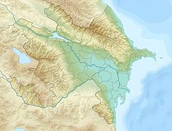
| Armenia | Syunik region |
| Azerbaijan | Zangelan district |
It flows through the territory of Armenia and controlled by the unrecognized Nagorno-Karabakh Republic lands formally located within the borders of Azerbaijan .
It originates from the city of Kajaran in the territory of Armenia from the confluence of the rivers Kajaranz and Kaputjuh [2] [3] . The height of the source is 3650 m above sea level.
In the upper reaches it flows through a deep canyon , which, gradually expanding, near the city of Kapan turns into a wide valley . Meals are mixed.
On the shores are the cities of Kajaran , Kapan , Zangelan and Mingivan .
The Kapan hydroelectric station and the Voghchi hydroelectric station were built on the river.
See also
- Hydrography of Azerbaijan
- Hydrography of Armenia
Notes
- ↑ Ohci tea on the map of 1903
- ↑ Map sheet J-38-XI .
- ↑ Map sheet J-38-33 Kafan . Scale: 1: 100,000. 1976 edition.