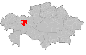
Mugalzhar district ( Kaz. Mұғalzhar audany ) is a second level administrative-territorial unit in the Aktobe region of Kazakhstan . The administrative center of the district is the city of Kandyagash .
| area | |
| Mugalzhar district | |
|---|---|
| kaz. Malyzhar Audany | |
| A country | Kazakhstan |
| Included in | Aktobe region |
| Akim | Sheriyazdanov Askar Turarovich |
| History and Geography | |
| Square | 29 530 km² (5th place ) |
| Timezone | UTC + 5 |
| Largest cities | Kandyagash , Emba , Gem |
| Population | |
| Population | ↘ 67 167 [1] people ( 2019 ) ( 1st place ) |
| Density | 2.28 people / km² (6th place) |
| Nationalities | Kazakhs (91.68%) Russians (5.64%) (2016) [2] |
| Digital identifiers | |
| Telephone code | +7 71333 |
| Postal codes | 030700, 030701 |
 | |
Akim - Sheriyazdanov Askar Turarovich has been working in this position since July 2019.
The district was formed in 1997 on June 17 as a result of the merger of the Mugodzharsky and Oktyabrsky districts, occupying an area of 27.8 thousand km² (9.2% of the region). The Mugalzhar district is located in the central part of the region, in the north it borders with the Algin and Khromtau regions, in the south with the Baiganinsky and Shalkarsky districts, in the west with the Temir district and in the east with the Aitekebi district.
The population is 67.4 thousand people (8% of the oblast population), of which the economically active population is 38.5 thousand people.
The district center of Kandyagash is located at a distance of 90 km from the regional center, with 33.7 thousand people living in it.
The administrative-territorial composition of the Mugalzharsky district includes 3 cities (Kandyagash, Emba , Zhem ) and 12 rural districts (Akkemirsky, Ashesaysky, Batpakkolsky, Yegindibulaksky, Enbeksky, Zhurunsky, named after K. Zhubanov , Kayindinsky, Kumzhargansky, Kumsaygysdal and Kumsaygysdal and Kumaysal) , where there are 38 rural settlements.
The name of the area is associated with the mountains of the same name .
Content
History
It was first formed on April 14, 1921 under the name Temir district in the Aktobe region . July 5, 1925 was transformed into Temir district . Again Temir district was formed on September 3, 1928 as part of the Aktobe district . In 1930, he became directly subordinate to the Kazak Autonomous Soviet Socialist Republic . In 1932 he moved to the Aktobe region. In 1967 it was renamed the Oktyabrsky District [3] .
On June 17, 1997, by the Decree of the President of Kazakhstan, the Oktyabrsky District was renamed the Mugalzhar District [4] .
Administrative division of the district
| No. | Name of the rural district / city | Administrative center | Rural areas |
|---|---|---|---|
| one | Kandyagash city | Kandyagash city | |
| 2 | Emba | Emba | |
| 3 | Mr. Jem | Mr. Jem | |
| four | Akkemir s / o | Akkemir | Akkemir, Yelek, Zharyk, Kotibar, Koktobe |
| five | Ashesaysky s / o | Ashesay | Ashesay, Aksu, Sabyndykol |
| 6 | Batpakkolsky s / o | Jagabulak | Zhagabulak, Zharkemer, Kozhasay, Saga |
| 7 | Yegindibulaksky agricultural district | Bulakty | Bulakty, Miyalykol |
| eight | Enbek s / o | Sagashili | Sagashili, Boscheli, Tepsen-Karabulak, Temirmost |
| 9 | Zhurunsky s / o | Zhurun | Zhurun, Dogs, Koldenen-Temir, Experienced, Izimbet, rzd. 53 |
| ten | s / about them. K. Zhubanova | Karakol | Karakol, Zhanaturmys |
| eleven | Kayindinsky s / o | Kayindy | Kayindy, Altynda |
| 12 | Kumzhargansky c / o | Birlik | Birlik, Kumjargan, Kumsai, Shengelshi |
| 13 | Kumsaysky s / o | Kumsai | Kumsay, Zhambyl |
| 14 | Mugalzhar village | Mugalzhar | Mugalzhar, rzd. 57 (Tas) |
| 15 | Taldyssays s / o | Taldyssay | Taldyssay, Enbek |
Minerals
On the territory of the district is the Ashchisay oil and gas field .
Population
- 64045 people ( 2009 );
Notes
- ↑ About the change in the population of the Aktobe region in the context of cities and regions from the beginning of 2019 to April 1, 2019 (inaccessible link - history ) . Statistics Committee of the Ministry of National Economy of the Republic of Kazakhstan. Circulation date May 19, 2019.
- ↑ The population of the Republic of Kazakhstan by individual ethnic groups at the beginning of 2016 . Statistics Committee of the Ministry of National Economy of the Republic of Kazakhstan. Date of appeal September 14, 2016.
- ↑ World Historical Project
- ↑ Decree of the President of the Republic of Kazakhstan dated June 17, 1997 No. 3550 “On changes in the administrative-territorial structure of the Aktobe, West Kazakhstan, Kzyl-Orda and Kustanai regions”.