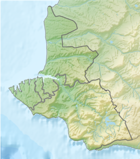
Laspinskaya bay ( Ukrainian Laspі ) - one of the bays of the Black Sea on the southern coast of Crimea ; located in the Sevastopol City Council about 30 km from the center of Sevastopol and 40 km from Yalta ; 5 km from the Laspi stop of the 33rd km of the Sevastopol-Yalta highway. The name Laspinsky Bay - Laspi comes from the Greek word λπσπη - mud [2] . And due to the presence in the past of a large number of geothermal springs that created mineralized clay along the entire coast of the bay [3] .
The bay has a coastline of 12 km and is located between Cape Sarych and Ayia . The diameter of its central bowl reaches 2.5 km. Currently, it is characterized by high transparency of water, which has made the bay a favorite place for divers . The Laspinsky tract offers the following attractions: the geological natural monument “Tyshlar Rocks” (or “Temple of the Sun”), as well as the underwater “Stone Forest”.
Being protected from cold northern winds by spurs of the Kokiyabel ridge up to 684.1 m high, Laspinskaya Bay is the warmest place in the Sevastopol region with an average January temperature of +5 ° C. Due to the mountain barrier, the air humidity here is slightly higher than in Sevastopol. The vegetation is typically Mediterranean: Crimean pine , small-fruited strawberries and junipers .
| Laspinsky bay | |
|---|---|
 | |
| Specifications | |
| Bay Type | bay |
| Location | |
| Upstream water area | Black Sea |
| A country |
|
| Region | Sevastopol |

Geography
A pebble beach with a length of half a kilometer and a width of 10-15 meters is located at the top of the bay [4] . In places, it is interrupted by piles of stone chaos approaching the sea itself. Only between the rocky chaos in the eastern part of the bay can you put up a tent. Although camping sites are equipped here, including drinking and industrial water intake points, there is often not enough space for everyone in peak season.
Flora
Laspi dominates the dry Mediterranean climate , hence the prevalence of xerophytic vegetation, which has adapted to winter drizzle and prolonged summer drought (up to 6 months). In the Laspinsky tract, red strawberry tree , tall juniper , Stankevich pine , Crimean peony , listed at one time (1980) in the Red Book of the Ukrainian SSR , as well as rare inhabitants of the Crimean forests grow : bright red pyracantha , Pontic needle , jasmine , and frankincense . At the same time, the population of Stankevich pine (also known as Sudak or Pizunda pine ) is the largest in the world. According to scientists from the Taurida National University named after V.I. Vernadsky, out of 36 species of Crimean orchids, 16 are found in the Laspinsky tract [5] . The queen of Laspino orchids is Komperia Komperia, discovered here at the end of the 19th century. It was opened by an amateur botanist of Crimea Karl Komper, who is also managing the estate on Cape Sarych. The name was given on the advice of the director of the Nikitsky Botanical Garden Steven.
Population
The shores of the bay were inhabited by people during the Paleolithic . In 1828, Russian archaeologists found flint tools on the banks and bottom of the bay used to open shell flaps [6] . In the Middle Ages, a fortified Byzantine settlement developed on the shore of Laspi Bay. Only half-overgrown ruins of the foundation and the remains of the water supply have survived to this day. The population continued to grow, and up to seven settlements formed along the shores of the bay. At the same time, the bay apparently got its name from the Greek village of Laspi, which was located several kilometers north of the bay between the Shaburla mountains (545 m) and Machuk (624.7 m) above the modern Yalta-Sevastopol highway [7] . In the 9th – 10th centuries, several churches were erected to satisfy the religious needs of the local Orthodox population, including the monastery of St. Elijah painted with frescoes. Until the end of the 18th century, the coast of the bay was densely populated by Crimean Greeks, because of which the toponym came to us in the Greek, and not in the Turkic version. Most of them moved to the Donbass in 1778. The rest converted to Islam . In 1783, the bay became part of the Russian Empire. Some Greeks returned to their places. However, after the earthquake of 1790, water left almost all springs in newly formed cracks, making this place one of the driest in the Crimea , along with Sudak , given the large number of sunny days. As a result, people left this region for a long time, moving to the nearby Khaitinsky valley [6] . For this reason, Laspi still lacks a private sector , and almost the entire territory is divided among themselves by boarding houses .
In 1787, seeing Laspi from the slopes of the pass , Catherine II wrote in her diary: "This is so much like a fairy tale from" A Thousand and One Nights "that you don’t know whether you are in reality or in a dream." In 1792, the lands along the shores of the bay became the private property of Count Mordvinov. Later these lands were bought by the Frenchman Vassal. He built a wine cellar here and began to grow French grape varieties in Crimea, known throughout Russia. In 1915, V. A. de Planson created here a joint-stock company of “Crimean climate stations and sea bathing” with a fixed capital of 3 million rubles, one of the shareholders of which was F. Chaliapin [6] .
Modern Development
The bay is rightly considered the western gate of the South Coast : and from the north and west winds the bay is guarded by Mount Kokiya-Kala on Cape Ayia 588.8 m high, Mount Kush-Kaya - 664.3 m and the Kokiyabel Range 684.1 m high; from the east it is also covered by Mount Kalanykh-Kaya , 625 meters high. Due to the inaccessibility of this region and the lack of open water sources, it began to develop its resort potential only after 1972, when the 33rd km of the Sevastopol – Yalta highway was laid here [8] . On the way to the site, pay attention to the Karaul-Kaya rock, where a memorial sign to the engineer and writer N. G. Garin-Mikhailovsky, which is a pioneer of these places, and whose drawings of 1904 were used to lay the track, is installed. In the western part, the Batiliman tract stands out, the development of which under the dachas began with the St. Petersburg intelligentsia back in 1911.
However, after the drying of geothermal springs, the transparency of the water in the bay increased significantly and this place became an ideal refuge for diving enthusiasts, among which the local “Stone Garden”, an underwater network of boulders with grottoes and labyrinths, is popular [9] . This place has the cleanest sea water on the entire coast of Crimea.
Problems
Currently, the flora and fauna of the bay is being destroyed by numerous construction sites. Pension "Bay of Dreams", built partly on the shore, partly in the sea, has already done irreparable harm. There are practically no free approaches to the sea. The whole coast is in fences. Despite numerous protests from the population and government bans, construction continues.
Notable Facts
- In 1935-1936, the head of the domestic film industry B. Shumyatsky proposed creating a “movie town” in the bay following the example of Hollywood .
- The films “ Prisoners of the Sea ” (1932), “ Treasure Island ” (1936), “ Amphibian Man ” [6] , and “ Secret City ” (1973) were shot in Laspi Bay.
- The bay is isolated by a mountain belt, protecting the coast from the northern winds and the cold Yalta current , therefore Laspi Bay and Batiliman tract are the warmest places in the Sevastopol region, where the average annual temperature is +15 ºС and average January +5 ° C.
Notes
- ↑ This geographical feature is located in the waters adjacent to the Crimean peninsula , most of which is the subject of territorial disagreements between Russia , which controls the disputed territory, and Ukraine , within the borders of which the disputed territory is recognized by the international community. According to the federal structure of Russia , the subjects of the Russian Federation are located in the disputed territory of Crimea - the Republic of Crimea and the city of federal significance Sevastopol . According to the administrative division of Ukraine , the regions of Ukraine are located in the disputed territory of Crimea - the Autonomous Republic of Crimea and the city with special status Sevastopol .
- ↑ Oliferov, Timchenko . Rivers and lakes of Crimea . www.studfiles.ru . Date of treatment February 2, 2019.
- ↑ Otin E. S. Toponymy of the Azov Greeks: a historical-etymological dictionary of geographical names. Southeast Ltd., 2002—208 p.
- ↑ Laspi - Sights of Balaclava (inaccessible link) . balaclava.crimea.ua . Archived on October 17, 2016.
- ↑ The natural symbol of Laspi - orchid Komperiya Komper - My articles - Catalog of articles - Holidays in Laspi . ayia.at.ua. Date of treatment February 2, 2019.
- ↑ 1 2 3 4 Laspi Bay . vkrym.su . Date of treatment February 2, 2019.
- ↑ Alexey Ivanov . Laspi. From Aya to Sarych. Historical and geographical essays. ISBN 9668231260
- ↑ Detailed topographic map of Crimea . www.etomesto.ru . Date of treatment February 2, 2019.
- ↑ Stone Garden Laspi | Laspi.name . laspi.name . Date of treatment February 2, 2019.
Links
- Panoramas and photographs of Laspi . virtual-sevastopol.ru . Date of treatment February 2, 2019.