Rednitz ( German: Rednitz ) - a river in Germany , flows through Central Franconia (the land of Bavaria ). River index 242 [1] . At an altitude of 342 m [2] above the sea level, Rednitz form the confluent rivers Schwebische-Retzat and Frankish-Retzat .
| Rednitz | |
|---|---|
| him. Rednitz | |
 | |
| Characteristic | |
| Length | 46.43 km |
| Watercourse | |
| Source | river confluence: Schwebische Rezat and Frankish Rezat |
| • Location | Georgensgmund |
| • Height | 342 m |
| • Coordinates | |
| Mouth | Regnitz |
| • Location | northwest of the city of Fuerth |
| • Height | 283 m |
| • Coordinates | |
| Location | |
| Water system | Regnitz → Mine → Rhine → North Sea |
| A country |
|
| Region | Bavaria |

In describing his characteristics, Rednitz is sometimes considered together with Frankish-Rezat [1] . Then the basin area is 32117.99 [1] , the total length of the rivers is 123.68 km [1] . The length of the actual Rednica is 46.43 km.
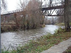
Rednitz at the confluence with Pegnitz northwest of the city of Fürth near Nuremberg form the River Regnitz , for which Rednitz is a left tributary. The height of the mouth of Rednitsa is 283 m [3] .
The cities of Roth , Büchenbach , Rednitzhembach , Schwabach , Stein , Nuremberg , Oberasbach and Zirndorf are located on the River Rednitz.