Shavla (from the Altai shaal - a young tree) - a river in Altai in the region of the North Chuysky ridge , the right tributary of Argut ( Katun basin). The river is 58 km long, the catchment area is 882 km² [2] .
| Shawla | |
|---|---|
 Shawla on the site from the confluence with the river. Left Chawla to the mouth of the river. Yoshtykol Shawla on the site from the confluence with the river. Left Chawla to the mouth of the river. Yoshtykol | |
| Characteristic | |
| Length | 58 km |
| Pool | 882 km² |
| Watercourse | |
| Source | |
| • Height | 2401 m |
| • Coordinates | |
| Mouth | Argut |
| • Location | 22 km on the right bank |
| • Height | 874 m |
| • Coordinates | |
| Location | |
| Water system | Argut → Katun → Ob → Kara Sea |
| A country |
|
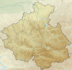
| Region | Altai Republic |
| Area | Kosh-Agachsky District |
| HWR code | |

Content
General Information
The source is an unnamed lake located at an altitude of 2401 m at the foot of the glacier. [3] For the first 1.5 kilometers, the river flows under stones, then emerges to the surface, gradually losing altitude, and after 1.5 km it flows into the lake at an altitude of 2163 m above sea level, again flowing out of the northern end of the lake, and after 2 km it flows into Lake Shavlinsky at an altitude of 1984 m. Over the next 500 m, the river loses its height sharply (a drop of about 150 m), crossing a powerful moraine ridge supporting the lake from the north. Then it takes a left tributary (on some maps - the river Left Shavla ), it becomes full-flowing and calmer. The current velocity in this section is about 2-3 m / s. After 10 km, the river takes the right tributary of the river. Eshtykol (height approx. 1600 m) and turns sharply to the west. The width of the river in this section is 10-12 m. Further, Shavla flows in a deep valley along the northern border of the Shavlinsky ridge , receives a dozen small tributaries, and flows into Argut after about 50 km.
Tributaries
- 2 km: Saylyugem (ave.)
- Ushtushken (lv)
- Arysh (lv)
- Carga Uzek (lv)
- Turat (pr)
- Karakol (lv)
- 17 km: Achik (ave.)
- 18 km: Saylyugem (lv)
- Tetiol (lv)
- Karaoyuk
- 27 km: Karakol (ave.)
- 35 km: Kmurguloyuk (lv)
- 40 km: Yoshtykol (ave.)
Tourism
Throughout the confluence of Eshtykol, the river is popular with water tourists. The standard route runs along the rivers Shawla, Argut and Katun . Depending on the water level, the complexity of the route can reach V c. The cascade of lakes in the upper reaches regulates the flow, so Shawla is less susceptible to rain floods than most rivers of similar orography. As with all rivers feeding on glacial waters, runoff increases somewhat in the afternoon (due to more intense melting during heating) and decreases by dawn. The water in the river is muddy (the so-called “glacial turbidity”), it is preferable to choose shallow tributaries for drinking. For backpackers, the river is a significant barrier. There are several fords on the section from the estuary of Eshtykol to Argut , but the authors of the reports strongly recommend using insurance or organizing a hinged crossing .
Water system: Argut → Katun → Ob → Kara Sea .
Water registry data
According to the state water register of Russia, it belongs to the Verkhneobsky Basin District , the water sector of the river is Katun , the river sub-basin of the river is Biya and Katun. The river basin - (Upper) Ob until the confluence of the Irtysh [2] .
Gallery
Shawla at the exit of Lower Lake View of the inflow of Shavly into Lower Shavlinskoye Lake Shavla inflow into Lower Shavlinsky lake Shawla between Upper and Lower Shavlinsky lakes The source of Shavly from Lower Shavlinsky lake
Notes
- ↑ Surface Water Resources of the USSR: Hydrological Understanding. T. 15. Altai and Western Siberia. Vol. 1. Gorny Altai and Upper Irtysh / ed. V.V. Seeberg. - L .: Gidrometeoizdat, 1966 .-- 216 p.
- ↑ 1 2 State Water Register . Shawla River . textual.ru . Ministry of Natural Resources of Russia (March 29, 2009). Date of treatment December 20, 2018. Archived March 29, 2009.
- ↑ Maps of the General Staff, Rosreestr, State Center