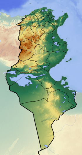
El-Jerid [1] ( Arabic: ا الجريد ) is a salt lake in the central part of Tunisia and a salt marsh depression located in a series of depressions stretching inland from the Gulf of Gabes .
| El jerid | |
|---|---|
| Arab. شط الجريد | |
 | |
| Morphometry | |
| Absolute height | 16 m |
| Dimensions | 120 × 60 km |
| Square | up to 5-7 thousand km² |
| Location | |
| A country |
|
Description
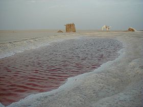
During winter rains, El Jerid turns into a saltless drainage lake with an area of 5-7 thousand km². In summer, when precipitation is absent, and the temperature often reaches +50 ° C , the lake almost completely dries up, and mirages are often observed.
The vegetation is sparse, with a predominance of halophytes ; thickets of tamarisk and gorse are found near the wadi [2] . Outlets of artesian waters are found along the edges of the basin, around which are oases , in which the date palm has been cultivated since ancient times [3] .
An asphalt road was laid along the crest of the constructed dam through the hollow in the 1970s.
Gallery
Notes
- ↑ Algeria, Tunisia, Morocco // Atlas of the world / comp. and preparation. to the ed. PKO "Cartography" in 1999; open Ed .: T.G. Novikova , T.M. Vorobyova . - 3rd ed., Eras., Fr. in 2002 with diaposes. 1999 - M .: Roskartografiya, 2002. - S. 190—191. - ISBN 5-85120-055-3 .
- ↑ Chott el Jerid // Dictionary of modern geographical names / Rus. geo about . Mosk. Centre; Under the total. ed. Acad. V.M. Kotlyakova . Institute of Geography RAS . - Yekaterinburg: U-Factoria, 2006.
- ↑ Jerid - an article from the Great Soviet Encyclopedia .
See also
- Melgir
Links
- (English) Dry salt lake