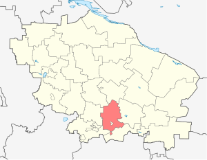
Georgy district - a territorial unit ( district ) in the Stavropol Territory of Russia . It corresponds to the newly formed (by combining the eponymous municipal district and the urban district of the city of Georgievsk ), the new municipal formation of the Georgy city district .
| district [1] / city district [2] | |||||
| Georgievsky district | |||||
|---|---|---|---|---|---|
| St. George City District | |||||
| A country | Russia | ||||
| Included in | Stavropol region | ||||
| Adm. center | city Georgievsk | ||||
| Head of District | Maxim Viktorovich Kletin | ||||
| History and Geography | |||||
| Date of formation | 1924 | ||||
| Area | 1 919.77 [3] km² (19th place ) | ||||
| Timezone | MSK ( UTC + 3 ) | ||||
| Population | |||||
| Population | ↘ 165 798 [4] people ( 2019 ) (5.93%, 5th place ) | ||||
| Density | 86.36 people / km² | ||||
| Nationalities | Russians (67.2%), Armenians (23%), Gypsies (2.2%), Ukrainians (2%) | ||||
| Denominations | Orthodox (71%), Gregorian-Armenian (23%) | ||||
| official languages | Russian | ||||
| Digital identifiers | |||||
| Telephone code | +7 87951 | ||||
| Okato | 07,215,000,000 | ||||
 | |||||
Included in the eco-resort region of the Caucasian Mineral Waters .
The administrative center is the city of Georgievsk .
Content
- 1 Introduction
- 2 Geographical location
- 3 History
- 3.1 XVIII century
- 3.2 XIX century
- 3.3 XX century
- 3.4 XXI century
- 3.5 Municipal territorial structure
- 4 Official Symbols
- 4.1 Georgievsky municipal district
- 4.2 St. George City District
- 5 population
- 6 settlements
- 7 Local government
- 8 Economics
- 9 Transport
- 10 Archeology
- 11 See also
- 12 Notes
- 13 Literature
- 14 References
Introduction
Modern social and ethno-political processes taking place in the North Caucasus are best focused on individual small territories at the city or administrative district level. The social problems of the Georgievsky district of the Stavropol Territory fully reflect all the main problems of the population and resettlement in the North Caucasus. On its open spaces there are common processes and phenomena characteristic of the whole country, as well as curious phenomena that could only form here over time under the influence of local physical and economic-geographical conditions. The region is characterized by many all-Russian phenomena and processes, such as the characteristics of the natural movement of the population, the problem of employment and the whole range of social problems associated with it, which are a reflection of the economic crisis of the Russian village.
At the same time, the Georgievsky district stands out against the all-Russian background with a high concentration of the rural population in a relatively small territory (occupying an area of only 0.11 ‰ of the country, it concentrates 2.35 ‰ of the rural population), settlement patterns, ethnic structure of the population, stable migration to the countryside life and mentality of the villagers. The problems facing the countryside of the Georgievsky district are currently relevant for any other territory of the Russian Ciscaucasia, and therefore deserve special consideration.
Geographical position
Georgievsky district is located almost in the geographical center of the North Caucasus in the southern part of the Stavropol Territory. Understanding the situation that has developed now in its vastness lies in the economic and geographical position. At each of its levels, EGP is characterized by ecotonicity , which is characterized by an increase in various processes and phenomena than in homogeneous territories.
At the micro level, this is one of the important districts of the Stavropol Territory in terms of plan, located on a kind of transition from the highly developed urbanized region of the CMS to agricultural regions with a low level of penetration of urban lifestyles. When considering various indicators, the region is in many respects both monocentric and in the sphere of influence of the CMS core, and it influences the development of neighboring regions ( Kirovsky , Sovetsky , Stepnovsky ), for which Georgievsk is the “main” city in the vicinity when considering various kinds indicators.
MesoEGP is largely determined by the transport situation and the position regarding the administrative boundaries of the region. Georgievsk - is a fairly powerful transportation hub. Historically, it focuses on railways and roads, communications from the foothills to the plain, along the Kuma valley, north to Stavropol , along the Podkumka valley. Directly not bordering neighboring republics, it is at the junction of the ethnocultural spaces of the plain Russian Ciscaucasia and the mountain republics.
It currently covers an area of 1,919.8 km² and extends 73 km from north to south and 45 km from west to east. It borders on six districts of the Stavropol Territory and the city of St. George, inside it. Georgievsky district - geographically belongs to the ecological-resort region of federal significance - Caucasian Mineral Waters .
History
As part of the Stavropol Territory, the Georgievsky District was formed in 1924 from the volosts and villages of Georgievsky, Pyatigorsky, Mozdoksky, Aleksandrovsky and Holy Krestovsky counties. Georgievsky district is one of the most interesting territories for studying the geography of the rural population in Russia. The region is characterized by many all-Russian phenomena and processes, such as the characteristics of the natural movement of the population, the problem of employment and the whole range of social problems associated with it, which are a reflection of the economic crisis of the Russian village.
18th century
The lands of the steppes of Ciscaucasia have been inhabited since ancient times mainly by nomadic tribes. The most ancient archaeological finds belong to the culture of the Scythians, then the Sarmatians, Alans , Huns , Polovtsy , Mongols lived and wandered here, since the XIV century the main population was Circassians ( Circassians ). Intensive Russian colonization of the North Caucasus began in the second half of the 18th century. In September 1777, the fortress of St. George was laid on the left bank of the Podkumka , 6 miles from its mouth. Under the cover of a powerful fortress in the Kuma Valley, the first Russian settlements began to emerge: the villages of Alexandria (1784), Abundant (1784), New Zealanders (1784), Podgornoye (1786), Nezlobnoe (1786). Relative security, lack of serfdom, natural wealth, favorable climate and advantageous geographical location - all this contributed to the rapid growth of the Kuma villages.
The tsarist government pursued an orderly policy of quickly settling the steppes of the Ciscaucasia. Every year, thousands of peasants were resettled in the Kuma villages. Migrants arrived in the settlements of the St. George part of the Kum valley mainly from the Voronezh, Oryol and Tambov provinces. The resettlement was carried out by “hundreds,” that is, groups of communal peasants from one village. At first, “hundreds” were located next to each other, because at first the villages were represented by conglomerates of several “hundreds”. Later, merging into a single massif, they turned into very large settlements by modern standards, numbering several thousand people in the first years after the foundation.
- List of populated areas of St. George County for 1789 [5]
- village
- Newly established - 1182 and 579 dzh.p. (Chap. economic and palace peasants, as well as single-palace)
- Abundant - 1348 dm.p. and 822 dzh.p. (main sample odnodvortsi)
- Podgornoye - 1058 d.m. and 740 dzh.p. (main sample odnodvortsi)
- settlement
- Alexandria - 838 dm and 545 dzh.p. (main sample odnodvortsi)
By a decree of August 30, 1790, the Caucasian governorate and the Caucasian province were liquidated, the provincial government offices were transferred to Astrakhan, the city of Ekaterinograd and the Ekaterinograd district were abolished. The villages of State, Nezlobnoe, Nina, Otkaznoye, and the settlements of Aleksandrovskaya and Grigoryevskaya came from the Yekaterinograd district to the St. George district [6] .
XIX century
In 1802, Georgievsk became the center of the Caucasus province, its role as an administrative and military center increased. The surrounding villages, which surpassed the provincial city in terms of population, fell only under administrative influence, and partly economic, otherwise remaining autonomous settlements. The rural economy was in full self-sufficiency.
In 1825-1831, after several major highland raids, the government took a number of measures to strengthen the southern borders. Dozens of villages in the foothills were founded, including the village of Georgievskaya opposite Georgievsk in 1829. They were transferred to the Cossack estate and became the villages of Alexandria , Podgornaya , Nezlobnaya . Later, in 1848, the village of Lysogorsk was founded between Georgievsky and Pyatigorsk . The abolition of serfdom in its own way affected the countryside of the Ciscaucasia. In the vicinity of Georgievsk there was not a single landlord property; all villages were represented by communities of state peasants.
The construction and opening of the Vladikavkaz railway in 1875 led to the beginning of an economic recovery. The railway passed through the southwestern part of the modern district. One of the largest railway stations in the North Caucasus was created in the village of Nezlobnaya, which served as a transshipment base for the entire Kumsky valley. Its cargo turnover at the end of the 19th century was the largest on the Vladikavkaz railway. At the turn of the century, the territory of the present Georgievsky district was the densely populated valleys of Kuma and Podkumka.
XX century
The same growth trends continued at the beginning of the 20th century. The Stolypin agrarian reform had a certain effect. In the Georgievsky district, it only led to the creation of a network by a farm in vast areas north of the Kuma Valley. One of them - Ulyanovka on Wet Karamyk exists today, and the rest have disappeared. In 1913, a railway was built through Georgievsk, and Vinogradnaya station was opened in the village of Alexandria. In 1915-1916, the Kumskaya railway was built from Georgievsk to the city of the Holy Cross. Proving the need for the construction of this road, local historian G. N. Prozritelev wrote: “ Our Prikumsky Territory is a bonanza: there are millions of pounds of bread, leather, wine, its production is expressed in a huge amount. Village on the river. Kume almost merged into one continuous settlement. In a word, this is the best and richest place in the province . ”
The First World War, revolutions, the Civil War, the famine of 1921-1922 caused enormous damage to both the economy and the population of the Georgievsky district. The fertile agricultural land ceased to exist. NEP revived the economy, healed the wounds of war. From the late 1930s, the city began to grow rapidly in its surroundings. This is due to the fact that in 1924 the Georgievsky district was formed within the borders in many respects similar to modern ones; the rapid process of industrialization began, the need for new buildings in the workforce arose. Georgievsk turned into a multifunctional center of the district.
In 1930, the South Ossetian Village Council was formed as part of the district, which included the settlements Vesely Khleborob, Dolinovka , Kazbek , Nariman, South Ossetia, New Hope, Effort [7] .
In March 1932, the following were transferred from the Georgievsky district to the Aleksandrovsky district : Sablinsky, South Ossetian, Svobodnensky, Sukhopadensky village councils, land plots of the Military Commissariat and Konkoperatsiya and the Ulyanovsk state farm “Sheep breeder”, and the Soviet village council was transferred from the liquidated Prokhladnensky district [8] .
On January 10, 1943, the Georgievsky district was liberated from Nazi invaders [9] .
On August 20, 1953, the Alexandria-Obilnensky district was abolished. Its territory was transferred to the Georgievsky district [10] .
February 1, 1963 were formed instead of the existing 15 rural areas: Alexandrovsky, Apanasenkovsky, Blagodarnensky, Vorontsovo-Aleksandrovsky, Georgievsky, Izobilnensky, Ipatovsky, Kochubeyevsky, Krasnogvardeisky, Kursky, Levokumsky, Mineralovodsky, Petrovsky, Prikumsky and Shpakovsky [11] .
On January 12, 1965, the Presidium of the Supreme Council of the RSFSR decided [12] :
- Arzgirsky , Aleksandrovsky , Apanasenkovsky , Blagodarnensky , Georgievsky district, Izobilnensky, Ipatovsky, Kochubeyevsky, Krasnogvardeisky, Kursky, Levokumsky, Mineralovodsky, Novoaleksandrovsky, Petrovsky, Prikumsky, Soviet and Shpakovsky rural areas of the region; Convert Adyge-Khablsky, Zelenchuksky, Karachaevsky, Malokarachaevsky, Prikubansky and Khabezsky rural areas of the Karachay-Cherkess Autonomous Region into regions.
As of March 1, 1966, the Georgievsky District included 18 village councils: Alexandria, Georgievsky, Gornozavodskaya, Zolsky, Komsomolsky, Krasnokumsky, Lysogorsky, Maryinsky, Nezlobnensky, Novozavedensky, Novopavlovsky, Novomedzensky, Obilensky, Podgornensky, Staropavnovsky, Ulumovskiy, Ulumovsky, Ulomna, Shumny, Ulomna, Ulomna, Uumna ] .
In connection with the disaggregation of collective farms and the need for more intensive use of land resources, a whole network of small villages was created in the northern and southern parts of the region. The Great Patriotic War and intensive urbanization in the post-war years caused significant damage to the Georgievsky district. In most villages and villages, an absolute decline in population and economic activity was noted. Since 1969, the St. George region has existed within its modern borders.
As of January 1, 1983, there were 12 village councils in the district: Alesandrian, Georgievsky, Krutoyarsky, Lysogorsky, Nezlobnensky, Novinsky, Novozavedensky, Obilnensky, Podgornensky, Ulyanovsky, Urukhsky and Shaumyanovsky [14] .
By a decision of the Presidium of the Stavropol Territory Council of People’s Deputies of October 8, 1990 No. 81, the Balkovsky Village Council (with its center in the village of Balkovsky ) was formed in the Georgievsky District, which included the villages of Balkovsky and Rogova , isolated from the Ulyanovsk Village Council of the same region [15] .
21st Century
On December 13, 2001, the Government of the Stavropol Territory decided “To transfer the Krasnokumsky Village Council from the subordination of the administration of Georgievsk to the Georgievsky District” [15] .
On October 4, 2004, in accordance with the Law of the Stavropol Territory “On Giving Municipal Formations of the Stavropol Territory the Status of Urban, Rural Settlement, Urban District, and Municipal District” [16] , the Georgievsky Municipal District was formed.
From June 1, 2017, in accordance with the Law of the Stavropol Territory dated March 2, 2017 No. 21-KZ [17] , all municipalities of the Georgievsky municipal district and the urban district of the city of Georgievsk were transformed, by combining them, into the Georgievsky city district .
The territorial unit ( district ) has retained its status [18] [19] .
Municipal Territory
Until 2017, in the abolished Georgievsky municipal district, there were 24 settlements consisting of 14 rural settlements:
| No. | Rural settlements | Administrative center | amount populated points | Population |
|---|---|---|---|---|
| one | Alexandria Village Council | village of Alexandria | 3 | ↘ 12 595 [20] |
| 2 | Balkovsky Village Council | Balkovsky village | 2 | ↗ 1055 [20] |
| 3 | Krutoyarsky Village Council | Padinsky village | 2 | ↘ 1508 [20] |
| four | Nezlobnensky Village Council | Nezlobnaya stanitsa | 2 | ↗ 20 137 [20] |
| 5 | Novy settlement | Novy settlement | one | ↘ 3053 [20] |
| 6 | Krasnokumskoye village | Krasnokumskoye village | one | ↘ 17 451 [20] |
| 7 | Novozavedennoe village | Novozavedennoe village | one | ↘ 5057 [20] |
| 8 | Obilnoe village | Obilnoe village | one | ↗ 6377 [20] |
| 9 | st Georgievskaya | st Georgievskaya | one | ↘ 6151 [20] |
| 10 | Lysogorskaya village | Lysogorskaya village | one | ↘ 11 198 [20] |
| eleven | Podgornaya village | Podgornaya village | one | ↘ 5892 [20] |
| 12 | Ulyanovsk Village Council | Novoulyanovsky village | 2 | ↘ 2350 [20] |
| 13 | Urukhsky Village Council | Urukhskaya village | 2 | ↘ 3903 [20] |
| fourteen | Shaumyanovsky village council | Shaumyansky village | four | → 3791 [20] |
Prior to the abolition of the municipal formation of the urban district of the city of Georgievsk, it included the only settlement (administrative center) - the city of Georgievsk [21] .
Official Symbols
Georgievsky Municipal District
The emblem and flag of the municipal district were approved on February 5, 2008 [22] [23] and on February 27, 2008 they were entered in the State Heraldry Register of the Russian Federation with assignment of registration numbers 3895 and 3896 respectively [24] .
The heraldic description of the coat of arms of the Georgievsky municipal district of the Stavropol Territory read: “ The azure shield with the Holy Great Martyr Saint George the Victorious in a silver robe, with a gold nimbus and a diadem in brown hair on a silver horse with a purple harness, silver spear with popira, scarlet weapons ” [22] .
The flag was a “rectangular cloth of azure color with an aspect ratio of 2: 3, bearing the central figures of the coat of arms of the St. George Municipal District of the Stavropol Territory: St. Great Martyr St. George the Victorious in a silver robe, in a scarlet cloak, with a golden halo and a diadem in brown hair on a silver horse with a purple harness, a silver spear trampling a silver dragon with scarlet weapons ” [23] .
After the abolition of the St. George Municipal District, this symbolism is no longer used [25] .
St. George City District
At present, the district uses the coat of arms and flag of the city of Georgievsk [25] , approved on June 26, 2009 [26] and entered in the State Heraldry Register of the Russian Federation with assignment of registration numbers 5058 and 5059, respectively [27] . It is expected that by the end of 2018, the municipality will carry out work on re-registration of previously adopted official symbols. In addition, the issue of developing new symbols of the urban district is being discussed [25] .
The heraldic description of the current coat of arms of the St. George District of the Stavropol Territory reads: “In the purple shield in the opening of the gate arch of the golden fortress, toothed into the brickwork of the tower with five battlements and two loopholes, the Holy Great Martyr George the Victorious in a silver robe, in a scarlet and gold halo a diadem in brown hair on a silver horse with a scarlet harness, a gold spear, trampling a silver dragon ” [26] .
The flag is a “purple cloth with an aspect ratio of 2: 3, fully repeating the heraldic composition of the coat of arms” [26] .
Population
District population distribution
Georgievsk (40.44%)
Not inconsiderate (11.91%)
Krasnokumskoe (10.53%)
Alexandria (7.09%)
Lysogorskaya (6.75%)
Profuse (3.85%)
The rest (19.43%)
| Population size | ||||||||
|---|---|---|---|---|---|---|---|---|
| 1804 [28] | 1825 [28] | 1931 [29] | 1959 [30] | 1970 [31] | 1979 [32] | 1989 [33] | 1990 [34] | 1991 [34] |
| 19,200 | ↗ 22,000 | ↗ 115 368 | ↘ 86 709 | ↗ 93 656 | ↘ 63 418 | ↗ 72 417 | ↗ 73 431 | ↗ 74 872 |
| 1992 [34] | 1993 [34] | 1994 [34] | 1995 [34] | 1996 [34] | 1997 [34] | 1998 [34] | 1999 [34] | 2000 [34] |
| ↗ 76 413 | ↗ 77 453 | ↗ 79 675 | ↗ 81 716 | ↗ 83 140 | ↗ 84 380 | ↗ 85 256 | ↗ 87 310 | ↗ 88 979 |
| 2001 [34] | 2002 [33] | 2003 [34] | 2004 [34] | 2005 [34] | 2006 [34] | 2007 [34] | 2008 [34] | 2009 [35] |
| ↗ 89 974 | ↗ 91 371 | ↘ 91 303 | ↘ 91 175 | ↗ 91 232 | ↘ 91 048 | ↘ 90 806 | ↗ 91 116 | ↗ 91 535 |
| 2010 [36] | 2011 [37] | 2012 [38] | 2013 [39] | 2014 [40] | 2015 [41] | 2016 [42] | 2017 [20] | 2018 [43] |
| ↗ 101 367 | ↘ 101 357 | ↗ 101 516 | ↗ 101 580 | ↘ 100 978 | ↘ 100 886 | ↗ 100 933 | ↘ 100 518 | ↗ 167 262 |
| 2019 [4] | ||||||||
| ↘ 165 798 | ||||||||
The dynamics of the number in the imperial period
Before Russian colonization, there was no permanent population on the territory of the district; therefore, population dynamics can only be carried out from the end of the 18th century. For more than two hundred years, the boundaries of administrative entities have constantly changed, so we will take into account the population living in the modern borders of the district.
At the foundation of Georgievsk, the first inhabitants of the fortress were 500 soldiers of the Kabardinsky regiment and Khopersky Cossacks. In the village of Georgievskaya, the first Russian rural settlement in the region in 1777, 675 people were settled. In 1790, according to indirect data, at least 2,000 people lived in the villages Nezlobnoye, Abundant and Newly Born, in Alexandria about 1,700 people. By 1800, there were 6 villages in the district, numbering about 10-12 thousand people.
Until the first All-Russian population census, there are no statistics on the population of villages in the vicinity of Georgievsk. The population of rural settlements grew quite slowly until the 70s of the XIX century, mainly due to natural growth. So in the villages of Obilnoye and Novozavedenny in 1873 there were only 3884 and 2918 inhabitants, respectively. The end of the 19th - beginning of the 20th centuries is characterized by a rapid increase in the population of Prikumsky villages, which can be explained by both a powerful migration flow from Russia and an increase in natural growth as a result of a decrease in mortality.
The greatest population of the Georgievsky district reached before the First World War. The 1914 census recorded a population of 43.9 thousand people in the rural settlements surrounding Georgievsk.
Population dynamics in the Soviet period
In 1926, only 44.4 thousand people lived in the Georgievsky district, that is, the same number as 12 years earlier. An absolute decrease in the population was noted only in the villages of Lysogorskaya, Podgornaya and the village of Obilnoye. Moreover, 6 new villages were added, whose total population did not exceed 1.5 thousand people.
The next milestone was the 1939 census. If in most regions of the RSFSR there was a rapid decline in the rural population (the share of the rural population decreased by 16% from 1926 to 1939), then in the settlements of the Georgievsky and Alexandria-Obilnensky regions it even grew slightly and amounted to 46.6 thousand people or 105% 1926 due to the growth of villages in the northern part of the Alexandria-Obilnensky district.
Losses in the Great Patriotic War greatly affected the population. The districts from August 1942 to January 1943 were under fascist occupation, many civilians died. Therefore, in 1946, only 35.1 thousand people lived in our villages (75% by 1939).
Despite intensive urbanization, the Georgievsky district managed to restore the pre-war population, however, only by the end of the 1950s. The 1959 census gave the lowest population values for most of the large villages and villages of the district in the 20th century, although immediately after the war the number of inhabitants in them was even less. Compared with the pre-revolutionary 1914, the rural population of the Georgievsky district even increased slightly, which is uncharacteristic of Russia as a whole.
In the 1960s, trends changed, and large villages began to gradually gain population. This process went faster in the rural settlements closest to Georgievsk. In total, in the Georgievsky district, the rural population increased by 19 thousand people, or 42%, while in the RSFSR it fell from 1960 to 1980 by 33%.
The dynamics of the number in the post-Soviet period
Georgievsky district is one of the eight districts of the Stavropol Territory, where throughout the second half of the 20th century the rural population increased. The population growth rate for the period from 1959 to 2000 was on average 1.34% (for different census decades, from 0.89% to 1.72% is a fairly stable growth) (higher growth rates were observed only in the Piedmont region −1.50 %), in the Stavropol Territory - 0.22%, and in the Russian Federation –0.87%. In this connection, the share of the district’s population in the total rural population in Russia increased by 248% and now stands at 2.16 ‰.
In the 1990s, several trends in population dynamics were observed. It is logical to divide the entire period under review (1989-2006) into three segments, depending on factors that determine population growth.
1989-1994 - characterized by lower population growth rates - 1.19% (in the UK - 1.98%), the rural population grew by only 5.0 thousand people, from 72.4 to 77.4 thousand people. Such indicators are due to several reasons:
- in the Georgievsky district, the coefficient of natural growth, which was already negative in 1993, was rather low for rural territories of the region;
- the main influx of migrants was directed to Georgievsk, where the diasporas of non-indigenous peoples had a longer history, in contrast to other territories of the region, where an inversion of the urban trend in migration was observed, typical for Russia in the early 1990s;
- Georgievsk did not undergo agrarianization, since the suburban zone was highly developed, and no outflow to the region was observed for this reason;
- urban residents, who received plots in the immediate suburbs in the early 1990s, did not actively relocate beyond the city limits. Suburbanization was proceeding at the usual pace.
1994-1999 - the population during this period increased by 6.7 thousand people, and amounted to 83.2 thousand people by 01.01.1998. The population growth rate was twice the figure for the previous period (2.1%), and 4 times the average in the regions, becoming, along with the Shpakovsky, Piedmont and Mineralovodsky districts, the owner of the highest population growth rates in the region. The population of Georgievsk, the main object of migration relations, stabilized in 1995. This fact is explained by a number of processes taking place in the suburban rural areas of the region, and is the result of the imposition of two prevailing processes:
- the beginning of the First Chechen War (December 1994) predetermined the mass exodus of civilians, mainly the Russian population. A stream of refugees in the region "settled" along the main transport routes, primarily along the Rostov-Baku railway. Georgievsk and the Georgievsky district, as the first relatively safe Russian region on this "corridor", experienced in 1994-1996. the largest migration burden among all territories of the region. For the most part, Russian IDPs settled in villages uniformly throughout the region, since housing and places of employment in the village were easier to find than in cities experiencing a second influx of migrants with a sharp collapse in industry;
- mass commissioning of housing by urban dwellers in the suburbs. The mid-1990s were characterized by the settlement of new microdistricts of the private sector in Nezlobnaya (Neftekachka district, military town), Krasnokumsky (Lazurny settlement), the northern part of Novy settlement, and the northeast station. St. George's. There is an acceleration in the pace of suburbanization, the expansion of transport accessibility of the suburbs. The process is inherent in all large cities of the region with a developed suburban zone;
- expansion of the influx of non-Slavic migrants into the countryside. The city could not cope with the flows of refugees from Transcaucasia, so their intensive resettlement began in the main resettlement zone of the Georgievsky district.
1998-2001, the slowdown in population growth, taken into account by statistics. As of January 1, 2000, 84 723 people lived in the Georgievsky District, which is 1.6 thousand more than at the beginning of the period. According to the latest data, as of October 1, 2001, there were 151,435 residents in Georgievsk and the Georgievsky district, while the city had 65.8-66.0 thousand people, and the region 85.4-85.6 thousand people. This population dynamics is explained by processes characteristic of other suburban areas of the region:
- The second Chechen war did not give a powerful influx of refugees. In August-September 1999, the city accepted up to 3000 internally displaced persons, but they were distributed among other territories of the region and Russia. Moreover, by that time in Chechnya there was practically no Russian contingent left, and non-Russian unofficially began to infiltrate bypassing statistical accounting;
- The 1998 crisis dramatically slowed the commissioning of housing in the suburbs. Moreover, the bulk of those wishing to move to the suburbs have already done this and the scale of housing construction has objectively decreased;
- the influx into the countryside was due to migration from the city and interregional migration of non-titular peoples.
2001-2006 stabilization of the population of the region. As of 01.01.2006, 91.5 thousand people lived in the Georgievsky District. Since the last census of the population, which "found" in the region about 6 thousand inhabitants, the population has not changed. The main reason for this is the exhaustion of the migratory influx. In the Georgievsky district, migration growth continues to be observed, but it is only enough to cover the natural population decline. People from Georgievsk, rural areas of the south and east of the region, from Armenia and Azerbaijan still go to the region.
In general, over the period (1989-2006), the population in the Georgievsky district increased by 19.1 thousand people, or 26%, while in the region only 133 thousand people (13%). Consequently, the increase in the rural population of the region by 15% is due to its growth in the Georgievsky district. Despite the fact that the share in the population is only 7.7%. The trends in population dynamics observed in the Georgievsky district are characteristic of the rest of the suburban areas of the region (Shpakovskaya, Predgorny, Mineralovodsky, Kochubeyevsky), and were the result of the meso-EGP of the district (migration of internally displaced persons), when the district occupied a central place in the “plume” of resettlement refugees stretching from Chechnya through the southern and western regions of the region, the east of the Krasnodar Territory, Rostov Region to Russia. They also found all-Russian trends in the region in terms of negative natural growth, urban-rural migration, the expansion of suburbanization and other socio-economic processes that affected the dynamics of the population.
At the intra-district level, the growth trends of large and small settlements have changed since 1981. The population of the 9 largest villages and villages increased by 18.6 thousand people, or 34%, the remaining 15 only 2.7 thousand or 31%, and the main growth was provided by the suburban settlements of Novy and Shaumyansky . In terms of population, the Georgievsky district ranks second in the Stavropol Territory, yielding to the neighboring Piedmont region. In Russia, the Georgievsky district is officially in 12th place.
Resettlement systems of the Georgievsky district
Currently, there are 24 settlements on its territory, forming a network of rural settlements of the region, since all of them are officially rural. All of them belong to 15 rural administrations. The differences between them are significant: from the Rogova farm, lost in the steppe, to the huge village of Nezlobnaya with high-rise buildings and the Internet, from the Novy settlement to the sleeping village of Georgievsk, to the agricultural village of Ulyanovka, from the depopulating and depressed Krutoyarsky and Novomykhailovsky to the intensively growing old-fashioned village of Krasnomysky the village of Abundant to the Soviet model villages such as Walnut Grove or Prietoksky.
As a result of the concentration of the rural population in the few settlements, the population of rural settlements in the region is very high, on average about 4.0 thousand people, which is 2.5 times higher than the average regional and 17 higher than the average Russian indicator. The average population of villages in the Georgievsky district is the 9th indicator in Russia after a number of large regions of Chechnya, Dagestan, Ingushetia and the Kuban.
The settlements of the Georgievsky district do not create a continuous network of settlements. In the northern part of the district, one can distinguish one's own resettlement system. Several villages are scattered between endless fields. All of them were founded in the 1930s in connection with the development of virgin lands between Tomuzlovka and Kuma. They are located at the bottom of the beams, on the banks of irrigation canals or the drying rivulets of Sukhoi and Wet Karamyk. Among these settlements, the village stands out. Novoulyanovsky (2100 inhabitants), standing on the banks of the Wide Channel and Wet Karamyk. Novoulyanovsky is connected with the rest of the area by an asphalt road to the station. Alexandria. This is the most backward part of the district, due to its remoteness.
To the southeast of these villages and to the Kumsky valley, a completely uninhabited territory stretches over a 20–25 kilometer strip, occupying 770 km² or 40% of the district’s area. This is the land of agricultural enterprises, whose central estates are located in the Kumsk villages and villages. Submeridial roads connect field camps and MTF with these settlements. The absence of permanent settlements in this territory is quite natural. In the eighteenth and nineteenth centuries, peasants settled along river valleys without reaching dry interfluves and gullies; in the twentieth century, the influence of the lands of Kumsky villages spread just 15-20 km north of the village. At the beginning of the century, an attempt was made to populate this territory with the creation of farms, but soon they were either abandoned or turned into branches of collective farms and state farms. Now many fields from this zone are again abandoned, agricultural land is cultivated only in the next few kilometers from the Kum valley.
To the south lies the Kuma River Valley - the most developed and populated place in the area, along with the Podkumka Valley. On the banks of this steppe river are six rural settlements with a total population of 25.3 thousand people. There are four oldest villages of the region, founded by the first settlers at the end of the XVIII century. These are the villages of Obilnoe and Novozavedennoe , which later became the villages of Alexandria and Podgornaya . The average population of these villages is 6100 people! At the same time, the population of these villages did not recover from the turmoil of the 20th century. In 1914, their total population was 25.6 thousand inhabitants, with an average population of 6390 people / ssp.
All rural settlements of the Kumsky valley form a single settlement system connected in the west with the agglomeration of Mineralnye Vody, in the east through the village of Soldato-Aleksandrovskoye with other villages of the Kumsky valley, and in the south with the settlement system of the Podkumka valley. In addition to these villages, several streets of the village of Krasnokumsky go to Kuma. In the river valley, between the Georgievsk - Mineralnye Vody railway line from the village of Krasnokumsky and up to 1860 kilometers of railway, the main distribution area for summer cottages is located in the Georgievsky district. 3 km south of Alexandria is the village of Tersky at the leper colony. It can also be attributed to the settlement system of the Kumsky valley. The territorial growth of the network of settlements in the vicinity of Georgievsk in the 20th century is clearly reflected in the underlying figures.
Podkumka Valley is the most populated place in the area . On the banks of the Podkumka are the village of Krasnokumskoye, the city of Georgievsk, the village of Nezlobnaya and the village of Lysogorskaya. A total of 104.5 thousand people live in them, or more than 2/3 of the total population of St. George's Territory, including 38 thousand or 45% of the rural population. In addition to the listed settlements, the settlement system of the Podkumka Valley includes the villages located on the starboard side of the valley along the Podkumka - Teplyoy Rechke channel. This is the village of Georgievskaya, located opposite the city and the villages of Shaumyanovsky and Orekhovaya Roscha, as well as the small villages Novomikhailovsky and Semenovka connected to the road near the Georgievsk-Budennovsk railway. The Novy settlement, which lies to the west of the city center behind the railway station Georgievsk-Nezlobnaya, also belongs to the Podkumskaya settlement system. These six settlements in total give another 11.8 thousand people.
To the west of Georgievsk between the valleys of Podkumka and Kuma up to the village. Inozemtsevo also lacks a resident population. There are not a single rural settlement on an area of 120 km². South of the Podkumka Valley lies an uninhabited territory (208 km²) of interfluve space, intersected by the Etoka Valley. To the south-west of it stretches from the Soldat-Aleksandrovsky chain of settlements along the Zolka River. In the Georgievsky district, on the banks of this river, there are two settlements: Urukhskaya and the village Nizhnezolsky. The village arose at the end of the 19th century and did not gain population like other villages of the region, Nizhnesolsky appeared in the 1930s and has a fairly standard size for itself - 1300 people. The southernmost village of the region, falling out of all settlement systems, is Prietoksky village, lost among the orchards of the Nezlobnensky fruit and vegetable farm. From Prietoksogo closer to Kabardino-Balkaria than to Georgievsk. It is interesting to note that the vast majority of settlements are located in river valleys and the bottom of beams. And only one village. The Prietoksky stands on the watershed of Zolka and Etoka.
Population density in large rural settlements
When characterizing the population and density of the rural population, it is interesting to pay attention to the density of the population within large settlements. They are characterized by an uneven distribution of the population within the built-up territory of the village. To the center, the building density increases, the streets become narrower, in some villages the number of storeys increases. All this leads to an increase in population density. Closer to the outskirts, the building and the street network become irregular in nature, a continuous array of buildings breaks up into plots, sections and farms.
The average population density in all villages, villages and three large villages of the region, where a population of more than 2000 people and an area of several km² is shown. The highest density is observed in suburban settlements, regardless of their population. In Nezlobnaya and Krasnokumsky it is due to the presence of micro-districts with 3-5-story residential buildings in the center, and a high population density in the areas of modern housing construction, in Shaumyansky, Georgievskaya and Novy, the last only last factor. In these five villages, the population density is above 1000 people / km², which is extremely high for rural settlements. The population of the largest settlements in the Kumsky valley and Lysogorskaya is quite stable and varies from 893 h / km² in Podgornaya to 688 h / km² in Novozavedenny. In these villages, the population density was previously much higher than now, since in 1914 more people lived in them than at present, and the area under development was much less. These settlements are characterized by the presence of small microdistricts of 2-3-storey apartment buildings and the absolute predominance of the private sector. In the two remaining settlements, the density is about 550 h / km².
Natural movement
The indicators of the natural population movement in the Georgievsky district reflect the all-Russian picture. Since 1993, there has been a natural decline in the population, which is less and less blocked by the migratory influx. The most important indicators of the natural movement of the population in 1998-2000. shown in table 3. When analyzing it, there are general trends to a decrease in the birth rate, to an increase in the mortality rate and, as a result, to an increase in the coefficient of the negative value of natural growth. For a long time, the indicators of the Georgievsky district were relatively prosperous, but in 1999–2000 the district approached in many respects the average regional and average Russian levels. The relatively high birth rate in the region is due to the large share of the non-Russian population, whose birth rate is higher. Mortality in the area is close to the mid-edge. Mortality exceeded the birth rate in 2000 by 1.45 times, around the edge by 1.51 times, and even more throughout the country. Over the five years, the marriage rate has significantly decreased from 7.4 to 5.0, the divorce rate has remained at about the same level.
Population migrations
Migration for a long time remained the leading factor in the formation of the population and national composition in the Georgievsky district. With the exception of short periods during wars, this territory was characterized by a constant influx of population.
During the 1990s, several main areas of migration flows were noted:
- The beginning of the 1990s The influx of the Russian population from the northern regions of the country. In the city and the district in the 1980s, housing was built for the "northerners", which was commissioned in the early 1990s. The flow of economic migrants was small, relative to the neighboring Piedmont region and the CMS resort towns, and exhausted itself with the aggravation of the growing economic crisis and the aggravation of the situation in the North Caucasus.
- The beginning of the 1990s. The process of suburbanization inherent in large cities of the region and the inversion of the urban trend in urban-rural migration observed in Russia in 1992-1996 had some effect on migration to the countryside, but there was no outflow from Georgievsk, as well as in the region to overall, both urban and rural populations grew in parallel.
- Mid 1990s The increase in migration inflows to the suburbs, the intensive settlement of microdistricts in Nezlobny, Krasnokumsky, Novy, and Georgievskaya. Suburbanization effect associated with the lack of land resources in the urban area for further construction and the unwillingness of the city authorities to change the borders of Georgievsk.
- 1994-1997 The first wave of migration from Chechnya. Mostly Russian immigrants, who were deployed throughout the district. The city turned out to be more affluent, in the countryside the rest of the refugees. A distinctive feature of this migratory stream was the high educational level of internally displaced persons, in the past the intellectual “elite” of Grozny. The appearance in the city of a large number of qualified teachers led to a sharp increase in the branches of universities and universities in Georgievsk. In 1993, the first branch was opened - the North Caucasus State Technical University, at the beginning of the 2001-2002 academic year. In the city there were already 17 universities operating with a total number of students of 3000-5000.
- 1999-2001 years. The influx of population associated with the Second Chechen War. Much less intense than during the First. Chechens predominated ethnically. The appearance in the area and the beginning of the colonization of peoples uncharacteristic for this territory: Chechens, Dargins, Kurds, etc. Their active penetration into the sphere of trade, small business.
- 1990s. Continuation of active Armenian colonization of the territory. The expansion of the area of residence, which in the early 1990s covered only Bolshoi Georgievsk, and by the beginning of the 21st century, had grown to the main settlement area of the region (Kuma Valley and Podkumka). At first, migrants from Nagorno-Karabakh and Azerbaijan predominated. In recent years, more and more has come from Armenia itself, which is associated with a rather difficult socio-economic situation in the republic and the establishment of the diaspora in large rural settlements of the region. Similar trends are observed in the whole region.
- 1990s. Positive migration balance with other regions of the region and the subjects of the Russian Federation throughout the whole decade. The area, due to its EGP and climatic conditions, has always remained attractive for resettlement.
- 1990s. High rates of hidden migration. Many of the migrants in rural areas are not counted. With a sufficient degree of confidence, we can talk about 10-15 thousand unregistered immigrants, mainly from Nagorno-Karabakh and Armenia. With them, the population of the St. George district is about 100 thousand people. All of the above trends in the field of population migration are more or less characteristic of the Stavropol Territory as a whole. The Georgievsky district can serve as an indicator, where migration flows in the best possible extent were manifested in the 1990s.
Analyzing statistics on population migration in the Georgievsky district for 2000, it can be found that officially mechanical growth was 503 people, 200 of them in the village of Krasnokumsky. 2.36 thousand people arrived in the region, 1.85 thousand people left, which is noticeably less than in the mid-90s. The main share in the structure of immigrants is arrived from other regions of the region (51% of the total number of arrivals), and from other regions of Russia (36%). First of all, these are residents of the former Georgievsk and surrounding areas. Emigration also occurs predominantly in other territories of the region (54%) and other regions of Russia (40%). A rather large number of those who left for non-CIS countries (3%), while there were no arrivals from them in 2000. A positive migration balance in the Georgievsky district was noted in all directions, except for countries of the far abroad. The main migration exchange is with St. George, where the region has positive migration balances.
Gender composition
According to the 2010 census, 50 003 men (49.33%) and 51 364 women (50.67%) lived [44] .
National composition
Georgievsky district is one of the most multinational regions of the Stavropol Territory. Being at the crossroads of important transport routes, Georgievsk and the surrounding villages have always served as a haven for representatives of various nationalities.
Over the XX century, the region has ceased to be as mononational as before. If at the beginning of the 20th century in the region the Ukrainian population was almost half the number (especially in the villages of Georgievskaya, Nezlobnaya, Podgornaya, Lysogorskaya), then during the 20th century the Little Russian population changed its identity. And at the beginning of XXI is only 2.1%.
According to the data of the ethnic composition according to the 1989 census, out of 64,680 people lived in the Georgievsky district: Russians - 51099, Armenians - 5882, Ukrainians - 2016, Gypsies - 1090, Greeks - 574, from one hundred to five hundred people counted the diasporas of Belarusians, Dargins, Chechens, Germans. In the ethnic structure, the share of the Russian population was 82.1%, which was lower than in Georgievsk, but higher than the share of Russians in the region and was equal to the share of Russians in the RSFSR. In general, the Slavic population was 83.5%, which is also higher than the average regional value, but lower than the Russian average. The second largest ethnic group in the region was Armenians - 7.0%, followed by Ukrainians - 3.1% and Gypsies - 1.7%. By the number of the last Georgievsky district, it occupied absolutely the first place in the region.
In the 1990s, the ethnic composition in the region changed dramatically. Since there are no official data on ethnic structure, it can only be ascertained from personal observations that the number of Armenians has noticeably increased over the past 12 years. Moreover, if they previously preferred to settle in the city, now the flow of unregistered immigrants from Nagorno-Karabakh and Armenia is sent to suburban villages and other large rural settlements of the region. New settlers quickly acclimatize and join the ranks of people employed in the tertiary sector, mainly in trade.
According to the last census of 2002, the national composition of the St. George district was as follows: Russians 67.2%, Armenians 23%, Gypsies 2.2%, Ukrainians 2%, Aguls 0.6%, Azerbaijanis 0.5%, Lezgins and Germans in 0.4%, Dargins and Koreans 0.3% each and Chechens 0.2%. All other 65 nations account for less than 3% of the population. Now the share of Slavs in the total population is 70.3%, the share of Caucasian peoples is 25.5%. Accordingly, over the last intercensal period, the share of the former decreased by 7%, and the latter increased by the same value. Which is evidence of a gradual change in the ethnic composition of the population.
The Georgievsky district has the highest share of Armenians among rural districts of the Stavropol Territory, whose total diaspora, together with Georgievsky, is 11.0 thousand people or 3.4% of the total Russian number of rural Armenians! Georgievsky district is also the most gypsy in the region - the only one where they are the third largest ethnic group (2.2 thousand people or 3.2% of the total Russian rural gypsies). The 2002 census found about 0.6 thousand aguls in the St. George district - this is their largest number in Russia outside Dagestan. During the census period, the number of Jews, Germans, Ukrainians and Greeks decreased, for obvious reasons - an outflow to their historical homeland or a change of self-identification.
According to the 2010 census, the following nationalities lived (nationalities less than 1%, see in the footnote to the line “Other”) [44] :
| Nationality | Number | Percent |
|---|---|---|
| Russians | 76,447 | 75,42 |
| Armenians | 13 905 | 13.72 |
| Gypsies | 3857 | 3.80 |
| Ukrainians | 1202 | 1.19 |
| Others [45] | 5956 | 5.88 |
| Total | 101 367 | 100.00 |
Labor resources
According to the data of the Georgievsk Employment Center in Georgievsk and the Georgievsky district, as of October 1, 2001, the able-bodied population of working age was 86.3 thousand people, or 57% of the 151.4 thousand permanent population, which is slightly higher than the average for Russia. Most of the population is employed in the national economy; such 49.8 thousand or 57.4% of the working-age population (79% in the Russian Federation). The entire economically active population is 55.4 thousand, or 36.6% of the total resident population (49% in the Russian Federation). The rest of the economically active population is unemployed. They are officially registered in the employment service - 817! person or 1.5% of the total economically active population. At the same time, hidden unemployment at the St. George's Social Work Center is estimated at 4.3 thousand people, or 8.5%, which is close to the national average. But these figures do not fully reflect the situation. The total employment rate is 57.7%! The fact that 36.5 thousand people or 42.5% of the total able-bodied population is not employed in the national economy indicates that more than 20 thousand able-bodied citizens, according to the balance of labor resources, do not have permanent jobs and permanent earnings.
In the Georgievsky district, this part of the population is employed either in the shadow economy or in a personal subsidiary plots (according to the data of the St. George Population Center, more than 7,500 people). In territorial context, the lowest unemployment is observed in suburban settlements, where labor pendulum migration to the city is widespread, the tertiary sector is better developed, and there are small working industrial enterprises. In large suburban settlements, unemployment is much higher, according to indirect information it reaches 50 - 70% among the working population. Most of the inhabitants of Alexandria, Lysogorsk, Abundant, Newly appointed, officially registered in different agricultural enterprises, survive thanks to personal subsidiary plots. For many, LPH products have a marketable appearance and are marketed in the markets of Georgievsk, Pyatigorsk, Mineralnye Vody, Budyonnovsk, the benefit is that these villages and villages have a favorable transport position. There is lively trade on highways passing through these settlements.
Settlements
The territory of the district and the corresponding urban district includes 25 settlements [17] [19] :
| List of settlements | |||
|---|---|---|---|
| No. | Locality | Type of settlement | Population |
| one | Alexandria | stanitsa | ↗ 11 761 [36] |
| 2 | Balkovsky | village | ↗ 1112 [36] |
| 3 | Georgievsk | city | ↘ 67 054 [4] |
| four | Georgievskaya | stanitsa | ↘ 6151 [20] |
| 5 | Krasnokumskoe | village | ↘ 17 451 [20] |
| 6 | Krutoyarsky | village | ↗ 476 [36] |
| 7 | Lysogorskaya | stanitsa | ↘ 11 198 [20] |
| 8 | Not evil | stanitsa | ↗ 19,746 [36] |
| 9 | Nizhnezolsky | village | ↘ 1209 [36] |
| 10 | Newfound | village | ↘ 5057 [20] |
| eleven | Novomikhailovsky | farm | ↘ 291 [36] |
| 12 | Novoulyanovsky | village | ↘ 1997 [36] |
| 13 | New | village | ↘ 3053 [20] |
| fourteen | Abundant | village | ↗ 6377 [20] |
| fifteen | Walnut grove | village | → 354 [36] |
| 16 | Padinsky | village | ↗ 1099 [36] |
| 17 | Podgorny | stanitsa | ↘ 5892 [20] |
| eighteen | Prietoksky | village | ↗ 560 [36] |
| 19 | Horny | village | ↘ 7 [36] |
| twenty | Semenovka | village | ↘ 216 [36] |
| 21 | Tersky | village | ↗ 779 [36] |
| 22 | Ulyanovka | village | ↘ 485 [36] |
| 23 | Urukhskaya | stanitsa | ↘ 2826 [36] |
| 24 | Farm named after Kirov | farm | ↗ 260 [36] |
| 25 | Shaumyansky | village | ↗ 3119 [36] |
Abolished settlements
- Gofnungsfeld (Hoffnungsfeld, Kolontarovka; also Kalantarovka, Russo-Kolontarevskaya, Russo-Kalantarov).
- until 1917 - Stavropol province., Svyatokrestovsky (Praskoveysky) / Novogrigoryevsky district, Starodubskaya district .; in owls period - Ordzhonikidze region, Vorontsovo-Aleksandrovsky / Arkhangelsk region.
- Mennonite village on own. earth, DOS. in 1911. On the lion. river bank Kuma, 65 km to the north. -tail. from Georgievsk. Name by last name landowner Kolontarov. Earth 1070 dess. (1916; 13 households). The beginning school, hut-reading room, agricultural cooper. comrade (1926). Life: 176 (1920), 348/348 German (1926) [46] .
Local government
Heads of the district
- Isakov Mikhail Nikolaevich [47]
Heads of district administration
- 2008-2013 - Shabaldas Vasily Egorovich
- since July 2013 - Bobrov Alexander Vladimirovich [48]
Heads of District
- since 2017 - Klimenchenko Alexander Pavlovich (acting) [49]
- since November 2017 - Kletin Maxim Viktorovich [50] [51]
Economics
Georgievsky district is one of the most developed agricultural regions of the Stavropol Territory, where there are a variety of business entities - large capitalist farms of local and Moscow agricultural holdings, collective farms, private farms and private farms. The main indicators of the development of the region’s economic development in 2002 were as follows:
- employment in public agriculture - 3649 people,
- agricultural products per employed in agricultural - 136.5 thousand rubles,
- SHP products - 0.5 billion rubles.,
- sown area - 113.9 thousand ha
- SHP production: sunflower - 8400 tons, vegetables 195 tons, grain 218700 tons, meat (slaughter weight) - 2011 tons, milk - 8025 tons, Grain yield - 28.3 c / ha.
- The number of cattle - 7100 heads, pigs - 3300 heads.
- Private household production - 0.4 billion rubles, sown area of 2.1 thousand hectares.
- Production: potatoes 10.0 thousand tons, vegetables 4.5 thousand tons, meat 4.7 thousand tons, milk 10.5 thousand tons.
- Cattle stock - 9 thousand heads, pigs - 13.0 thousand heads.
All data is taken from: On the results of the accounting of livestock and livestock production in farms of all categories in 2002. Statistical Digest. - Stavropol: Stavropol Regional Committee of the state. statistics. - 2003. and Sown area, gross harvests and crop yields. Statistical Digest. - Stavropol: Stavropol Regional Committee of the state. statistics. - 2003 .
Transport
Railway transport
The Moscow - Rostov - Baku highway, a double-track electrified railway, was built in 1875 through the village of Nezlobnaya, and in 1914 it was led through the Kumsky Valley through Georgievsk through the territory of the Georgievsky District. From this highway in 1914-1916. the "Georgievsk-Budennovsk" railway (then the Holy Cross) was built - a single-track non-electrified one. Also, a single-track non-electrified branch "Georgievsk-Nezlobnaya" runs through the territory of the district.
Passenger traffic is carried out on the first two branches. Suburban trains in the district stop at st. Alexandria, Art. Podgorny, p. Warm River, p. Novomikhailovsky. Long-distance trains only in Georgievsk.
Public transport
A number of routes of general regional significance pass through the territory of the district: Mineralnye Vody - Podgornaya - Budyonnovsk - Kochubei , Georgievsk Prokhladny , Georgievsk Pyatigorsk . Rural settlements of the region are connected by paved roads with a federal road network. Georgievsk is connected by public transport routes to all villages of the district (except for Rogova). Several hundred routes were laid on the territory of the district, along which several hundred units of buses pass daily.
Air transport
The nearest international airport is 35 km from Georgievsk in Mineralnye Vody, respectively, a 20-80 minute drive from any rural settlement in the area.
Pipeline transport
There are 3 important oil pipelines and 1 gas pipeline in the Mineralnye Vody – Georgievsk – Mozdok direction, which supply gas to the South Caucasus.
Archeology
In the sands of a quarry located northwest of Georgievsk, the remains of a large-horned deer or megaloceros ( Megaloceros giganteus ), who lived here about 2 million years ago, and the skeleton of a southern elephant ( Archidiskodon meridionalis meridionalis ) were found [52] .
See also
- Administrative division of the Stavropol Territory
Notes
- ↑ from the point of view of the territorial structure
- ↑ from the point of view of the municipal (administrative-territorial) structure
- ↑ Report on the state and use of lands of the Stavropol Territory in 2010 (inaccessible link - history ) // Rosreestr Directorate for the Stavropol Territory.
- ↑ 1 2 3 Population by municipalities of the Stavropol Territory as of 01.01.2019 and on average for 2018 // Website of the Office of the Federal State Statistics Service for the North Caucasus Federal District (North Caucasus Statistics). - Date of appeal: 04/19/2019.
- ↑ List of state and particular villages, settlements and villages in the Caucasian province "for December 18, 1789. In the book Administrative and territorial structure of the Stavropol Territory from the end of the 18th century to 1920. Reference book. Stavropol. 2008 (inaccessible link - history ) // www .stavarhiv.ru. - Date of access: 07/18/2019.
- ↑ The administrative-territorial structure of Stavropol from the end of the XVIII century to 1920. Directory. Stavropol. 2008 (inaccessible link - history ) // www.stavarhiv.ru. - Date of treatment: 07/18/2019.
- ↑ Historical background (inaccessible link) : [ arch. 03/01/2016 ] // Site of the municipality of the village of Dolinovka, Novoselitsky District, Stavropol Territory. - Date of appeal: 11/20/2012.
- ↑ Resolution of the All-Russian Central Executive Committee of March 10, 1932 “On Changes in the Administrative Territorial Division of the North Caucasus Region” // Collection of Legalizations and Orders of the Workers 'and Peasants' Government. I department. - 1932. - No. 28 (March 31). - S. 176.
- ↑ Calendar of state holidays of the Russian Federation, memorable dates and significant events in the Stavropol Territory for 2011 : [ arch. 01/16/2015 ] // The official website of the administration of the Kursavsky Village Council of the Andropovsky District, Stavropol Territory. - Date of treatment: 01/17/2015.
- ↑ Chronicle of the main administrative-territorial changes in the Stavropol Territory in 1945-1991. // Industry of the Stavropol Territory in archival documents (1945-1991) / scientific. ed. T.A. Bulygin. - Stavropol: Committee of Stavropol. Territory for Archives, 2007. - S. 562-564.
- ↑ Decree of the Presidium of the Supreme Council of the RSFSR of February 1, 1963 "On the consolidation of rural areas, the formation of industrial areas and the change of subordination of districts and cities of the Stavropol Territory" (inaccessible link - history ) // www.libussr.ru. - Date of treatment: 07/18/2019.
- ↑ Decree of the Presidium of the Supreme Council of the RSFSR of January 12, 1965 "On changes in the administrative-territorial division of the Stavropol Territory" (inaccessible link - history ) // www.ussrdoc.com. - Date of treatment: 07/18/2019.
- ↑ Stavropol Territory. Administrative division on March 1, 1966 / Executive Committee of the Stavropol Territory Council of Workers' Deputies; comp. S. T. Perepelyatnikov, ed. B. Chernov. - Stavropol: Stavropol book publishing house, 1966. - 64 p.
- ↑ Stavropol Territory. Administrative division on January 1, 1983 / Executive Committee of the Stavropol Regional Council of Workers' Deputies; ed. Yu. V. Nikolaev. - Stavropol: Stavropol Book Publishing House, 1983. - 63 p.
- ↑ 1 2 Administrative-territorial transformations in the Stavropol Territory registered after the 1989 All-Russian Population Census (inaccessible link) : [ arch. 09/01/2011 ] // New Stavropol Territory: information portal.
- ↑ Law of the Stavropol Territory dated 04.10.2004 No. 88-KZ “On Giving the municipalities of the Stavropol Territory with the status of urban, rural settlement, urban district, municipal district”
- ↑ 1 2 Law of the Stavropol Territory dated March 2, 2017 No. 21-KZ “On the transformation of municipalities that are part of the Georgievsky municipal district of the Stavropol Territory by combining them with the municipal formation by the city district of the city of Georgievsky of the Stavropol Territory" (unavailable link) : [ arch . 06/11/2017 ] // The official Internet portal of legal information of the Stavropol Territory.
- ↑ Law of the Stavropol Territory of March 1, 2005 No. 9-KZ on the administrative-territorial structure of the Stavropol Territory (inaccessible link - history ) // docs.cntd.ru. - Date of treatment: 07/18/2019.
- ↑ 1 2 Decree of the Government of the Stavropol Territory of May 4, 2006 No. 63-p “On approval of the Register of administrative-territorial units of the Stavropol Territory” (inaccessible link - history ) // docs.cntd.ru. - Date of treatment: 07/18/2019.
- ↑ 1 2 3 4 5 6 7 8 9 10 11 12 13 14 15 16 17 18 19 20 21 22 The population of the Russian Federation by municipalities as of January 1, 2017 : [ arch. 07/31/2017 ] // Website of the Federal State Statistics Service (Rosstat) . - 2017 .-- July 31. - Date of appeal: 07/31/2017.
- ↑ Law of the Stavropol Territory of July 7, 2011 No. 59-kz “On Amending the Laws of the Stavropol Territory on the Establishment of the Borders of Municipalities of the Stavropol Territory” (inaccessible link) : [ arch. 04/03/2017 ] // The official website of the Duma of the Stavropol Territory.
- ↑ 1 2 Decision of the Council of the St. George Municipal District of the Stavropol Territory of February 5, 2008 No. 59-5 “On the coat of arms of the St. George Municipal District of the Stavropol Territory” : [ arch. 09/16/2015 ] // Official site of the Georgievsky district of the Stavropol Territory.
- ↑ 1 2 Decision of the Council of the St. George Municipal District of the Stavropol Territory of February 5, 2008 No. 60-5 “On the Flag of the St. George Municipal District of the Stavropol Territory” : [ arch. 09/16/2015 ] // Official site of the Georgievsky district of the Stavropol Territory.
- ↑ Symbols : [ arch. 11/01/2016 ] // The official site of the Georgievsky district of the Stavropol Territory.
- ↑ 1 2 3 Minutes No. 37 of the meeting of the heraldic commission under the governor of the Stavropol Territory (June 28, 2018) : [ arch. 09/17/2018 ] // Portal of public authorities of the Stavropol Territory.
- ↑ 1 2 3 Decision of the Duma of the city of Georgievsk dated June 26, 2009 No. 300-29 “On the official symbols of the city of Georgievsk” (inaccessible link) : [ arch. 10/19/2016 ] // The official website of the St. George City District.
- ↑ State Heraldic Register of the Russian Federation, No. 5001-6000 : [ arch. 03/01/2017 ] // Heraldicum: official site of the Russian Center for Flag Studies and Heraldry.
- ↑ 1 2 Administrative and territorial structure of the Stavropol Territory from the end of the 18th century to 1920 : [ arch. December 22, 2017 ] / Committee of the Stavropol Territory for Archives, State Archive of the Stavropol Territory; comp. G. A. Nikitenko (resp. Comp.), E. B. Gromova, M. I. Krivneva. - Stavropol: OJSC "Publishing and Printing Company" Stavropol ", 2008. - 399 p.
- ↑ Administrative and territorial division of the USSR (as of January 1, 1931): I. RSFSR : [ arch. August 19, 2013 ] / CEC of the USSR, All-Russian. CEC. - Moscow: Power of the Soviets, 1931 .-- 191 p.
- ↑ The population of the USSR according to the census as of January 15, 1959, in the republics, territories, regions, national districts, regions, cities, urban-type settlements, district centers and large rural populated areas (by administrative-territorial division as of January 1, 1960) . Moscow: Central Statistical Bureau under the Council of Ministers of the USSR (1960). Archived August 23, 2011.
- ↑ 1970 All-Union Population Census . Archived on August 22, 2011.
- ↑ 1979 All-Union Population Census . Archived on August 22, 2011.
- ↑ 1 2 Population for each urban and rural settlement of the Stavropol Territory on the date of VPN-1989 and VPN-2002 : [ arch. 12.01.2015 ] // Website of Stavropolstat. - Date of treatment: 01/12/2015.
- ↑ 1 2 3 4 5 6 7 8 9 10 11 12 13 14 15 16 17 18 Resident population
- ↑ The number of permanent population of the Russian Federation by city, urban type and district as of January 1, 2009 : [ arch. 02/02/2014 ] // Website of the Federal State Statistics Service (Rosstat) . - Date of treatment: 02.01.2014.
- ↑ 1 2 3 4 5 6 7 8 9 10 11 12 13 14 15 16 17 18 Results of the 2010 All-Russian Population Census. Total population (including men, women) by municipalities and settlements of the Stavropol Territory : [ arch. 04/05/2015 ] // Website of the Office of the Federal State Statistics Service for the North Caucasus Federal District (North Caucasus Statistics). - Date of treatment: 04/05/2015.
- ↑ Estimation of the resident population of municipalities of the Stavropol Territory as of January 1, 2011 (taking into account preliminary results of the 2010 All-Russian Population Census)
- ↑ Estimation of the resident population of the municipalities of the Stavropol Territory as of January 1, 2012 : [ arch. 12.01.2015 ] // Website of Stavropolstat. - Date of appeal: 12/26/2017.
- ↑ The population of the Russian Federation by municipalities as of January 1, 2013. - M.: Federal State Statistics Service of Rosstat, 2013. - 528 p. (Table 33. The population of urban districts, municipalities, urban and rural settlements, urban settlements, rural settlements) . Date of treatment November 16, 2013. Archived November 16, 2013.
- ↑ Estimation of the resident population of the municipalities of the Stavropol Territory as of January 1, 2014 : [ arch. 04/02/2014 ] // Website of the Office of the Federal State Statistics Service for the North Caucasus Federal District (North Caucasus Statistics). - Date of treatment: 04/02/2014.
- ↑ Population of the Russian Federation by municipalities as of January 1, 2015 : [ arch. 08/06/2015 ] // Website of the Federal State Statistics Service (Rosstat) . - Date of appeal: 08/06/2015.
- ↑ The population of the Russian Federation by municipalities as of January 1, 2016 : [ arch. 10.10.2017 ] // Website of the Federal State Statistics Service (Rosstat) . - Date of appeal: 04/27/2018.
- ↑ Population by municipalities of the Stavropol Territory as of January 1, 2018 // Website of the Office of the Federal State Statistics Service for the North Caucasus Federal District (North Caucasus Statistics). - Date of treatment: 04/27/2015.
- ↑ 1 2 2010 All-Russian Population Census in the Stavropol Territory. Volume 3 book 1 “National composition and language skills, citizenship” : [ arch. 04/05/2015 ]. - Date of treatment: 04/05/2015.
- ↑ Abazins (21), Avars (75), Aguls (741), Adyghe (5), Azerbaijanis (724), Arabs (6), Assyrians (35), Balkars (13), Bashkirs (22), Belarusians (203) , Bulgarians (15), Hungarians (6), Greeks (141), Georgians (115), Dargins (398), Jews (21), Yezidis (389), Ingush (43), Kabardins (77), Kazakhs (34) , Kalmyks (14), Karakalpaks (6), Karachais (142), Komi (8), Komi-Permyaks (12), Koreans (418), Kumyks (52), Laks (47), Latvians (6), Lezgins ( 355), Lithuanians (6), Mari (24), Moldavians (45), Mordovians (52), Germans (228), Nogais (41), Ossetians (152), Poles (34), Romanians (8), Rutuls ( 11), Tabasarans (68), Tajiks (7), Tatars (133), Turks (10), Turkmens (20), Udmurts (105), Uzbeks (23 ), Circassians (14), Chechens (181), Chuvashs (19), Estonians (6) who gave other answers about nationality (65), did not indicate nationality (560)
- ↑ The Germans of Russia. Settlements and places of settlement: an encyclopedic dictionary. / Comp. V.F.Diesendorf. “ERN”, Moscow, 2006 (inaccessible link - history ) // wolgadeutsche.ru. - Date of treatment: 07/18/2019.
- ↑ Georgievsky municipal district (inaccessible link - history ) .
- ↑ Results of the competition for filling the post of head of the administration of the St. George municipal district (inaccessible link - history ) // gmr-sk.ru. - Date of treatment: 07/18/2019.
- ↑ St. George City District : [ arch. 12/01/2017 ] // Portal of public authorities of the Stavropol Territory.
- ↑ Georgievsky urban district was headed by Maxim Viktorovich Kletin (inaccessible link) : [ arch. 01/09/2018 ] // The official website of the St. George City District.
- ↑ Leaders : [ arch. September 14, 2017 ] // The official website of the St. George City District.
- ↑ The oldest large-horned deer found in southern Russia, Science and life. (inaccessible link - history ) // www.nkj.ru. - Date of treatment: 07/18/2019.
Literature
- Tsutsiev A.A. Atlas of the ethno-political history of the Caucasus (1774–2004) . - M .: "Europe", 2007. - 128 p. - 2000 copies. - ISBN 978-5-9739-0123-3 .
Links
- The official website of the administration of the St. George municipal district of the Stavropol Territory .
- Georgievsky urban district // Portal of public authorities of the Stavropol Territory.
- News portal of the St. George city district .