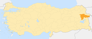
Agra [1] ( tur. Ağrı ) - silt in the east of Turkey .
| Silt | |
| Agra | |
|---|---|
| tour. Ağrı | |
| A country | Turkey |
| Includes | 8 districts |
| Adm. center | Karakose (Agra) |
| History and Geography | |
| Area | 11 315 km² (26th place ) |
Height
|
|
| Timezone | UTC + 2, in summer UTC + 3 |
| Population | |
| Population | 537 665 people ( 2009 ) ( 40th place ) |
| Density | 47.52 people / km² (58th place) |
| Official language | Kurdish, Turkish |
| Digital identifiers | |
| ISO 3166-2 Code | TR-04 |
| Telephone code | +90 472 |
| Postal codes | |
| Auto Code numbers | 04 |
| Official site | |
 | |
Content
- 1 Geography
- 2 History
- 3 population
- 4 Administrative divisions
- 5 notes
Geography
Il Agra in the east borders with Iran , in the north - with the silts of Igdir and Kars , in the west - with the silts of Mush and Erzurum , in the south - with the silts of Van and Bitlis .
The northern part of the region is occupied by the Agrydag ridge (the highest point is Mount Kekse , 3445 m), in the northeast, on the border with Ygdyr silt, is Mount Ararat (5165 m).
The origins of the Murat River (a tributary of the Euphrates ).
History
From 1927 to 1930, the Kurdish Republic of Ararat existed on the territory of silt.
Population
The population is 537,665 inhabitants (2009). The majority of the population are Kurds .
The largest cities are Karakose (Agra) , Dogubayazit .
Administrative Division
Il Agra is divided into 8 districts:
- Agra (Ağrı)
- Diyadin
- Dogubeyazıt (Doğubeyazıt)
- Eleşkirt
- Hamur
- Patnos
- Tashlichay (Taşlıçay)
- Tutak
Notes
- ↑ Agra // Dictionary of geographical names of foreign countries / ed. ed. A.M. Komkov . - 3rd ed., Revised. and add. - M .: Nedra , 1986.- S. 9.