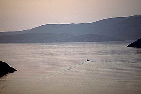
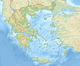
Kytnos [1] [2] , Kythnos [3] , Kythn [4] ( Greek Κύθνος ) is an island in Greece , in the southern Aegean Sea . Included in the Cyclades archipelago. Located between the islands of Kei and Serifos , 91 kilometers southeast of Athens . The port of Merihas in the west of Kitnos is 26 nautical miles from Lavrion and 52 nautical miles from Piraeus [5] . The population of 1,456 inhabitants according to the 2011 census [6] . The area is 99.432 square kilometers [7] , the coastline is 111 kilometers [8] . Residents are predominantly engaged in agriculture, livestock, fisheries, shipping and tourism. The wines and cheeses of Kitnos have been known since ancient times [5] .
| Kytnos | |
|---|---|
| Greek Κύθνος | |
 | |
| Specifications | |
| Square | 99,432 km² |
| Highest point | 356 m |
| Population | 1456 people (2011) |
| Population density | 14.64 people / km² |
| Location | |
| Archipelago | Cyclades |
| Water area | Aegean Sea |
| A country |
|
| Periphery | South Aegean |

The island is part of the ferry route Piraeus - Kitnos - Serifos - Sifnos - Milos - Kimolos . There are wind and solar power stations on the island [5] .
The highest peak is Kakovolo ( Greek Κακόβολο ) with a height of 356 meters [5] .
History
According to legend, the first inhabitants of Kitnos were Dryopes, who resettled after the Doric invasion in the XIV century BC. e. from Euboea , the island was called Dryopis , now the name has been preserved outside the village of Dryopis , the modern name of the island comes from the Dryopian king Kifna. Later, in the VIII century BC. e. the Ionians drove the Dryopes from the island and settled here [5] [9] .
On the northeast coast of the island in the place of Maroulas ( Μαρουλάς ) near the village of Loutra , a settlement and cemetery of the Mesolithic period were discovered, 8500 - 6500 BC. e. , the earliest known settlement of the Cyclades [5] [9] [10] . Most of this settlement is currently flooded by the sea. Excavations in 1996 revealed human skeletons , stone tools and other artifacts proving the presence of a person for a long time in this place (possibly hunter-gatherers).
According to archaeological data, Kitnos was inhabited in the Copper Age , in the Early Cilician period , in the 3rd millennium BC. e. when copper deposits in Kitnos led to the emergence of settlements and metallurgical furnaces. Kitnos was also inhabited in the Mycenaean period , 1600 - 1100 BC. e. . During the Mycenaean period, a port and a settlement appeared in Vriokastro, agriculture is developing on the island, and Kitnos supplies wine and cheese. In the prehistoric period, the island was called Ofiusa ( dr. Greek Ὀφιοῦσσα ), "Snake Island". In the archaic period, Kitnos reached its peak. The political structure of the island had integral features of the rule of aristocracy and democracy . This prompted Aristotle to write a philosophical work - “The Constitution of Kythnos” ( Κυθναίων Πολιτεία ), in which he saw state governance close to ideal. In the Greco-Persian wars, the island fought on the side of the Greeks. Herodotus writes that the island sent one trireme and one pentecenter to participate in the battle of Salamis [11] . Further, the island was a member of the First Athenian Maritime Union [4] . After the Peloponnesian War and the Wars of the Diadochs, Kitnos fell into decay during the Hellenistic period [5] [9] .
In the Roman period, Kitnos was used as a trading warehouse and a place of exile. In the VII century, residents due to piracy leave the ancient city of Kitnos and move to the impregnable Kefalokastro or Orya Castle in the north of the island. In 1207, three years after the siege and fall of Constantinople, Kitnos was captured by the Venetians , led by Marco Sanudo, and became part of the Naxos duchy they created. In 1337 he passed the noble family of Gozzadini from Bologna. In 1537, Kithnos was captured and destroyed by Admiral Hayreddin Barbarossa , and Gozzadini became vassals of the Ottoman Sultan. In 1566, the management of the island was transferred to Joseph Nasi . After his death in 1579, Kitnos became part of the Ottoman Empire. Sultan Murad III in 1580 and Sultan Ibrahim I in 1646 gave the Cyclades, including Kitnos, privileges that contributed to economic and cultural prosperity and the development of self-government. During the Russo-Turkish war of 1768-1774, it was captured by Russia, and returned to the Turks in the Kuchuk-Kainardzhiysky world [9] [5] .
Kitnos was one of the first islands to take part in the national liberation Greek revolution of 1821 and in 1830, like other Cyclades, reunited with Greece. In the 19th century, refugees from Crete founded Silakas ( Greek Σύλλακας ), now Driripis. At this time, Kitnos became known for its hot springs ( θερμές πηγές ) in Loutra Bay, due to which it was given the second name Termia or Fermia [4] ( Θερμιά ). During this period, shipping is growing [9] [5] .
In February 1862 there was an uprising against King Otto I, known as the “Kitniac” ( Κυθνιακά ). The revolutionaries, mainly from the island of Syros, tried to release the political prisoners who were in Kitnos after the suppression of the uprising in Nafplion . In the bay of Ayia Irini, the revolutionaries Leotsakos , Moraitinis and Skarvelis died in battle with the royal troops [5] [9] .
In 1941, Kitnos during the occupation of the axis of the countries fell into the Italian zone. After the truce between Italy and the Allies in 1943, he fell into the German zone [5] .
Archaeological sites
In the early Ciscal period , in the 3rd millennium BC. e. there was a significant settlement in Skurjes ( Σκουριές ) in the northeast of Kitnos [10] . Of particular importance are the remains of metallurgical furnaces and tools of the early Cilician period, which can be used to judge the development of copper deposits in Kitnos [5] .
In the place of Vriokastro ( Βριόκαστρο ), north of the modern port of Merihasa was a permanent fortified settlement from the Mycenaean period. During excavations in 1990-1995, in 2001 and since 2002 [12] , the ruins of the walls and buildings of the ancient Kitnos polis of the classical, Hellenistic and Roman periods have been preserved here. In the bay of Mandraki ( Μανδράκι ) was an ancient fortified port. In the course of underwater archaeological work carried out since 2005 by the University of Thessaly and the Inspectorate of Underwater Antiquities, marble statues of the Roman period were found, a bust in armor of the 1st century BC. e. and three herms of the II century, foundations of coastal walls and a breakwater 100 meters long in the southern part of the harbor. On the acropolis was an important temple of Demeter , which was used by residents from the VIII century BC. e. until the 1st century. Two rectangular buildings, presumably temples of the 4th or 3rd century BC, are found below on the plateau. e. At the cape north, another sanctuary was found. During excavations conducted in 2002-2006 [12] , Thessaly University, together with the Inspectorate of Prehistoric and Classical Antiquities, found finds relating to the archaic and Hellenistic period. Two stone altars were found and in the neighborhood a double temple of Apollo and Artemis of the 7th century BC. e. An untouched vault with offerings, mostly jewelry of the archaic period, was found in the temple. To the north during excavations since 2009, the foundation of the monument was found and below is a public building of the classical period [12] . According to archaeological data, the ancient city was inhabited continuously from the 10th century BC. e. until the VI – VII centuries, when the inhabitants moved to the Castle of Oria [10] .
From the classical period , several round and rectangular towers remained. In the northern part of Kitnos, near Cape Kefalos, there is Kefalokastro Castle ( Κεφαλόκαστρο ) or Orya Castle ( Κάστρο της Ωριάς ), currently uninhabited, during the Byzantine period and the period of Francoocracy , until the 18th century it was the administrative center of the island. The churches of the Forty Sebastian Martyrs and St. Sostis have been preserved here [5] . In the place of Kastelos ( Κάστελλος ) was a fortified acropolis of the archaic period, VII-VI century BC. e. [ten]
Museums
In the Dryopis there are Byzantine and Folklore museums [5] .
Architecture
The administrative center of the island, the village of Kitnos is located 7 kilometers northeast of the port of Merihasa and is an example of Cycladic architecture [5] .
In the Dryripis, houses have tiled roofs, which is associated with local ceramic production, and are a folk version of neoclassical architecture [5] .
In Kitnos there are the churches of Jesus the Savior (rebuilt in 1636), St. John the Baptist with a carved iconostasis of the XIV century, the Cathedral of St. Barbara of the XVIII century, the monastery of Our Lady of Nikus with a catholic in the form of a three-nave basilica with a dome that combine late Byzantine architecture with traditional standards. In the church of St. Sava in 1673 there is a coat of arms of Gozzadini, in the Church of the Transfiguration of the Lord there are paintings of famous Cretan artists Antonios, Emanuel and Ioannis Skordilis [5] .
Katafiki Cave
Near the village of Driripis in the area of “Fires” there is the Katafiki cave ( Καταφύκι ), one of the largest in Greece, rich in stalactites [13] . The cave was used by residents as a refuge during the Second World War [5] , and also as a place for the celebration of Easter .
Kithnos Community
The community (dim) of Kitnos ( Greek Δήμος Κύθνου [6] ) is included in the peripheral unit Kei-Kitnos in the periphery of the South Aegean Islands . The population of 1,456 inhabitants according to the 2011 census [6] . An area of 100.187 square kilometers [14] . The density of 14.53 people per square kilometer [6] . The administrative center is Kitnos . In the 2014 local elections, Stamatios Garderis ( Σταμάτιος Γαρδέρηарх ) was elected Dimarch .
There are two communities in the Kithnos community:
| Community | Population (2011) [15] , people | Area [14] , km² |
|---|---|---|
| Dryapis | 787 | 50,226 |
| Kytnos | 669 | 49,961 |
Population
| Year | Population |
|---|---|
| 1991 | 1611 [16] |
| 2001 | 1538 [16] |
| 2011 | ↘ 1456 [6] |
Natives
- Leonidas Paraskevopoulos (1860-1936) - general, participant in the Greek-Turkish war of 1897, the Balkan and World War I, commander of the Greek army of the period 1918-20, including the initial victorious period of the Asia Minor campaign.
Notes
- ↑ Greece // Atlas of the World / comp. and preparation. to the ed. PKO "Cartography" in 2009; ch. ed. G.V. Pozdnyak . - M .: PKO "Cartography": Onyx, 2010. - S. 74. - ISBN 978-5-85120-295-7 (Cartography). - ISBN 978-5-488-02609-4 (Onyx).
- ↑ Kitnos // Dictionary of geographical names of foreign countries / ed. ed. A.M. Komkov . - 3rd ed., Revised. and add. - M .: Nedra , 1986.- S. 165.
- ↑ Strabo . Geography . X.5.3; with. 485
- ↑ 1 2 3 Cythnus // The Real Dictionary of Classical Antiquities / ed. F. Lubker ; Edited by members of the Society of Classical Philology and Pedagogy F. Gelbke , L. Georgievsky , F. Zelinsky , V. Kansky , M. Kutorgi and P. Nikitin . - SPb. , 1885.
- ↑ 1 2 3 4 5 6 7 8 9 10 11 12 13 14 15 16 17 18 Τσώνος Κωνσταντίνος. Κύθνος (Greek) (inaccessible link) . Εγκυκλοπαίδεια Μείζονος Ελληηνισμού, Μ. Ασία . Ίδρυμα Μείζονος Ελληηιισμού (31 Μαρτίου 2005). Date of treatment November 6, 2017. Archived November 7, 2017.
- ↑ 1 2 3 4 5 Δελτίο τύπου. Ανακοίνωση των αποτελεσμάτων της Απογραφής Πληθυσμού-Κατοικιών 2011 για το Μόνιμο Πληθυσμό της Χώρας (Greek) . Ελληνική Στατιστική Αρχή (28 Δεκεμβρίου 2012). Date of treatment June 4, 2017.
- ↑ Eπιφάνεια, πραγματικός μόνιμος πληθυσμός και των κατοικημένων νήσων tes Eλλάδος (. Greek) // Σtatiσtikh eπethpiδa τησ Eλλαδοσ 2009 2010. & - Πειραιάς: Ελληνική Στατιστική Αρχή , 2011. - Σ. 47 . - ISSN 0081-5071 .
- ↑ Eπιφάνεια ελληνικών εδαφών και μήκος ακτών (Greek) // Σtatiσtikh eπethpiδa τησ Eλλαδοσ 2009 & 2010. - Πειραιάς: Ελληνική Σττ 28 . - ISSN 0081-5071 .
- ↑ 1 2 3 4 5 6 Αδωνις Κύρου. 100 αιώνες στα κύματα του Αιγαίου (Greek) (unavailable link) . Δήμος Κύθνου. Date of treatment November 6, 2017. Archived November 7, 2017.
- ↑ 1 2 3 4 Αλέξανδρος Μαζαράκης Αινιάν. Αρχαιολογικοί χώροι (Greek) . Δήμος Κύθνου. Date of treatment November 6, 2017.
- ↑ Herodotus . Story. Viii. 46
- ↑ 1 2 3 Αλέξανδρος Μαζαράκης Αινιάν. Αρχαιολογικές έρευνες (Greek) . Δήμος Κύθνου. Date of treatment November 6, 2017.
- ↑ Kythnos . gnto.ru. Date of treatment November 6, 2017.
- ↑ 1 2 Απογραφή πληθυσμού - κατοικιών της 18ης μαρτίου 2001 (μόνιμος πληθυσμός) (Greek) . - Πειραιάς: Εθνική στατιστική υπηρεσία της Ελλάδας , 2009. - Τ. I. - Σ. 418 . - ISSN 1106-5761 .
- ↑ Πίνακας αποτελεσμάτων Μόνιμου Πληθυσμού-Απογραφής 2011 (Greek) . Ελληνική Στατιστική Αρχή (20 Μαρτίου 2014). Date of treatment October 22, 2017.
- ↑ 1 2 Μόνιμος και Πραγματικός Πληθυσμός της Ελλάδος. Σύνολο Ελλάδος, νομοί, δήμοι / κοινότητες, δημοτικα / κοινοτικά διαμερίσμα και οικισμοί. Απογραφές πληθυσμού 2001 και 1991 (Greek) (unavailable link) . Ελληνική Στατιστική Αρχή . Date of treatment June 22, 2017. Archived July 16, 2006.
Links
- kythnos.gr - official site of the community (Dima) of Kitnos