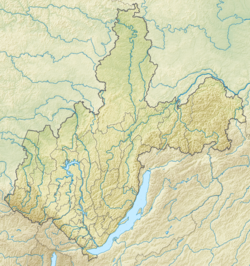
Kirenga is a river in the Irkutsk region of Russia, the right tributary of the Lena . A shipping section 438 km long from the village of Karam to the mouth is included in the list of waterways of the country [2] [3] .
| Kirenga | |
|---|---|
| Characteristic | |
| Length | 669 km |
| Pool | 46,600 km² |
| Water consumption | 650 m³ / s (18 km from the mouth) |
| Watercourse | |
| Source | river confluence: Left Kirenga and Right Kirenga |
| • Location | Baikal Range |
| • Height | 764.2 m |
| • Coordinates | |
| Mouth | Lena |
| • Location | 3155 km from the mouth, Kirensk |
| • Height | 250 m |
| • Coordinates | |
| Location | |
| Water system | Lena → Laptev Sea |
| A country |
|
| Region | Irkutsk region |
| Areas | Kachugsky district , Kazachinsko-Lensky district , Kirensky district |
| HWR code | |
Description
Length - 669 [2] km (from the source of the Left Kirengi - 746 [2] km). The catchment area is 46,600 km² [2] .
The river is formed at an altitude of 764.2 meters above sea level by the confluence of the Left Kirenga and Right Kirenga rivers, originating on the western slopes of the Baikal Range , on the territory of the Baikal-Lensky Reserve .
In the upper reaches, the river, leaving the reserve, makes a large loop from east to west and then to the north, after which the north becomes the main direction of the river flow.
In the middle course, the western section of the Baikal-Amur Railway (BAM) approaches the river. Near the village of Magistralny is the station Kirenga , from which the BAM goes along the left bank of the river for about 25 km. At the Okunaysky village, BAM crosses Kirengu and then goes along the right bank to the village of Ulkan (about 18 km), from where it leaves to the southeast, leaving the river valley. In parallel with BAM, the Ust-Kut - Severobaykalsk interregional highway passes.
Major tributaries
(distance from the mouth)
- 97 km: Kutima river (ave.)
- 179 km: Minya river (ave.)
- 261 km: Okunaika River (ave)
- 294 km: Ulkan River (ave)
- 472 km: Handa River (lv)
- 669 km: River Left Kirenga (lv)
- 669 km: Right Kirenga River (pr)
Settlements
On the river there are settlements of Kachugsky , Kazachinsko-Lensky and Kirensky districts of the Irkutsk region ( from source to mouth ): Chinong , Karam , Tarasovo , Yukhta , Ulkan (2 km east of the channel), End Lug , Okunaysky , Novoselovo , Sedankina , Trunk (3 km west of the channel), Keys , Pauses , Ispiriticha , Kazachinskoe , End Lug , Karnaukhova , Ermaki , Korotkovo , Transverse , Verkhnemartinovo , Nizhnemartinovo , Kutima , Ust-Kirenga , Sidorova .
At the mouth of Kirenga and on both banks of the Lena is the city of Kirensk .
Hydrology
The river freezes in late October - early November and remains under ice cover until the end of April - beginning of May. The average annual flow rate of 18 km from the mouth is 650 m³ / s. It has mainly rain nutrition.
Etymology
There are several versions about the origin of the name of the river.
The interpretation of M. N. Melkheev , according to which the hydronym is from Evenki, is generally recognized . kiri with the suffix "ӈа" translates as "dirty." The bottom of the Kirenga is lined with stones, resulting in an optical effect: the surface of the river appears black, although in fact the water is clean and clear.
According to the second version, supported primarily by the inhabitants of Kirensk , the hydronym comes from Evenki. siren in the meaning of "eagle's nest . "
In Yakutia , however, there are versions about the Turkic origin of the name: from Yakut. “Kiyiri uҥa”, which means “right entrance” - meaning “right tributary” (version of local historian and lawyer Boris Charpykov) [5] .
Notes
- ↑ Surface Water Resources of the USSR: Hydrological Understanding. T. 17. Lensko-Indigirsky district. Vol. 1. Upper Lena / ed. V.A. Vinogradova. - L .: Gidrometeoizdat, 1966 .-- 170 p.
- ↑ 1 2 3 4 State Water Register . Kirenga . textual.ru . Ministry of Natural Resources of Russia (March 29, 2009). Date of treatment December 20, 2018. Archived March 29, 2009.
- ↑ On approval of the list of inland waterways of the Russian Federation . Date of treatment February 8, 2018.
- ↑ Kirenga At Shorokhovo . R-ArcticNET. Date of treatment February 8, 2018.
- ↑ Why is Kirenga called Kirenga?
Links
- Kirenga // Great Soviet Encyclopedia : [in 30 vol.] / Ch. ed. A.M. Prokhorov . - 3rd ed. - M .: Soviet Encyclopedia, 1969-1978.