Fiery Earth [1] ( Spanish: Tierra del Fuego [1] [ ˈ t j e r a ð e l ˈ f w e ɣ o ]) - an archipelago between the Atlantic and Pacific oceans in the extreme south of South America [2] , composed which includes about 40 thousand islands. The total area of the archipelago is 73,753 km² , of which the main island of Tierra del Fuego (Isla Grande) is 47,992 km² .
| Tierra del Fuego | |
|---|---|
| Spanish Tierra del fuego | |
 Tierra del Fuego, view from the Beagle Channel | |
| Specifications | |
| Number of islands | about 40 thousand |
| Largest island | Tierra del Fuego |
| total area | 73 753 km² |
| Highest point | 2488 m |
| Population | 251,000 people (2006) |
| Population density | 3.4 people / km² |
| Location | |
| Washer water areas | Atlantic ocean , pacific ocean |
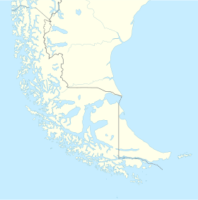
| Country |
|
Most of the islands of the archipelago belong to Chile and are part of the Magallanes region. Isla Grande Island is divided between Chile and Argentina , where it enters the Tierra del Fuego province. Argentina also owns the easternmost island of the archipelago - Estados .
Content
Geography
The archipelago is separated from the mainland by the Strait of Magellan , and from Antarctica - by the Drake Strait . The largest island, which is called the same as the archipelago, Tierra del Fuego (another name is Isla Grande), and the south-lying Oste and Navarino are separated by the Beagle Channel .
The highest point is Mount Darwin (2488 m), previously it was Mount (2469 m). The coast of the islands of the archipelago is severely indented, especially in the southwest. South of the archipelago is the southernmost point of South America - Diego Ramirez Islands.
Geology
The geology of the archipelago is characterized by the influence of Andean orogenesis and repeated Pleistocene glaciations. The island's geology can be divided into large east and west oriented units. The southwestern islands of the archipelago, including Cape Horn , are part of the South Patagonian batholith, and Cordillera Darwin and the area around the Beagle Channel comprise the main cordillera, on which the highest mountains are located. The folded and sliding Magallan belt extends north of Lake Fjord Almirantazgo and Lake Fagnano, and to the north of it lies the Magallan Lowland - an old sedimentary basin where hydrocarbon reserves are located. [3] Ortogneyss, whose age is 525 million years, is known to underlie some of the oil wells in the north of the Sierra del Fuego. [four]
The Magallano-Fagnansky fault, a silistral shift, crosses the southern part of the main island from west to east. This is an active fault located inside and parallel to the Fuegian fold and slide belt and marks the boundary between the southern belt of the Paleozoic meta-deposits and the northern Mesozoic belt of sedimentary deposits. Lake Fagnano occupies a hollow cut out by a glacier in an exhaust basin formed along the zone of the Magallano-Fanyansk fault. [five]
Podzols and ineptisols are found under the betuloid forests of Nothofagus in the Sierra del Fuego. [6]
Climate
This region is characterized by a subpolar oceanic climate (Köppen climate classification Cfc) with short, cold summers and long, humid, moderately mild winters: in the far west, an average of 3000 mm of precipitation falls, and on the east side their amount sharply decreases. The air temperature is stable throughout the year: in Ushuaia it barely exceeds 9 ° C in summer and an average of 0 ° C in winter. In summer, snowfall is possible. Cold and humid summers help preserve ancient glaciers. The southernmost islands have a subantarctic climate typical of the tundra, which makes tree growth impossible. The climate in some areas of the interior of the country is characterized by polarity. Regions of the world with a climate similar to the climate of the southern part of the Sierra del Fuego are: Aleutian Islands , Iceland , Alaska Peninsula , Faroe Islands , Macquarie Island, Heard and MacDonald Islands.
Flora
Only 30% of the islands have forests that are classified as Magellan subpolar. The northeast consists of the steppe and cool semi-desert. Six species of trees are found in the Sierra del Fuego: Canelo (Drimys winteri), Maytenus magellanica, Pilgerodendron uviferum, the southernmost conifer in the world, and three species of southern beech: Nothofagus antarctica, Nothofagus pumilio, and evergreen Nothofagus betuloides. Several types of fruits grow outdoors in these forests, such as beach strawberries (Fragaria chiloensis var. Chiloensis forma chiloensis) and calafate (Berberis buxifolia), which have long been harvested by Indians and people of European descent. These are the only forests in the world that have developed in such a cold summer. Forest cover is located very close to the southernmost tip of South America. The wind is so strong that trees in wind-affected areas grow in perverted forms, inspiring people to call them “flag trees”. The vegetation of the trees extends south to the island of Isla de los Estados , the island of Navarino and the northern part of the island of Hoste . Communities of night phages are found at altitudes above 500 m above sea level. Further south, the Wollaston Islands and the south of Host Island are covered in subantarctic tundra. The Sierra del Fuego forests have gone beyond local significance; they were a source of trees that were planted abroad in places with almost the same climate, but which were originally devoid of trees, such as the Faroe Islands and nearby archipelagos. Most species were collected in the coldest places in the Sierra del Fuego, mainly in areas bordering the tundra. These efforts led to positive changes, as strong winds and cool summers on the Faroe Islands did not allow trees from other regions of the world to be grown. Imported trees are mainly used as curtains against the wind and to combat erosion caused by hurricanes and grazing in the Faroe Islands [15].
Fauna
Among the most visible animals of the archipelago are Australian parrots, sea gulls , guanacos, foxes , kingfishers , kingfishers, condors , king penguins, owls and fire hummingbirds.
North American beavers introduced in the 1940s reproduced and caused significant damage to the island's forests. Governments have developed a large-scale beaver fishing and killing program in the Sierra del Fuego. [7]
Like the mainland of Chile and Argentina in the north, this archipelago boasts one of the best trout fisheries in the world. Brown trout of marine origin often exceeds 9 kg, especially in rivers such as Rio Grande , San Pablo and Lago Fagnano. Most of this water is privately owned, with catch and release and fly fishing.
The waters adjacent to the Sierra del Fuego are very rich in a variety of cetaceans. [8] In the 2000s, the number of habitats of southern right whales in the Sierra del Fuego [9] , as well as humpback [10] [11] and some others, such as blue whales, [12] southern fins, southern safes, 23 and southern blowjobs. [13] [14] The Beagle Channel is a prominent place for observing rare endemic dolphins [15] and less studied dwarf whales.
Among the cedars that live here are South American sea lions (flax lions of Otaria), [16] [17] South American fur seals (Arctocephalus australis), [18] [19] carnivorous leopards (Hydrurga leptonyx) (seals that feed on seals) and giant sea elephants (Mirounga]).
History
The discoverer Magellan believed that the archipelago is the northern part of the Unknown Southern Land - Terra Australis Incognita. Received its name after his voyage. Local residents (Indians) at night burned bonfires on the shore, but Magellan decided that these were lights of volcanic origin , and called the open territory Tierra del Fuego.
Colonization of Tierra del Fuego at the end of the 19th century was carried out by Julius Popper .
Population
On the island of Tierra del Fuego, there is the end point of the Pan American Highway , the southernmost railway in the world ( Train at the End of the World ) and the southernmost city of the planet - Ushuaia (Argentina). On the island of Navarino is the southernmost inhabited locality of the Earth - Puerto Toro (Chile). Most of the population lives on the island of Tierra del Fuego.
Among the aborigines of Tierra del Fuego (also known as the landowners , or fuegins), the Yagan people, speaking the isolated Yaman language, predominate, and the peoples of mainland South America are also represented on the island. Previously, Selknam lived on the islands, but the Argentine authorities in the late XIX - early XX centuries staged their genocide .
Archipelago in Art
- On Isla Grande, the action of Mine Reed's novel Tierra del Fuego (1885) takes place.
- On the island of Oste , the action of the novel by Jules Verne “The Shipwreck of Jonathan” (1897) takes place.
- Jules Verne wrote the story " Estados Island" Lighthouse at the End of the World "(1905).
- The fate of the indigenous population of the archipelago is dedicated to the story of R. F. Itz “The Tragedy of Tierra del Fuego” from the collection “Lotus Flower. The stories of an ethnographer ”(1962).
- is a 1948 film from Argentina.
- “ Dangerous Light at the End of the Earth " is an adventure film based on the novel of the same name by Jules Verne produced in the USA, Spain and Switzerland (1971).
- is a film produced by Chile, Spain and Italy (2000).
Notes
- ↑ 1 2 Fiery Earth / Telnova N.O. // Nikolay Kuzansky - Ocean. - M .: Great Russian Encyclopedia, 2013. - S. 656–657. - (The Big Russian Encyclopedia : [in 35 vols.] / Ch. Ed. Yu. S. Osipov ; 2004—2017, vol. 23). - ISBN 978-5-85270-360-6 . }}
- ↑ Morphometric characteristics // Atlas of the oceans: Atlantic and Indian oceans / rev. Ed .: S. G. Gorshkov ; ch. Ed .: V.I. Faleev . - L .: Ch. control navigation and oceanography Min. Defense of the USSR, 1977 .-- S. 20.
- ↑ Menichetti, M .; Lodolo, E .; Tassone, A. Structural geology of the Fuegian Andes and Magallanes fold-and-thrust belt - Tierra del Fuego Island (English) // Geologica Acta : journal. - 2008 .-- March ( vol. 6 , no. 1 ). Archived July 18, 2011.
- ↑ Hervé, Francisco ; Miller, Hubert; Pimpirev Christo. 2003. Patagonia - Antarctica Connections before Gondwana Break-Up in Antarctica Contributions to Global Earth Sciences. Chapter 5.1
- ↑ Lodolo, Emanuele; Menichetti, Marco; Bartole, Roberto; Ben ‐ Avraham, Zvi ; Tassone, Alejandro; Lippai, Horacio. Magallanes-Fagnano continental transform fault (Tierra del Fuego, southernmost South America ) // Tectonics: journal. - 2003. - Vol. 22 , no. 6 . - P. 1076 . - DOI : 10.1029 / 2003TC001500 . - .
- ↑ Gerding, Victor & Thiers, Oscar (2002), " Characterization of soils of Nothofagus betuloides (Mirb) Blume forests, in Tierra del Fuego, Chile ", Revista Chilena de Historia Natural T. 75 (4): 819–833 , < http://www.scielo.cl/scielo.php?pid=S0716-078X2002000400015&script=sci_arttext >
- ↑ Strieker, Gary Argentina eager to rid island of beavers . Cable News Network (July 9, 1999). Date of treatment June 30, 2007. Archived March 3, 2008.
- ↑ ARGENTINA. PROGRESS REPORT ON CETACEAN RESEARCH, JUNE 2000 TO JUNE 2001 with STATISTICAL DATA FOR THE SEASON 2000/2001
- ↑ Hoy en Rio Grande, Tierra del Fuego (ballena) . Archived on May 5, 2014.
- ↑ Whale Watching in the Southern Cone - Argentina (unavailable link) . Archived on May 31, 2014.
- ↑ Whale Watching in the Southern Cone - Gallery (link not available) . Archived on May 31, 2014.
- ↑ Blue Whale ( Balaenoptera musculus ) on Tierra del Fuego Check List . Archived on September 17, 2016.
- ↑ Minke Whale ( Balaenoptera acutorostrata ) on Tierra del Fuego Check List . Archived January 4, 2018.
- ↑ Record of a dwarf minke whale ( Balaenoptera acutorostrata ) in northern Brazil . Archived on May 5, 2014.
- ↑ Scotia Sea: Part 5. The Great Marine Mammals . Archived on May 5, 2014.
- ↑ Sailing to the Sea Lions and Les Eclaireurs Lighthouse in Catamarans . Archived January 20, 2013.
- ↑ Southern Sea Lions: Tierra del Fuego, Argentina (September 25, 2011). Archived on May 5, 2014.
- ↑ Mark Horrell: Tierra del Fuego . Flickr Archived on November 4, 2016.
- ↑ Ballenas en el Canal de Beagle . Archived on May 5, 2014.
Literature
- Delabord J., Loofs H. At the edge of the earth: (Tierra del Fuego and Patagonia) / Per. with him. I. S. Samylina and O. V. Mikheeva; After B.V. Andrianova . - M .: Thought , 1969. - 128, [32] p. - (Travel. Adventures. Fiction). - 50,000 copies.
- Zubov A.A. People of Tierra del Fuego . - M .: Geografgiz, 1961 .-- 40 p.: Ill.
- Coloane Francisco . Tierra del fuego. Stories / Transl. with spanish. - M.: Khudozh. literature, 1963 .-- 224 p.
- Sakhnin A.Ya. Tierra del Fuego. - M.: Soviet Russia, 1978. - 226 p.: Ill.
- Tierra del Fuego (archipelago) // Great Soviet Encyclopedia : [in 30 vol.] / Ch. ed. A.M. Prokhorov . - 3rd ed. - M .: Soviet Encyclopedia, 1969-1978.