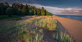
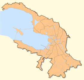
"Komarovsky coast" - a monument of nature , a specially protected natural area [1] . Located along the Primorsky highway between the Morskoy and Sportivnaya streets of the village of Komarovo in the Kurortny district of St. Petersburg , occupying a part of the shallow coastal water area covered with boulders.
| Nature Monument "Komarovsky Beach" | |
|---|---|
 The coast of the Gulf of Finland in Komarovo | |
| IUCN Category III ( Nature Monument ) | |
| basic information | |
| Square | 180 ha |
| Founding date | April 22, 1992 |
| Managing Organization | GKU "Directorate of specially protected natural territories of St. Petersburg" |
| Location | |
| A country |
|
| Nearest town | Zelenogorsk |


General Information
The nature monument “Komarovsky Bereg” was declared a small Council of the St. Petersburg City Council of People's Deputies No. 97 of April 4, 1992.
The area of especially protected natural territory is 180 hectares.
The nature monument is of regional importance.
History
The territory adjoining the coast of the Gulf of Finland in the Komarovo region began to be explored by a man relatively recently - only about 120 years ago. At the same time, the history of the neighboring settlements - Zelenogorsk (formerly Terioki) and Repino (formerly Kuokkala) dates back at least 500 years. Villages with such names were already mentioned at the beginning of the 16th century. in the tax lists of Swedish possessions on the Karelian Isthmus. Up until 1940, when the territory became part of the USSR, the Finnish population prevailed (the so-called Karelian Finns).
An idea of the appearance of the territory of a modern nature monument before the start of development is provided by a topographic map dated to the end of the 1850s. Here, the entire territory along the Gulf of Finland between Terioki and Kuokkala (which was then part of the Grand Duchy of Finland) is covered with forest. It is coniferous on the upper terrace and the Litorina ledge, and on the lower terrace a large area is occupied by black alder trees with spruce. Only along the bay from the Middle Ages did the coastal road (Rantatie) - the current Primorskoye Highway. Lands were not of great value for agriculture: on the upper terrace - due to the extreme poverty of “washed” soils on lake-glacial sands, on the lithorine terrace - due to high water logging.
The development of the territory began after the construction of the St. Petersburg-Vyborg- Riihimäki railway. Following the launch of the road in 1870, a “summer boom” of the late XIX - early XX century arose, unrecognizably transforming the patriarchal Finnish province. The wealthy residents of St. Petersburg, including the creative intelligentsia, rushed here: a new discovery of “Old Finland” took place, joined to Russia by Peter I. The Terioki village with the railway station of the same name became the informal “summer capital” of the Karelian Isthmus. At the end of the XIX century. Petersburgers, attracted by the magnificent pine forests, picturesque shores of the Gulf of Finland and silence, which was no longer enough in the populous Terioki, began to buy land from local peasants and build up sites with summer houses to the southeast (the current village of Komarovo). At the same time, to provide summer residents with dairy products and other foodstuffs, the peasants began clearing forests and draining parts of the Litorina terrace, creating agricultural land here.
By the beginning of the XX century. between Terioki and Kuokkala, an already so large holiday village was formed that in 1901 a railway platform was built with it, in 1903 it received station status. The name of the station and the village - Kellomäki - dates back to the name of the sandy hill, where during the construction of the railway a bell was suspended between the pines, the sound of which informed the workers about the beginning of the lunch break and the end of the working day. By the time the station appeared, the St. Petersburg summer residents prevailed among the population of Kellomäk, some of whom lived here in the winter. However, residents of various regions of Finland settled here, engaged in trade, construction, sawing, peat extraction, etc. In the summer, builders from Poland and gardeners from the Baltic States came to Kellomäki. The latter, known for their craftsmanship throughout Europe, created real masterpieces of landscape art on the poor sands of local terraces. Constructed according to the designs of famous architects, the country houses were striking in their luxury.
On the territory of the Komarovsky Bereg nature sanctuary, there is a part of the park of the former Reno villa (Chizhov’s cottage). The owners of the villa used the relief and natural vegetation of the territory and arranged on the upper and lower terraces and the Litorina ledge a park with four artificial ponds, the banks of which were lined with stone. In the novel by the St. Petersburg writer Natalia Galkina “Villa Reno”, real and fictional events taking place in the villa reveal a bizarre connection of times, cultures, characters, one of which was the right landscape of Komarovsky shore with a majestic dense forest, views of the Gulf of Finland, cascades of ponds, ravines with streams, to which the characters are addressed as living beings.
After the revolution of 1917 and the independence of Finland, relations with Petrograd were interrupted. Almost all the cottages of Komarov were abandoned by the owners and became the property of the Finnish state. In the 1920s. about 600 dachas were sold for export and dismantled, about 200 of them were in Järvenpää (near Helsinki).
On the degree of development of the territory in the first decades of the XX century. provides a topographic map produced in Finland in the 1920s. The forest area has decreased significantly compared with the middle of the XIX century. Agricultural lands (mainly hayfields) occupied at least 18 hectares, i.e., about 10% of the area of the nature monument.
In the first period of Finland’s independence, life in Kellomyäki was rather quiet compared to the pre-revolutionary times. Summer residents from other regions of Finland appeared, small enterprises. The beach on the Gulf of Finland was constantly maintained in a well-maintained condition. By the beginning of the Winter War in 1939, 167 families lived in the village, among which, besides Karelian Finns, there were also refugees from Russia. The fully evacuated village of Kellomäki was abandoned on the first day of the war, November 30, 1939. After the war ended in March 1940, the Finnish districts of the Karelian Isthmus became part of the USSR . From September 1941 to June 1944 the village was again occupied by the Finnish army, but it was forbidden to return to the civilian population in the front line.
The new history of Kellomäk began after the end of the Second World War, when the Soviet authorities immediately turned their attention to a cozy village on the shores of the bay. Already on October 14, 1945, the Resolution of the Council of People's Commissars of the USSR No. 2638 “On the construction of summer houses for the full members of the USSR Academy of Sciences” was issued. The decree prescribed to allocate land plots ranging in size from 0.5 to 1 hectare near the railways in dacha areas, build, in particular, 25 “individual dachas” near Leningrad and transfer them “gratuitously to private ownership to full members of the Academy of Sciences of the USSR”, as well as electricity, water supply and sewage and land improvement. The “Academic Village” in Kellomyaki was built on the upper terrace, on both sides of the western part of Bolshoy Prospekt, renamed Kurortnaya Street. There it still exists, being located along the northern border of the nature monument “Komarovsky bereg”.
The neighborhood of the nature monument “Komarovsky Beach” with the “Academic Village” had some unusual consequences. For example, along the ledge and on some parts of the slope among the forest grow species of trees and shrubs, obviously brought by scientists from expeditions and planted by them in their summer cottages (for example, the population of Maakak cherry at about 30 years old).
It is possible that the construction of summer houses for academics played a significant role in the renaming of the village of Kellomäki into Komarovo in 1948 - in honor of the president of the USSR Academy of Sciences V.L. Komarov , who lived here for several months shortly before his death. Komarovo became a part of the Resort zone created since 1946 along the coast of the Gulf of Finland between Sestroretsk and Smolyachkovo . The cottages that survived the pre-war period were repaired and handed over to the use of children's institutions, as well as prominent figures of science and culture in Leningrad. In Komarovo, as well as in neighboring Repino, holiday homes of creative organizations were built. By the mid-1950s. well-arranged (compared to other suburbs of Leningrad), the village acquired a stable image of the center of the creative and intellectual elite (including disgraced) of the northern capital.
A focused course on the development of all types of recreation has led to an almost complete collapse of the agricultural functions of landscapes. All the forests of the suburban zone of Leningrad were included in group I, where industrial logging was prohibited, fire protection was strengthened, and regular sanitary measures were carried out. Almost all forests of the Resort Zone have acquired the status of forest parks; the road and meliorative network was maintained here, recreation areas were equipped, etc. The Komarovsky Bereg nature reserve’s forests are in a satisfactory condition, although the pre-war ameliorative network is partially not functioning anymore.
Ecological route
The ecological route with information stands, wooden flooring, benches and a gazebo is functioning on the territory of the nature reserve “Komarovsky Bereg”. Following the route, you can independently get acquainted with all the natural complexes of protected areas. Attendance is free.
- Photo Gallery
Map of the Komarovsky coast in 1922
The beach on the territory of the monument of nature
Dunes
Coast of the Gulf of Finland
The foundation stone of the monument of nature
Ecotrail on the territory of the nature monument
Anthill on Komarovsky shore
Eco route on Komarovsky coast
Eco route on Komarovsky coast
Eco route on Komarovsky coast
Komarovsky coast
Komarovsky shore
Komarovsky shore
Geology and relief
Comprehensive geological surveys conducted during the preparation of the Master Plans of Leningrad in the 1980s, established the following geological structure of the territory.
The bottom-up section is represented by Quaternary sediments with a thickness of up to 35 m, occurring on the rocks of the Vendian Upper Proterozoic complex of impermeable clays and argelites: above them is the blurred surface of Upper Kotlinian clays from boulder loams , and so on, from below upward, the moraine of the Dnieper glaciation, the moraine of the Moscow glaciation, and the moraine of the glacier loamy, and the like from below upwards the moraine of the Dnieper glaciation, the moraine of the Moscow glaciation, and the moraine of the glacier loamy, and the like from the bottom up stages of glaciation from sands and ribbon clays, moraine from the Ludskoy stage of Valdai glaciation from boulder loams, sandy loam with gravel and boulders, Lugovskoye lake and lake-ice ikovy deposits from loams, band clays, sandy loams, layered sands, pebbles, emerging to the surface.
The relief of the territory of the Komarovsky Bereg reserve is located within the Litorina lower accumulative terrace (formerly Litorina Sea ), which existed on the site of the Baltic Sea 5–10 thousand years ago. The modern Litorina terrace is represented by a clearly visible slope up to 30 m high. The lower part is gently sloping, up to 600 m wide, has marks from 0 to 12 m in the Baltic height system . The wavy surface with a two-degree slope and separate marshy hollows is represented by fine- and medium-grained sands with boulders near the water of the Gulf of Finland and the zero-moon part at the base of the sea cliff. Relief downs are ground. The coast of the bay is represented by dunes in the form of coastal shafts up to 50 m wide and up to 5 m high. Dunes are composed of fine-grained sea sand. The coastal bank front repeats the bay shore. Here is a sandy, pebbly and sandy beach . Above - a modern coastal shaft with a height of up to 2 m. On the shaft exposed to intensive swelling, a gently sloping eolian relief is formed. Lowlands with peat in wet years are heavily flooded.
Litorinovy ledge, limiting the lower terrace, has a height of up to 18 m, reaching absolute elevations of up to 30 m. Composition: boulderless lake-glacial sands. At the foot of the slope - numerous outlets of groundwater with springs . There are many ravines - erosion hollows, up to 75 m wide and up to 12 m deep. Streams are formed, the water of which contains a large amount of iron. The top of the Litorina escarpment is composed of glacial sands with well-rounded pebbles.
Fauna
On "Komarovsky coast" 3 species of amphibians, 1 species of reptiles, 20 species of mammals and 143 species of birds are noted. The composition of terrestrial vertebrates is depleted due to the isolation of the nature monument from large forests.
The main feature of the species composition of the fauna of birds "Komarovsky shore" is the absolute predominance of forest species. Mosaic forest vegetation contributes to the fact that in close proximity can nest birds, committed to different types of forest. It is this feature that makes up the specificity of the nesting population of birds in the territory. For example, within 1 hectare birds can nest, characteristic of both spruce forests ( forest currant , kinglet , chiffchaff , etc.), and for pine forests or for mixed forests (most forest passerines). The basis of the nesting population at the present time are widespread passerine birds. Birds of prey, with the exception of the single nesting case of the merlin , are found during seasonal migrations and occasionally in winter ( sparrowing house); of owls, only the owl was noted, also during the wintering period.
Over the past several decades, the species composition of the fauna of birds has undergone significant changes. Part of the species, such as the Tawny Owl , the Nightjar , the Slab , the Forest Lark and, probably, the Hawk Slav disappeared in the given territory. After a long absence in recent years, individual cuckoos and orioles began to appear.
The protected area has a good potential for habitat for different types of woodpeckers due to the availability of suitable biotopes, as well as an abundance of anthills. Over the years, there were some nesting creeps , desirable , gray-haired, large and small variegated woodpeckers , in winter there are also white-backed and three-toed woodpecker.
Birds, characteristic of open landscapes, are represented by only two species that live on the seashore - this is a small plover and a white wagtail (currently only the last species nests). Migratory species make up 80% of all birds nesting here, and resident - only 20%.
The coastal zone of the Gulf of Finland is a stopping place for some migratory species of waterfowl and near-water birds, but at present they are extremely irregular. Previously, occasionally there were large clusters of small swan and whooper swan. Of the gulls, which are always many in the coastal zone of the bay, only small gulls demonstrate a distinct migration movement. Other species make regular daily movements, which can be difficult to distinguish from migratory movements. Of the rare species, the klusha , the small and the polar tern , and the necktie are sometimes noted during migrations.
A set of mammal species includes the common shrew , red-headed vole, ermine, white hare, and common hedgehog. Of the chiroptera, the northern leather jacket is most common.
Landscapes and vegetation
Most of the territory of the nature monument is located on the Litorina terrace, which stretches from the coast of the Gulf of Finland to a well-marked slope. This terrace is the bottom of the ancient Litorina Sea, and the slope (the ledge of the Litorina terrace) is its coast. Moving along the litorina terrace from the coast of the gulf to the Zelenogorsk highway, one can see how the plant communities replace each other: sandy beaches with isolated plants are replaced by dunes with grass communities and dogrose; further spread sparse pine forests and black-walled forests, which in turn are replaced by spruce and pine forests.
Spruce forests occupy the main part of the territory "Komarovsky shore." Particularly noteworthy are the old-growth spruce forests, where nests of northern forest ant are found in large numbers, forming “federations” - groups of related nests, including up to a dozen or more ant hills with layings.
Flora
The flora of higher vascular plants of the nature monument is quite rich (405 species). Of great interest is the group of psammophilic (growing on the sand) coastal species: sea mustard, sea rank , buterlaciferous raking , sandy hair , sand fescue, sandy sedge and wrinkled rosehip (introduced species). As a result of the conservation measures taken in recent years, the state of populations of psammophilic plants and their communities has improved significantly. The floristic interest in the complex of immoral species of forest communities is no less interesting. In the composition of the tree layer, there is a linden of the heart- leaved , Norway maple , oak ; among the bushes there is hazel , viburnum , wolf's bark , black honeysuckle - an introduced species that has actively spread in the lower part of the ledge under the canopy of spruce forest, sometimes forming dense thickets. Among the grassy non-moral and sub-moral species, the most common species here are: crow's eye , black-headed crow , lungwort , greenfinch , hooffoot, and a rarely found jagged conifer. On the upper terrace in the pine forests there is a rather rare shrub from the family of winter trees - an umbrella winter woman .
Plant photo gallery
Honeymoon
Starfish lanceolate
Starfish oakwood
Crested
Chistyak
Black Alder
Gravilat river
Oxygen
Maple
Lily of the valley
Maynik
Sand husk
Sand husk
Mixed forest
Violet
Bird cherry
Villa Reno
The reserve includes a park of the early 20th century Renault villas, which is included in the cultural and historical heritage of the Kurortny district of St. Petersburg at the federal level of protection as part of the address: Komarovo, ul. Marine 8 Mansion by Georges Borman . The villa is associated with the name of the first Nobel laureate of Russia Pavlov Ivan Petrovich [2] .
- Park Villa Reno in 2010
The foundation of the gazebo over Morskaya Street
Staircase to the cascade of ponds
Lower pond with an island
Pond on the middle creek
Upper pond
Dam between ponds
Cascade of ponds
- Objects on the territory of the nature monument in 2010
An object
Pine
Morskaya street 4
Morskaya street 4
Literature
- Komarovsky shore - a complex natural monument. SPb. Center of the Russian Academy of Sciences. SPb., 2002.
- Red Book of Nature of the Leningrad Region. T. 1. Specially Protected Natural Territories (Ed. Ed. G. A. Noskov) SPb., 1999.
Notes
- ↑ Decision of the Small Council of the St. Petersburg City Council No. 97 dated April 22, 1992.
- ↑ Galkina Natalia. Villa Reno. Novel. M., 2004
Links
- Nature Monument "Komarovsky Beach" on the official website of the village of Komarovo (Inaccessible link) . Archived April 19, 2012.
- List of PAs of the Leningrad Region and St. Petersburg
- MARINE AND MARITIME PAs (inaccessible link) . Archived July 22, 2013.
- Map of specially protected natural areas (PAs) on the official website of the administration of St. Petersburg (Not available link) . Archived January 16, 2009.