Veksa is a river in the Pereslavl region of the Yaroslavl region . It flows from Lake Pleshcheeva . It flows into Lake Somino , from which the Nerl River flows into the Volga [1] . The State Water Register of Russia considers Veksa together with the Nerl [2] .
| Veksa | |
|---|---|
| Characteristic | |
| Length | 9 km |
| Watercourse | |
| Source | Pleshcheevo lake |
| • Height | 137.4 m |
| • Coordinates | |
| Mouth | Somino |
| • Height | 134.7 m |
| • Coordinates | |
| River slope | 0.3 m / km |
| Location | |
| Water system | Somino → Nerl → Volga → Caspian Sea |
| A country |
|
| Region | Yaroslavskaya oblast |
| Area | Pereslavl district |
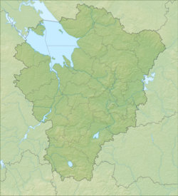
Length - 9 km. The source of Vöksy is located in the northwestern part of Lake Pleshcheeva. In the upper course flows through the territory of the national park "Pleshcheevo Lake ." In the middle part of the river is the village of Kupanskoe . In its lower part, the river is blocked by a dam. There are no other settlements on the river [1] . The height of the mouth is 134.7 m above sea level. The height of the source is 137.4 m above sea level. River slope - 0.3 m / km.
The course of the river is fast, the width over the entire length of 20-30 meters. Vöksa is navigable for boats and boats all over two sections from the dam.
The etymology of the name goes back to the Finno-Finnish wuoksi - stream. This name is often carried by rivers flowing from lakes in northern Russia [3] .
Notes
- ↑ 1 2 Map sheet O-37-XXVII Pereslavl-Zalessky . Scale: 1: 200 000. Status of the terrain for 1982. 1992 edition
- ↑ State Water Register . Nerl (Veksa Plescheevskaya) . textual.ru . Ministry of Natural Resources of Russia (March 29, 2009). Date of treatment December 20, 2018. Archived March 29, 2009.
- ↑ What the Voeksa River Tell About . Archived on August 29, 2009. . galich.com