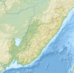
Avvakumovka - a river in the Primorsky Territory of Russia . It is formed by the confluence of the Furmanovka ( before 1972 - Tadagou ) [2] and Kazakovskaya (Sin-Kvandagou) [3] rivers, flows in the southeastern direction, making a kink to the south in only one place, then, straightening up, maintains its former direction and flows in Olga Bay of the Sea of Japan .
| Avvakumovka | |
|---|---|
 Avvakumovka, near the mouth Avvakumovka, near the mouth | |
| Characteristic | |
| Length | 67 km |
| Pool | 3170 km² |
| Water consumption | 16 m³ / s (s. Vetka) |
| Watercourse | |
| Source | river confluence: Furmanovka and Kazakovskaya |
| • Location | with. Furmanovo |
| • Coordinates | |
| Mouth | Olga Bay |
| • Location | west of the village Olga |
| • Height | 0 m |
| • Coordinates | |
| Location | |
| Water system | Japanese Sea |
| A country |
|
| Region | Primorsky Krai |
| Area | Olginsky district |
| HWR code | |
It was named by Russian immigrants [3] in honor of Archimandrite Avvakum (Honest) , who was on board the ship that opened the bay of St. Olga in 1857. The Chinese name of the river is Wai-Fujin [3] , not used by Russian settlers.
Content
Description
The length of the river is 67 km, the catchment area is 3170 km², the total river fall is 770 m. Its width to the mouth of the Vasilkovka river is 20–25 m, and the depth is 0.4–0.8 m. According to observations from 1937 to 1985, the annual average water consumption in the area of the village of Vetka is 16 m³ / s [4] .
In summer, floods are frequent, caused mainly by intense prolonged rains.
In the lower reaches, the Wai Fujin Valley is very picturesque. The cliffs on the right side have bizarre outlines and look like people, castles, minarets, etc. On the left side, high double terraces of clay shales stretched again, gradually turning in the north into the mountains.
- Arseniev V. K. "In the wilds of the Ussuri region" [5]
Settlements on the river: Furmanovo , Mikhailovka , Moldavanovka , Novonikolaevka , Vetka , Perm .
The Avvakumovka River has a conservation status, in the summer it goes to spawn a sim , in the fall - chum . The movement of small vessels with internal combustion engines is prohibited (only fishing inspection boats when hunting poachers ).
Major tributaries
(distance from the mouth)
- 7.8 km - Arzamazovka river (lv)
- 9.2 km - Vasilkovka River (pr)
- 32 km - Benevka river (ave.)
- 38 km - River Trout (pr)
- 49 km - Vygonka river (lv)
- 56 km - Kharchenkova Pad river (lv)
Gallery
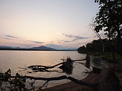
Avvakumovka river, Devil's cliff between the village of Perm and the village of Olga The mouth of Avvakumovka and the Gulf of Olga. The mouth of Avvakumovka, view from the Gulf of Olga.
Notes
- ↑ Surface Water Resources of the USSR: Hydrological Understanding. T. 18. The Far East. Vol. 2. Lower Amur (from the village of Pompeevka to the mouth) / ed. A.P. Muranova. - L .: Gidrometeoizdat, 1970 .-- 592 p.
- ↑ Resolution of the Council of Ministers of the RSFSR of December 29, 1972 N 753 . www.libussr.ru . Date of appeal April 24, 2019.
- ↑ 1 2 3 Arsenyev V.K. In the wilds of the Ussuri Territory. - M .: Moscow Worker, 1956 .-- S. 116.
- ↑ Avvakumovka at Vetka unopened (unavailable link) . UNESCO: Water resources . Date of treatment April 19, 2013. Archived on April 20, 2013.
- ↑ Arsenyev V.K. In the wilds of the Ussuri Territory. - M .: Moscow Worker, 1956 .-- S. 119.
Literature
- Arseniev V.K. In the wilds of the Ussuri Territory. - M .: Moscow Worker, 1956.- 487 p. - 100,000 copies.
Links
- Primogoda: Avvakumovka River . primpogoda.ru . Date of appeal April 24, 2019.