Kanchalan , in the upper South Tadleoan [2] (with Chuk. - “revenge site”), in the lower Gytgomkivam (with Chuk. - “lake-shrub river”) [3] - the river in the Far East of Russia , flows through the Iultinsky and Anadyr districts of the Chukotka Autonomous Region . The length is 426 km.
| Kanchalan | |
|---|---|
 | |
| Characteristic | |
| Length | 426 km |
| Pool | 20,600 km² |
| Water flow | 220 m³ / s (wellhead) |
| Watercourse | |
| Source | |
| • Location | Chukchi Highlands |
| • Height | above 419 m |
| • Coordinates | |
| Mouth | Bering Sea |
| • Location | Kanchalan estuary of the Gulf of Anadyr |
| • Height | 0 m |
| • Coordinates | |
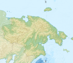
| Location | |
| Water system | Bering Sea |
| A country |
|
| Region | Chukotka Autonomous Region |
| HWR Code | |
In terms of the basin area (20.6 thousand km²), Kanchalan ranks 5th among the rivers of Chukotka and 52nd in Russia.
Hydronim
In the XVII — XVIII centuries. referred to as Nerpichye , the modern name arose later - on the mound Konchan (“the only one”) [4] .
Hydrography
It originates from several sources at the Misty Mountain of the Chukchi Highlands . In the middle and lower reaches, the Kanchalan runs among the southern tundras of the Anadyr lowland . It falls into the Kanchalan estuary of the Anadyr Bay of the Bering Sea . The banks of the river are mostly low, with floodplain areas, slightly hilly, sometimes elevated and steep, overgrown with shrubs and grass. Occasionally sandy, sandy-pebbly and rocky beaches or drying stones lie along them. There are many lakes in the floodplain. In the lower reaches, the channel width averages about 800 m, the maximum 1.5 km.
The bottom in the river is uneven, the deep sections from 10 to 20 m alternate with shallow ones, where depths of 5–7 m prevail. The greatest depth — 24.5 m — was noted in the mouth area. The bottom soil is silt, sand, silty sand off the coast, in some places pebbles and stone [5] .
Power snow and rain. It freezes in mid-October and opens in early June [2] . The spring flood begins with a gradual increase in the water level by 2–3 m and lasts 8–20 days, with flood floods occurring during the fall. The highest floods occur in the second half of August.
In the lower reaches of the river, semi-diurnal tides of the Bering Sea have a significant effect on fluctuations in the water level. Their magnitude ranges from 0.2 to 1 m. At the mouth of the Kanchalan, surge events occur. With strong southerly or easterly winds blowing for several days, the water level may rise by 1-2 m, due to which the ice cover at the mouth is cracked, this is typical until the end of November and the beginning of December [6] .
Large tributaries - Tnekweem, Impenkuyym.
Economic Activities
The river is navigable 50 km from the mouth. Not far from the mouth of the river is located the village of Kanchalan , here as piers pontoons are installed, to which vessels with a draft of up to 1 m can approach. Navigation on the river is open from July 1 to August 15 [5] .
Tundra in the middle and lower reaches are used for reindeer pastures. White whales regularly come to the mouth of Kanchalan. Fishery is well developed on the river, whitefish and salmon are mined here, and the fish reserves of Kanchalan are seriously damaged due to land reclamation [7] .
A meteorological station of the 2nd category operates on the river [8] .
Notes
- ↑ Surface water resources of the USSR: Hydrological knowledge. T. 19. Northeast / ed. Yu. N. Komarnitskaya. - L .: Gidrometeoizdat, 1966. - 602 p.
- ↑ 1 2 Kanchalan // Great Soviet Encyclopedia : [in 30 t.] / Ch. ed. A. M. Prokhorov . - 3rd ed. - M .: Soviet Encyclopedia, 1969-1978.
- Ть Leontyev V. V. , Novikova K. A. Toponymic Dictionary of the North-East of the USSR / scientific. ed. G. A. Menovshchikov ; Far East Branch of the USSR . North-East. complex. SRI. Lab archeology, history and ethnography. - Magadan: Magad. Prince publishing house , 1989. - p. 126, 349. - 456 p. - 15 000 copies - ISBN 5-7581-0044-7 .
- ↑ Ibid, p. 180
- ↑ 1 2 GUNiO MO USSR, Lotia River Anadyr, 1987
- ↑ Kanchalan . - article from the popular science encyclopedia "Water of Russia".
- ↑ Fish (Inaccessible link) . Kaira-Vestnik (# 2, July 2002). The appeal date is December 14, 2013. Archived January 17, 2010.
- ↑ FSUE UGMS (inaccessible link) . Archived September 2, 2013.
Literature
- Chereshnev I. A., Shestakov A. V., Skopets M. B., Korotayev Yu. A. Makoedov A. N. Freshwater fish of the Anadyr basin . - Vladivostok: Dal'nauka, 2001. - 336 p.