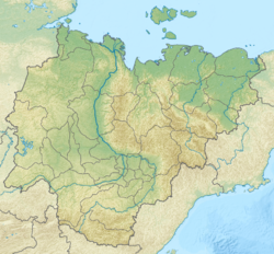
Irelyakh ( Yakut. Iireleeh ) - a river in Yakutia, a left tributary of the Ochchugui-Botuobuya river ( Vilyui basin). The length is 112 km, the catchment area is 829 km² [2] .
| Irelyah | |
|---|---|
| Yakut. Iireleeh | |
 Irelyakh river near the town of Mirny Irelyakh river near the town of Mirny | |
| Characteristic | |
| Length | 112 km |
| Pool | 829 km² |
| Water flow | 2 m³ / s (38 km from the mouth) |
| Watercourse | |
| Source | |
| • Height | above 365.3 m |
| • Coordinates | |
| Mouth | Ochchuguy-Botuobuya |
| • Height | 233 m |
| • Coordinates | |
| Location | |
| Water system | Ochchuguy-Botuobuya → Vilyuy → Lena → The Laptev Sea |
| A country |
|
| Region | Yakutia |
| Area | Mirny district |
| HWR Code | |
Water Mode
The river is powered by snow and rain. The average annual water discharge is at the city of Mirny (38 km from the mouth) 2 m³ / s, the largest - 135 m³ / s [3] . Ice weather from the beginning of October to the 2nd half of May; in winter, the river freezes to the bottom [3] . Used to supply the city of Mirny . There are diamond deposits in the river basin [3] .
Ecology
On August 17, 2018, as a result of the erosion of several dams in the Mirny district, polluted industrial water entered the river. Pollution passed along the river Irely, Ochchuguy-Botuobuya and Vilyuy , the concentration of "suspended solids" in the latter near the village of Suntar exceeded the norm by a factor of 20 [4] .
Notes
- ↑ Surface water resources of the USSR: Hydrological knowledge. V. 17. Lensko-Indigirsky District. Issue 4. Pool r. Lena from the mouth of the river. Aldan to the mouth of the river. Viluy and pool r. Viluy / ed. A.S. Sharoglazov. - L .: Gidrometeoizdat, 1964. - 128 p.
- ↑ Irelyakh River . State Water Registry . The appeal date is April 13, 2013. Archived April 17, 2013.
- ↑ 1 2 3 Irelyah // The Great Soviet Encyclopedia : [in 30 t.] / Ch. ed. A. M. Prokhorov . - 3rd ed. - M .: Soviet Encyclopedia, 1969-1978.
- ↑ In Yakutia, the concentration of pollutants in the Vilyui River exceeded the norm . regnum.ru . The appeal date is May 3, 2019.
