Samaria Gorge ( Greek Φαράγγι της Σαμαριάς ), also Samaria National Park [1] - the largest gorge in Europe , located in the mountains of Lefka Ori in the southwestern tip of Crete , in the community (dime) Sfakion in the peripheral unit of Chania in the periphery Crete One of the most famous attractions of Crete. The length of the gorge is about 13 kilometers, and the width varies from 3.5 to 300 meters. After passing control at the end of the gorge, it is necessary to overcome another 3 kilometers to the village of Ayia Rumeli . It is possible to get to the village by bus.
| Samaria Gorge | |
|---|---|
| Greek Φαράγγι της Σαμαριάς | |
 Samaria Gorge | |
| IUCN Category II ( National Park ) | |
| Location | |
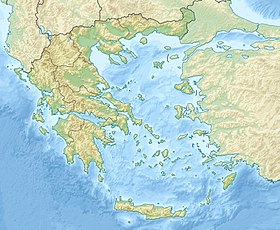
| A country |
|
The gorge received its name from the name of the Byzantine church of St. Mary of the XIV century. The church is located just below the former village of Samaria (approximately in the middle of the road).
Content
History
Samaria gorge has been populated since time immemorial. Here are the remains of temples dedicated, presumably, to Apollo and Artemis . In the VI century BC e. at the end of the gorge, the city of Tara ( Τάρρα ) was built. A small, but autonomous and widely known, minted coin. The coins depicted: on the one hand - the head of a wild goat, and on the other - a bee . The river flowing along the gorge was called Tareos and the gorge probably had the same name. Ancient authors Diodorus of Sicily , Sekliot mention the gorge near the city of Tara [ specify ] , Pliny the Elder and others. The city reached its heyday during Roman rule .
During the years of the Turkish yoke, residents of Sfakia and other areas hid from the massacre in the gorge. In fierce battles, the Sphakians saved the gorge from the invasion of the Turks.
During the dictatorship of Metaxas (1935-1940), revolutionary general Emanuel Mandakas and his associates found refuge in these places.
During World War II , the route of the Greek government emigrated to Egypt ran through the gorge. During the German occupation, there was a camp of resistance fighters . In 1942 and 1943, an expedition of German scientists worked in the gorge, who for the first time carried out a systematic study of the flora and fauna of the gorge, made the first film about the gorge and wild animals inhabiting it. During the expedition, the famous natural scientist Siebert died (fell off a cliff) [ specify ] .
During the civil war in Greece , left insurgents hid in the gorge, until June 1948 , when, in one of the villages, they were surrounded by a detachment of soldiers and police, and after a heavy battle they were destroyed. Here ended the civil war in Crete.
In 1962, the gorge received the status of a national park . Then from the village of Samaria resettled residents. The reserve covers an area of 4850 ha. At the end of the gorge, on the seashore, is the village of Ayia Rumeli.
National Park
Flora and Fauna
The purpose of the reserve is to protect the unique nature of Lefka Ori, and especially the endemic Cretan mountain goat Cree Cree ( Capra aegagrus creticus ). In addition to Cree Cree, other rare species of animals and birds live in the gorge. This is a wild cat (currently very few), various types of eagles , martens , badgers .
Among the plants in the gorge , Cretan endemics are also found. This, for example, dictamos, or Erondas and Cretan cypress . Other representatives of the gorge flora: various types of pine , plane trees , stone oak , Cretan maple , ebony and many others.
Tourism
Since 1931 , a branch of the Greek Mountaineering Society in the city of Chania has organized guided tours of tourist groups through the gorge. Since 1962, since the formation of the national park, hiking has become more systematic, and in 1969 , the first sales of tours in the gorge by travel agencies began. Since the beginning of 2000, 200,000 travelers pass through the gorge annually [2] . On some days, the trail can be up to 3,000 people at a time. You can avoid traffic jam if you go to the gorge early in the morning. The best time in the reserve is spring. In the summer in the gorge it is suffocatingly hot.
The entrance to the national park is located 5 kilometers from the village of Omalos . The tourist route begins at an altitude of 1250 meters above sea level along a trail with wooden fences laid along the slope of the mountain. The entire length of the gorge is 12.8 kilometers (often figure 18 is the distance from the settlement of Omalos to Ayia Rumeli). Walking passage takes 4-6 hours. An untrained person should be prepared for a painful sensation in the legs after descending the "steps". After the descent, the trail goes along the river bed, which almost dries out in the summer, the flow of water is periodically hidden by stones. Mountain peaks rising above the gorge reach a height of 2000 meters. The entire trail is marked with kilometer signs, along the route there are relaxation places, toilets and springs with drinking water, as well as fire fighting equipment. The route is patrolled by mule forestry officers.
In the gorge (directly on the route and away from it) there are several ancient churches: the Church of St. Nicholas (built on the site of the ancient temple of Apollo or Artemis), the Church of Christ, the Church of St. Mary of Egypt (which gave the name to the village of Samaria and the gorge. The building dates from XII— XIII centuries, on one of the walls the inscription "1379" is visible, the frescoes are dated 1740 ). Some of the temples are open to the public.
Approximately in the middle of the path are the restored traditional Cretan houses of the former village of Samaria (the inhabitants were relocated from it in 1962). The village has a telephone, a forest guard post, a pharmacy, a helipad and several mules, in case tourists have problems.
The narrowest part of the gorge, Portes Gorge, is located about 4 kilometers from the village of Samaria. The passage between the steep cliffs is about 3.5 meters wide, and the cliffs reach a height of 300 meters.
The exit from the gorge is located 3 kilometers from the sea, in the area of the village of Ayia Rumeli. The ferry going to the Chora Sfakion , Paleochora or Suyi takes tourists from the pier in the village - roads are laid to these settlements, while you can leave Ayia Rumeli only by water or go through the gorge on foot in the opposite direction, which is quite difficult. Ayia Rumeli has a hotel, a guesthouse and several taverns.
In winter and spring, during torrential rains, a stormy stream of water runs along the bottom of the gorge, stones fall from the walls. At this time, the national park is closed to tourists. Overnight in the gorge is prohibited year-round. Entrance to the route is paid (5 euros in prices of 2017, children under 12 years old are free), control points at the entrance and exit from the gorge allow you to determine the remaining in the gorge for their own safety. You can return through any point, so a ticket for a ship (11 euros in 2017 prices) is not included in the price. The route, according to the difficulty of passing, the surrounding landscapes and the methods of passing and delivering tourists (car - foot descent - ship) resembles the Maska gorge in Tenerife .
Gallery
View of the Samaria Gorge from the Xyloskalo side ( Ξυλόσκαλο )
National Park Entrance
Mountain goat " Cree Cree ", an endemic of Crete
Thyme Thymus capitatus , one of the plants growing in the gorge
Pine tree growing on a steep cliff
Church of St. Nicholas, located in the gorge
The ruins of the buildings of the village of Samaria
Cliffs
Cliffs
Notes
- ↑ Greece. Reference card. Scale 1: 1 000 000 / Editor-in-chief Y. A. Topchiyan. - M .: Roskartografiya, 2001. - (Countries of the world. Europe). - 2000 copies.
- ↑ Hanna, Nick. Kreeta = Engl. alkuteos: Globetrotter Travel Guide Crete / suom. Roinila, Maija. - Köln, Saksa: Könemann Verlagsgesellschaft mbH, 2000 .-- S. 113-116. - ISBN 3-8290-3261-7 .
Literature
- Andonis G. Plimakis. Samarya Gorge / Translation by Irini I. Naumidi. - G. Detorakis, Heraklion Biomechanical Area, 1998.