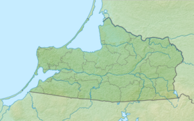
Lake Krasne (the Polish name is Lake Goldap , Polish. Jezioro Gołdap ) is a lake in the Nesterovsky District of the Kaliningrad Region of Russia and the Warmian-Masurian Voivodeship of Poland . The lake is located in Romintenska Forest , near the Polish city of Goldap . The lake crosses the Russian-Polish border , most of the lake belongs to Poland. The Russian part of the lake is located in the border strip, closed to the public; There is a border post on the east coast. A little to the west is the Gusev automobile checkpoint.
| Lake | |
| Red ( Goldap ) | |
|---|---|
 | |
| Morphometry | |
| Square | 2.26 km² |
| Deepest | 10.9 m |
| Pool | |
| Flowing river | Bright |
| Flowing river | Goldapa |
| Location | |
| Country |
|
| Regions | Kaliningrad Region , Warmian-Masurian Voivodeship |
| Identifiers | |
| HWR : | |
The area of the lake is 2.26 [2] km², the height of the water edge is 150 meters above sea level, the maximum depth is 10.9 m, the average is 5.6 m. The volume is 8345.3 thousand m³. The lake is oblong in shape, stretched from the southeast to northwest. Maximum length - 2930 m, width - 880 m, coastline - 7600 m.
The Yarka River flows into the lake , the Goldapa River flows from it.
Notes
- ↑ Surface Water Resources of the USSR: Hydrological Understanding. T. 4. Baltic region. Vol. 3. The Lithuanian SSR and the Kaliningrad region of the RSFSR / ed. M.V. Silicha. - L .: Gidrometeoizdat, 1963 .-- 171 p.
- ↑ State Water Register . Lake Red (Goldiper See) . textual.ru . Ministry of Natural Resources of Russia (March 29, 2009). Date of treatment December 20, 2018. Archived March 29, 2009.
Cartographic materials
- Map sheet N-34-XVII Suwalki . Scale: 1: 200 000. Terrain conditions for 1980-1984. 1989 Edition
- Kaliningrad region. General geographic map. 1: 200 000. Federal Service for Geodesy and Cartography, Moscow 1995.