The Taz Peninsula is a peninsula in the north of the West Siberian Plain , between the Gulf of Ob in the west and the Taz Bay in the east.
| Taz Peninsula | |
|---|---|
| Characteristics | |
| Area | about 20 thousand km² |
| Highest point | 100 m |
| Location | |
| Water area | Gulf of Ob |
| A country |
|

Geography
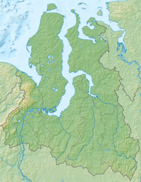
Length about 200 km, width on average 100 km, height up to 100 meters. The surface is flat, slightly inclined east to the Taz Bay and falls by large cliffs in the west to the Gulf of Ob. The highest point is 89 m above sea level (in the northern part of the peninsula).
The largest river, the Poylovoyakha (Poelavoyakha), originates in the southern part of the peninsula and flows into the Taz Bay in the east. The largest lakes are Sor (in the north) and Pyemalto (in the northeast).
The extreme western point of the peninsula is called Cape Parusny, in the north-west is Cape Krugly, in the north-east is Cape Povorotny.
Vegetation - moss-lichen and shrub tundra . The surface is covered with numerous lakes and swamps.
Economic value
There are gas fields, including the large Yamburgskoye oil and gas condensate field . Large-scale production is carried out in the southwestern, southern and central parts of the peninsula. Field development began in 1980, the license for development is owned by Gazprom Dobycha Yamburg LLC (100% subsidiary of Gazprom OJSC).
In the south-west of the peninsula there is a shift camp of gas workers - Yamburg . Railways laid to the village line and highway from the city of Novy Urengoy , highway from the village of Pangody . Near the village is the airport . Lines of gas pipelines go south from the places of gas production to the city of Novy Urengoy.
Administratively, the territory of the peninsula is part of the Yamalo-Nenets Autonomous Okrug . Almost completely refers to the Tazovsky and Nadym districts, a small part - to the Purovsky district.