Lepsy is a river in Kazakhstan , it belongs to the basin of Lake Balkhash , in terms of water content it takes 3rd place after the Ili and Karatal rivers. The length of Lepsy is 418 km, the basin area is 9400 km². [one]
| Leps | |
|---|---|
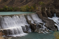 Lepsy near the Antonovskaya hydroelectric station Lepsy near the Antonovskaya hydroelectric station | |
| Characteristic | |
| Length | 418 km |
| Pool | 9400 km² |
| Water consumption | 18.7 m³ / s (Lepsinsk) |
| Watercourse | |
| Source | |
| • Location | Dzungarian Alatau |
| • Height | 3086 m |
| • Coordinates | |
| Mouth | Balkhash |
| • Height | 341.9 m |
| • Coordinates | |
| Location | |
| Water system | Balkhash |
| A country |
|
| Region | Alma-Ata's region |


It originates from the glaciers of the northern slopes of the Dzungarian Alatau, flows among various natural zones, flows into the eastern part of Lake Balkhash. In the east, the Lepsy basin is bounded by the Tentek basin, and in the west by the Baskan spurs. Leps is formed by the confluence of the Agynykatta rivers (left, 60%) and Sarymsakty (right, 40%), separated by the Lepsin spur. Immediately after the confluence of the sources of Lepsa, he leaves for Lepsinsky Canyon. Then the river flows in the Kargalinsky valley and Cherkassky gorge, and next - the dam of the hydroelectric power station. Below the dam, the valley expands sharply, the banks here are covered with forest, there are many dense thickets of shrubs, and there are dunes. The course drops noticeably, the river often breaks into channels, many islands.
There are 144 glaciers in the Lepsy river basin with a total area of 189.6 km². In the middle part of Lepsy takes a large tributary of the river. Baskan, which is now blocked by a dam and is almost completely disassembled for irrigation, therefore, it practically does not affect the water content of Lepsa. The water content of Lepsy is determined by 68 glaciers with a total area of 90.5 km². In the Sarymsakty river basin there are 21 glaciers with an area of 20.5 km².
Lepsa river food is mixed snow-ice. From mid-March to the second half of April, the first wave of snow flood caused by melting snow. From the second half of May until mid-June, a new, higher wave passes due to the melting of snow reserves in the highlands of the basin. The fall of the snow flood usually begins after its last peak and lasts for 15–20 days, followed by a group of waves of glacial flood that is very long in time, occupying the period from late June to the second half of August.
Daily fluctuations in water usually do not exceed 400 mm, annual 2400 mm.
| The average annual consumption in the area | |
|---|---|
| Village Lepsinsk | 18.7 m³ / s |
| Antonovka village (since 1993 - Koylyk) | 25.7 m³ / s |
| Lepsy stations | 22.1 m³ / s |
| The average monthly discharge of the Lepsy river in m³ / s in the area of the village of Lepsinsk | |||
|---|---|---|---|
| April | 19,4 | July | 38,0 |
| May | 43.6 | August | 30.6 |
| June | 46.0 | September | 15.7 |
The water in the upper reaches is clear, soft, suitable for drinking, and in the lower reaches muddy. It is used for water supply of the population, irrigation, mole alloy of the forest.
Notes
- ↑ Leps // Kazakhstan. National Encyclopedia . - Almaty: Kazakh encyclopedias , 2005. - T. III. - ISBN 9965-9746-4-0 .