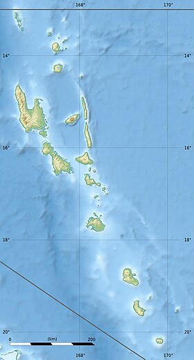
Gaua ( eng. Gaua ) - an island in the island group Banks (archipelago New Hebrides ) in the Pacific Ocean . Belongs to the Republic of Vanuatu and is part of the province of Torba .
| Gaua ( Santa Maria ) | |
|---|---|
| English Gaua | |
 | |
| Specifications | |
| Square | 328.2 km² |
| Highest point | 797 m |
| Population | 2491 people (2009) |
| Population density | 7.59 p / km² |
| Location | |
| Water area | Pacific Ocean |
| A country |
|
| Region | Torba |
Content
Geography
The island of Gaua is located in the northern part of the New Hebrides archipelago in the Banks island group . Washed by the waters of the Pacific Ocean and the Coral Sea . To the south-east is the island of Mere-Lava , to the north - the island of Vanua Lava . The nearest mainland, Australia , is located approximately 1,300 km [1] .
The island of Gaua, like the other islands of the New Hebrides , is of volcanic origin [1] . It consists of basalto - andesite stratovolcano , whose caldera is 6 × 9 km wide [2] . The formation of the historically active cone of Mount Garath and other small tuff cones in the southwestern part of the caldera was accompanied by the formation of a crescent-shaped caldera lake [2] . This lake is the largest freshwater lake of Vanuatu [3] and the entire Pacific Ocean (outside Papua New Guinea ) [4] . The area of Lake Letas is 1900 hectares , and the depth in some places reaches 360 m [4] . The lake is located at an altitude of 418 m. The highest point of the island, Mount Garat , reaches 797 m [1] . The area of Gaua is 328.2 km².
The climate on the island is humid tropical [1] . The average annual rainfall exceeds 3500 mm. Gaua is subject to frequent earthquakes and cyclones .
History
The European discoverer of Gaua was the Spanish navigator originally from Portugal Pedro Fernandez Quiroz , who discovered the island in 1606 and called it "Santa Maria" .
In March 1906, Gaua, like the other islands of the New Hebrides, became a joint possession of France and Britain , that is, the archipelago received the status of an Anglo-French condominium [5] .
On June 30, 1980, the New Hebrides gained independence from Britain and France, and the island of Gaua became the territory of the Republic of Vanuatu .
Population
In 2009, the population of the Gaua was 2,491 people [6] . The main occupation of the locals is agriculture ( cocoa cultivation and copra production). The islanders speak several Melanesian languages :
- Dorig (157 carriers in 2000; used in the villages of Dorig and Queteon);
- Koro (105 carriers in 1983; used in the villages of Koro and Mekeon);
- Lacon (300 carriers in 1983);
- noume (450 carriers in 1983) [7] .
The population lives in several coastal villages located on the western, southern and northeastern coasts of the Gaua. The largest settlements are the villages of Onetar and Beveto . The island has an airfield [3] .
See also
- List of islands of Vanuatu
- Gaua (volcano)
Notes
- ↑ 1 2 3 4 UN SYSTEM-WIDE EARTHWATCH Web Site . Vanuatu Islands. (eng.)
- ↑ 1 2 Gaua : [ eng ] // Global Volcanism Program . - Smithsonian Institution .
- ↑ 1 2 Positive Earth . Gaua. (eng.)
- ↑ 1 2 Ernest Bani and David Esrom . Republic of Vanuatu. (eng.) Archived July 17, 2010.
- ↑ Tufala Gavman . Condominiums from the Anglo-French Condominium of the New Hebrides / Brian J. Bresnihan, Keith Woodward, editors. - Suva, Fiji: Institute of Pacific Studies, University of the South Pacific, 2002. - Pp. 23.
- ↑ 2009 National Population and Housing Census (2009). Archived October 17, 2012.
- ↑ Ethnologue . Languages of Vanuatu. (English) ; Languages Banks. (eng.)
