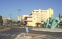
Hadera ( Hebrew חֲדֵרָה ) is a city in Israel .
| City | |||
| Hadera | |||
|---|---|---|---|
| חֲדֵרָה | |||
| |||
| A country | |||
| County | Haifa | ||
| The mayor | Zvi Handelman | ||
| History and Geography | |||
| Based | 1890 | ||
| Square | 53 km² | ||
| Height above sea level | 42 m | ||
| Timezone | UTC + 2 , in summer UTC + 3 | ||
| Population | |||
| Population | 93 973 people ( 2018 ) | ||
| Density | 1.455 people / km² | ||
| Nationalities | Jews | ||
| archive.is/20121205042350/http://www.hadera.muni.il/ (Hebrew) | |||

The city is located in Haifa District, almost on the border with the central region of Israel, in the middle between Tel Aviv and Haifa . The city center is located a few kilometers from the Mediterranean coast, and the western part of the city - Givat Olga - is located directly by the sea.
The city was founded in 1890 by members of the Hovevei Zion organization, immigrants from Russia and eastern Europe.
Content
Etymology of a Place
The name "Hadera" comes from the Arabic "El Khudeira" - "green", the predominant color of the marsh vegetation that previously dominated the area.
History
The story of Hadera began with the purchase of a wetland plot and the foundation of a small agricultural settlement on it. The first settlers were forced to fight the oppression and extortion of the Turkish authorities, Bedouin attacks, malaria. More than half of the settlers from Hadera die of malaria during the first 20 years. Settlers received help in 1895 when Baron Edmond de Rothschild allocated funds to drain the swamps, to build canals and plant large eucalyptus groves.
In the 20s of the XX century, a railway from Tel Aviv to Haifa was laid through Hadera. Currently, the city has a railway station. The train journey to Tel Aviv or Haifa is approximately 30 minutes. Two highways leading from Haifa to Tel Aviv - highway 2 and highway 4 also pass through the city.
In 1936, Hadera was given the status of a city. The city consists of districts built at a certain distance from one another. The largest areas are Givat Olga by the sea and Beit Eliezer, located east of the city center.
In 1982, between the city and the sea, a large power station was built, called the “Rabin Lights” in honor of Yitzhak Rabin .
Economics
The industrial zone is located in the northern part of the city. There are large paper and tire mills.
Education
The city has 98 kindergartens, 14 elementary schools, 12 secondary and intermediate schools, 2 art schools, and a secondary boarding school .
Health
The Hillel-Yafe hospital is located in the city, serving residents of the city and nearby settlements.
There is a large military sanatorium by the sea.
Population
According to the Central Bureau of Statistics of Israel , the population at the beginning of 2018 was 93,973 people [1] .
More than 22% of the population are immigrants who came after 1990 [2] . Among immigrants, a high percentage of immigrants from Russia and the CIS countries, mainly from the Caucasus.
Notes
- ↑ Official data on Israeli settlements on 12/31/2017 (Hebrew) . Central Bureau of Statistics of Israel . Date of treatment December 27, 2018.
- ↑ Statistical data for Israeli cities. Archived February 29, 2008.