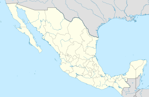
El Nayar ( Spanish: El Nayar ) [3] - a municipality in the Mexican state of Nayarit , with an administrative center in the village of Jesus Maria . The population according to the 2010 census was 34,300.
| Municipality of Mexico (AE Level 2) | ||
| El nayar | ||
|---|---|---|
| El nayar | ||
| A country | ||
| State | Nayarit | |
| Adm. Centre | Jesus Maria (2638 people, 8%) | |
| Number n.p. | 493 | |
| Population ( ▲ 2010 , census) | 34 300 people [one] | |
| Density | 6.7 people / km² | |
| Language composition | Spanish | |
| Square | 5142 km² | |
| Heights • highest point | La Sienegita (2340 m ) | |
| Coordinates of the administrative center | ||
| Coordinates extreme points | 21 ° 25 '- 22 ° 40' N 103 ° 58 '- 105 ° 03' west | |
| Educated | 1939 year | |
| Chairman (2011-2014) | Pedro de la Cruz Flores | |
| Timezone | UTC − 6 , summer UTC-5 | |
| Telephone code | +52 311 | |
| Postcode | 63530-63549 [2] | |
| INEGI Code | 009 | |
| http://delnayar.gob.mx/ (Spanish) | ||
State Map Position | ||
General information
The name El Nayar is given in honor of the ruler of the indigenous people of Cora (self-designation náayarite ), which existed here before the arrival of the Spaniards, and from the adverb, the core can be translated as “the son of God who rules the sky and the sun” [4] .
The area of the municipality is 5142 km², which is 18.3% of the state [5] . It borders with other Nayarit municipalities: in the south, with La Esqua , Santa Maria del Oro and Tepic , in the west with Santiago-Isquintla , Ruiz and Rosamorada , and in the north-west with Acaponeta . Del Nayar also borders on other states: in the north with Durango , and in the east with Zacatecas and Jalisco .
Institution and composition
The municipality was formed in 1939 [4] . The municipality includes 493 settlements, the largest of which are:
| code INEGI | Locality | Number of the population (2005) [6] | Number of the population (2010) [1] |
| 009 | Total | 30 551 | 34 300 |
| 0001 | Jesus maria ( Spanish: Jesús María ) (administrative center) | 2 390 | 2 638 |
| 0086 | Mesa del Nayar ( Spanish: Mesa del Nayar ) | 1,185 | 1,729 |
| 0137 | Santa teresa ( Spanish Santa Teresa ) | 1,087 | 1,558 |
| 0225 | Linda Vista ( Spanish Linda Vista ) | 867 | 769 |
| 0215 | Viejo Ranch ( Spanish Rancho Viejo ) | 638 | 622 |
Notes
- ↑ 1 2 INEGI. 2010 Mexico Census (Spanish)
- ↑ Postal codes of Del Nayar
- ↑ List of municipalities on the official website of the Nayarit State Administration (Spanish) (link not available) . Archived on June 6, 2015.
- ↑ 1 2 Encyclopedia of the Municipalities of Mexico. El Nayar Archived on January 10, 2014. (Spanish)
- ↑ National Municipal Information System (Spanish)
- ↑ INEGI. 2005 Mexico Census Archived July 22, 2011. (Spanish)
