Felipe Carrillo Puerto ( Spanish: Felipe Carrillo Puerto ) is a municipality in Mexico , Quintana Roo , with an administrative center in the city of the same name . The population according to the 2010 census was 75,026 .
| Municipality of Mexico (AE Level 2) | |||
| Felipe Carrillo Puerto | |||
|---|---|---|---|
| Felipe carrillo puerto | |||
| |||
| A country | |||
| State | Quintana Roo | ||
| Adm. Centre | Felipe Carrillo Puerto (25 744 people, 34%) | ||
| Number n.p. | 216 | ||
| Population ( ▲ 2010 , census) | 75,026 people [one] | ||
| Density | 5.6 people / km² | ||
| Names of residents | Carrilloportense | ||
| Square | 13 432 km² | ||
| Heights • highest point | Melchor Ocampo (31 m ) | ||
| Coordinates of the administrative center | |||
| Coordinates extreme points | 19 ° 03 '- 20 ° 22' N 87 ° 26 '- 88 ° 43' W | ||
| Educated | 1974 year | ||
| Chairman (2016—2018) | Paoli Elisabeth Perera Maldonado (PRI-PVEM-PNA) | ||
| Timezone | UTC − 6 , summer UTC-5 | ||
| Telephone code | +52 983 | ||
| Postcode | 77100—77259 [2] | ||
| INEGI Code | 23002 | ||
| http://www.felipecarrillopuerto.gob.mx/ (Spanish) | |||
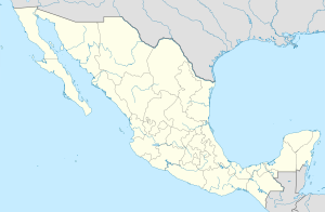
State Map Position | |||
Content
General information
The municipality got its name in honor of Felipe Carrillo Puerto - Governor of the State of Yucatan (1922-1924) [3] .
The area of the municipality is 13432 km², which is 30% of the total state area [4] . It borders with other municipalities of the state of Quintana Roo: in the north-east with Tulum , in the south with Bacalar , and in the west with Jose Maria Morelos , and also, in the north-west it borders with the other state of Mexico - Yucatan , and east washed by the Caribbean .
Institution and composition
The municipality was formed in 1974 , when the state of Quintana Roo was created , it consists of 216 settlements, the largest of which are:
| Code INEGI | Locality | Number of the population (2005) [5] | Number of the population (2010) [1] |
|---|---|---|---|
| 002 | Total | 65373 | 75026 |
| 0001 | Felipe Carrillo Puerto ( Spanish: Felipe Carrillo Puerto ) (administrative center) | 21530 | 25744 |
| 0250 | Tihosuco ( Spanish: Tihosuco ) | 4607 | 4994 |
| 0044 | Chunhuhub [6] ( Spanish: Chunhuhub ) | 3928 | 4644 |
| 0239 | Senior ( Spanish Señor ) | 2872 | 3095 |
| 0248 | Tepich ( Spanish: Tepich ) | 2573 | 2753 |
| 0108 | Nohbek [7] ( Spanish: Noh-Bec ) | 1883 | 2045 |
| 0276 | Shhasil Sur [7] ( Spanish X-Hazil Sur ) | 1305 | 1422 |
| 0282 | Shpichil [6] ( Spanish X-Pichil ) | 1265 | 1340 |
| 0126 | Polyuk ( Spanish Polyuc ) | 934 | 1226 |
| 0053 | Tsula ( Spanish: Dzulá ) | 1102 | 1223 |
Economics
According to statistics from 2000, the working population is employed by sectors of the economy in the following proportions: agriculture, livestock and fishing - 49.8%, industry and construction - 12.3%, services and tourism - 36.3%, etc. - 1.6% [4] .
Infrastructure
According to 2010 statistics, the infrastructure is developed as follows [4] :
- electrification: 94.7%;
- water supply: 96.8%;
- water disposal: 63.7%.
Photos
|
Notes
- ↑ 1 2 INEGI. 2010 Mexico Census (Spanish)
- ↑ Postal codes of Felipe Carrillo Puerto
- ↑ Encyclopedia of the Municipalities of Mexico. Felipe Carrillo Puerto (Spanish)
- ↑ 1 2 3 National Municipal Information System (Spanish)
- ↑ INEGI. 2005 Mexico Census Archived July 22, 2011. (Spanish)
- ↑ 1 2 On the map of the General Staff
- ↑ 1 2 On the map of the General Staff
Links
- Official Page (Spanish)
See also
- Municipalities of Quintana Roo
- Portal: Mexico

