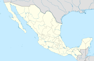
Oshkutskab ( isp. Oxkutzcab ) - a municipality in Mexico , Yucatan , with the administrative center in the eponymous city. The population, according to the 2010 census, was 29,325 people.
| Municipality of Mexico (AE Level 2) | ||
| Oshkutskab | ||
|---|---|---|
| Oxkutzcab | ||
| ||
| A country | ||
| State | Yucatan | |
| Adm Centre | Oshkutskab (23,096 people, 79%) | |
| Number of settlements | 42 | |
| Population ( ▲ 2010 , census) | 29 325 people [one] | |
| Density | 57.2 person / km² | |
| Language composition | spanish yucatec | |
| Square | 512.23 km² | |
| Heights • highest point | Nokakab (136 m ) | |
| Coordinates of the administrative center | ||
| Coordinates extreme points | 19 ° 58 '- 20 ° 21' N 89 ° 22 '- 89 ° 46' w. | |
| Formed by | 1918 | |
| Chairman (2010–2012) | Jose Gualberto Ayora Camara [2] | |
| Timezone | UTC-6 , in summer UTC-5 | |
| Postcode | 97880—97887 [3] | |
| INEGI code | 056 | |
| http://www.oxkutzcab.com/ (isp.) | ||
State map | ||
General Information
The name Oxkutzcab can be translated from the Mayan language in two ways: a city founded three times or a ramon , tobacco and honey gathering place .
The area of the municipality is 512.23 km², it borders with other municipalities of Yucatan : in the north with Tikul and Mani , in the east with Akil , in the southeast with Tekash , and in the west with Santa Elena . Also in the southwest, Oshkutskab is bordered by the municipalities of Campeche . [four]
Establishment and composition
The municipality was formed in 1918 . The municipality includes 42 settlements, the largest of which are:
| Locality | Number of population (2005) [5] | Number of population (2010) [1] |
| Total | 27,084 | 29 325 |
| Oshkutskab (administrative center) | 21 341 | 23,096 |
| Yashhachen | 1,517 | 1,633 |
| Shohuayan | 1,340 | 1,405 |
| Emiliano Zapata | 1 212 | 1,350 |
| Shul | 1,032 | 1 110 |
Economic Activity
The working population is employed by sector in the following proportions [6] :
- trade, services and tourism - 43.3%;
- agriculture and cattle breeding - 39.5%;
- production and construction - 16.3%.
Infrastructure
According to statistics from 2000, the infrastructure is developed as follows [4] :
- road length: 365.3 km;
- electrification: 90.8%;
- water supply: 88.7%;
- water disposal: 53.4%.
Attractions
In the municipality you can visit [6] :
- St. Francis of Assisi Church , built in the XVIII century ;
- Church of the Blessed Virgin of Pilar, built in the 17th century ;
- the chapel of St. Esteban , built in the XIX century ;
- former Hacienda Tabi;
- several archaeological sites of the Mayan civilization .
Sources
- ↑ 1 2 INEGI. Mexico Census 2010 (Spanish)
- ↑ Results of the elections of the chairmen of the municipalities of Yucatan - 2010 Archived September 16, 2011.
- ↑ Postal codes of Oshkutskaba
- ↑ 1 2 Encyclopedia about the municipalities of Mexico. Oshkutskab Archival copy of September 27, 2007 on the Wayback Machine (isp.)
- ↑ INEGI. Mexico Census 2005 Archived July 22, 2011. (isp.)
- ↑ 1 2 Oshkutskab on the official website of the state of Yucatan Archival copy of July 24, 2009 on the Wayback Machine (isp.)
See also
- Municipalities of Yucatan
- Portal: Mexico

