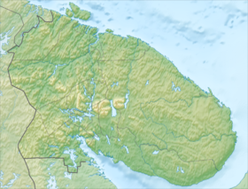
Chunatundra is a mountain range in the Murmansk region . The highest point is Mount Ebruchorr (1114 m above sea level). Located west of Lake Imandra . Included in the Lapland Nature Reserve [1] . It is composed of igneous rocks. The slopes of the mountains are covered with forest vegetation . The tops are flat, rocky. The largest peaks are Kamlagchorr (1064 m), Yllchorr (940 m), Seidnotchorr (806 m), Kerkchorr (886 m), Ruapnun (685 m), etc. The Chuna River flows along the western side of the massif. At the foot of the mountains there are many lakes, the largest of which are: Chunozero , Seyd'yavr , Vite, Myaskoye, Chinglesyavr, Tuyapyavr and Eljavr. It borders on the Monchetundra mountain range (in the east). [2] . In the north it passes into the Wolf Tundra . In the west of Chunatundra, the valley of the Chun River is separated from the Nyavka Tundra massif.
| Chunatundra | |
|---|---|
| Location | |
| A country |
|
| The subject of the Russian Federation | Murmansk region |

Notes
- ↑ Chunatundra - an article from the Great Soviet Encyclopedia .
- ↑ Topographic map