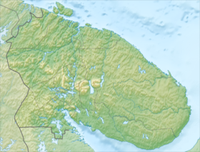
Kanozero is a lake in the Murmansk region , located in the southwest of the Kola Peninsula . It belongs to the White Sea basin , is connected with it by the Umba River, on which, in fact, it is located. Lake food is mostly snowy. The rivers Umba , Muna and Kana flow into the lake. Two branches of the Umba flow out: Kitsa (Padun threshold) and Rodving (Kanozersky threshold), which 10 km downstream will flow into Lake Ponchozero . [2] Ice freezing in October-November, ice drift in May-early June. The lake is also known for Kanozero petroglyphs . Surface area - 84.3 km². The catchment area is 4920 km². Altitude - 52 m.
| Lake | |
| Canozero | |
|---|---|
 | |
| Morphometry | |
| Absolute height | 52 m |
| Dimensions | 32 × 6 km |
| Square | 84.3 km² |
| Pool | |
| Pool area | 4920 km² |
| Flowing rivers | Umba , Muna , Kana |
| Flowing river | Umba |
| Location | |
| A country |
|
| The subject of the Russian Federation | Murmansk region |
| Identifiers | |
| HWR : | |


Notes
- ↑ Surface Water Resources of the USSR: Hydrological Understanding. T. 1. Kola Peninsula / ed. Yu.A. Yelshin. - L .: Gidrometeoizdat, 1969 .-- 134 p.
- ↑ Topographic map
Links
- State Water Register: Lake Kanozero (Can Lake) . // textual.ru. Date of treatment January 23, 2012. Archived March 11, 2012.