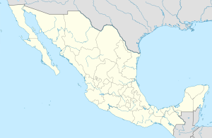
Salvador-Alvarado ( Spanish: Salvador Alvarado ) is a municipality in Mexico , the state of Sinaloa , with the administrative center in the city of Guamuchil . The population, according to the 2010 census, was 79085 people.
| Municipality of Mexico (AE Level 2) | ||
| Salvador Alvarado | ||
|---|---|---|
| isp. Salvador alvarado | ||
| ||
| A country | ||
| State | Sinaloa | |
| Adm Centre | Guamuchil (63,743 people, 81%) | |
| Number of settlements | 86 | |
| Population ( ▲ 2010 , census) | 79,085 people [one] | |
| Density | 102.2 person / km² | |
| Language composition | Spanish | |
| Square | 774 km² | |
| Heights • highest point | Terrero de los Guerrero (200 m ) | |
| Coordinates of the administrative center | ||
| Coordinates extreme points | 19 ° 30 '- 19 ° 36' N 99 ° 05 '- 99 ° 15' W.D. | |
| Formed by | 1963 | |
| Chairman (2016—2018) | Carlo Mario Ortiz Sanchez ( PRI - PNA Coalition) | |
| Timezone | UTC-6 , in summer UTC-5 | |
| Telephone code | +52 673 | |
| Postcode | 81400-81520 [2] | |
| INEGI code | 25015 | |
| http://www.salvadoralvarado.gob.mx (isp.) | ||
State map | ||
Content
General Information
The name Salvador Alvarado is given in honor of politician and revolutionary Salvador Alvarado [3] .
The area of the municipality is equal to 774 km ², which is 1.35% of the area of the state [4] . It is bordered by the other municipality of the state of Sinaloa : in the north with Sinaloa , in the east with Mokorito , in the south with Angostura , and in the west with Guasave .
Establishment and composition
The municipality was formed in 1963 [3] , it includes 86 settlements:
| Code INEGI | Locality | Number of population (2005) [5] | Number of population (2010) [1] |
|---|---|---|---|
| 015 | Total | 76537 | 79085 |
| 0001 | Guamuchil ( Spanish Guamúchil ) (administrative center) | 61862 | 63743 |
| 0040 | Benito juarez ( isp. Benito Juárez ) | 5128 | 5480 |
| 0016 | Gabriel-Leyva-Velasquez ( Spanish: Gabriel Leyva Velázquez ) | 710 | 776 |
| 0034 | El salitre ( El Salitre ) | 745 | 754 |
| 0044 | Tultit ( Spanish Tultita ) | 683 | 716 |
Economic Activity
According to statistics from 2000, the working population is employed by sector in the following proportions: agriculture, cattle breeding and fishing - 13.7%, industry and construction - 19.3%, services and tourism - 62.9%, other - 4.1% [4] .
Infrastructure
According to the statistics of 2010, the infrastructure is developed as follows [4] :
- electrification: 99.5%;
- water supply: 96%;
- water disposal: 96.8%.
Tourism
Major Attractions [3] :
- historical monuments to Salvador Alvarado , José Maria Morelos , Miguel Hidalgo y Costilla , Pedro Infanto and Benito Juárez ;
- architectural monuments: the former hacienda Sienega de Casal, several hotels built in the 19th century;
- Cerro de Mokaomos i Terreros is a tourist zone with buildings from the colonial period and a place for sport hunting and fishing near the dam Eustkio Bueln.
Photos
|
Sources
- ↑ 1 2 INEGI. Mexico Census 2010 (Spanish)
- ↑ Postal codes for Salvador Alvarado
- ↑ 1 2 3 Encyclopedia about the municipalities of Mexico. Salvador Alvarado
- ↑ 1 2 3 National Municipalities Information System (Spanish)
- ↑ INEGI. Mexico Census 2005 Archived July 22, 2011. (isp.)
See also
- Municipalities of Sinaloa
- Portal: Mexico
