Rio Lagartos ( Spanish: Río Lagartos ) is a municipality in Mexico , the state of Yucatan , with an administrative center in the city of the same name . The population, according to the 2010 census, was 3,438 people.
| Municipality of Mexico (AE Level 2) | ||
| Rio Lagartos | ||
|---|---|---|
| Rio lagartos | ||
| ||
| A country | ||
| State | Yucatan | |
| Adm. Centre | Rio Lagartos (2218 people, 65%) | |
| Population ( ▲ 2010 , census) | 3438 people [one] | |
| Density | 13.8 people / km² | |
| Language composition | Spanish, Yucatec | |
| Names of residents | Riolagartense | |
| Square | 249.1 km² | |
| Heights • highest point | 8 m | |
| Coordinates of the administrative center | ||
| Coordinates extreme points | 21 ° 24 '- 21 ° 36' N 88 ° 02 '- 88 ° 13' W | |
| Chairman (2010–2012) | Heisler Ramir Pacheco Alcoser [2] (PRI) | |
| Timezone | UTC − 6 , summer UTC-5 | |
| Postcode | 97720—97726 [3] | |
| INEGI Code | 061 | |
| http://www.riolagartos.gob.mx (Spanish) | ||
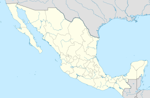
State Map Position | ||
Content
General information
The name of the municipality and the city was borrowed from the Lagartos River, which the discoverers named so because of the large number of crocodiles living here. From Spanish Lagartos can be translated as caimans .
The area of the municipality is 249.1 km², it borders with other municipalities of Yucatan : in the east with Tisimin , in the south with Panaba , and in the west with San Felipe . In the north, the shores of the municipality are washed by the Gulf of Mexico . [four]
Institution and composition
The exact date of the formation of the municipality has not been preserved, but in the records of 1900 it is mentioned that the settlement of Rio Lagartos is the center of the municipality of the same name. The municipality includes 28 settlements, the largest of which are:
| Locality | Number of the population (2005) [5] | Number of the population (2010) [1] |
| Total | 3,272 | 3,438 |
| Rio Lagartos (administrative center) | 2 127 | 2 218 |
| Las colorados | 1,068 | 1,151 |
| San salvador | 15 | five |
Economic activity
The working population is employed by sectors of the economy in the following proportions [6] :
- agriculture and fishing - 41.2%;
- trade, services and tourism - 37%;
- manufacturing and construction - 19.2%.
Infrastructure
According to statistics from 2000, the infrastructure is developed as follows [4] :
- length of roads: 104.8 km;
- electrification: 92.5%;
- water supply: 93.6%;
- water disposal: 83.3%.
Sources
- ↑ 1 2 INEGI. 2010 Mexico Census (Spanish)
- ↑ Results of the election of chairmen of the municipalities of Yucatan - 2010 Archived on September 16, 2011.
- ↑ Postal codes of Rio Lagartos
- ↑ 1 2 Encyclopedia of the Municipalities of Mexico. Rio Lagartos Archived May 1, 2007 on Wayback Machine (Spanish)
- ↑ INEGI. 2005 Mexico Census Archived July 22, 2011. (Spanish)
- ↑ Rio Lagartos on the official website of the state of Yucatan Archived on March 14, 2010. (Spanish)
See also
- Municipalities of Yucatan
- Portal: Mexico
