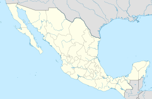
Progreso ( Spanish: Progreso ) is a municipality in Mexico , Yucatan , with an administrative center in the city of the same name . The population according to the 2010 census was 53,958 .
| Municipality of Mexico (AE Level 2) | ||
| Progreso | ||
|---|---|---|
| Spanish Progreso | ||
| ||
| A country | ||
| State | Yucatan | |
| Adm. center | Progreso (37 369 people, 69%) | |
| Number n.p. | fifteen | |
| Population ( ▲ 2010 , census) | 53 958 people [one] | |
| Density | 69.9 people / km² | |
| Language composition | Spanish, Yucatec | |
| Names of residents | Progreseño | |
| Area | 772 km² | |
| Heights • highest point | Chen-Waiyun (6 m ) | |
| Geographic Center Coordinates | ||
| Coordinates extreme points | 21 ° 08 '- 21 ° 22' N 89 ° 29 '- 89 ° 52' W | |
| Educated | 1875 year | |
| Chairman (2018–2021) | Julian Sakaryas Kuri ( PAN — PMC) | |
| Timezone | UTC − 6 , summer UTC-5 | |
| Telephone code | +52 969 | |
| Postcode | 97320—97330 [2] | |
| INEGI Code | 31059 | |
| http://www.ayuntamientodeprogreso.gob.mx/ (Spanish) | ||
State Map Position | ||
Content
- 1 General
- 2 Institution and composition
- 3 Economics
- 4 Infrastructure
- 5 Attractions
- 6 Photos
- 7 notes
- 8 References
- 9 See also
General information
The name Progreso is translated from Spanish as progress, development .
The area of the municipality is 772 km², which is 1.94% of the total state area [3] , and the highest point is 6 meters, located in the Chen-Wuyun settlement [1] .
It borders with other municipalities of Yucatan : in the east with Ishil , in the south with Chikshulub-Pueblo , Merida and Uku , in the west with Hunukma , and in the north it is washed by the waters of the Gulf of Mexico .
Institution and composition
The municipality was one of the first in the state on January 8, 1875 [4] , it consists of 15 settlements, the largest of which are:
| The code INEGI | Locality | Number of the population (2005) [5] | Number of the population (2010) [1] |
|---|---|---|---|
| 059 | Total | 49454 | 53958 |
| 0001 | Progreso ( Spanish: Progreso ) (administrative center) | 35519 | 37369 |
| 0004 | Chikshulub Puerto ( Spanish: Chicxulub Puerto ) | 5052 | 6010 |
| 0026 | Campestre Flamboyanes ( Spanish Campestre Flamboyanes ) | 3022 | 4027 |
| 0003 | Chelem ( Spanish Chelem ) | 3017 | 3509 |
| 0005 | Chuburná ( Spanish: Chuburná ) | 1720 | 1929 |
| 0009 | San Ignacio ( Spanish: San Ignacio ) | 767 | 766 |
| 0078 | El Paraíso ( Spanish: El Paraíso ) | 285 | 315 |
Economics
According to statistics from 2000, the working-age population is employed by sectors of the economy in the following proportions [3] :
- trade, services and tourism - 60.4%;
- manufacturing and construction - 21.7%;
- agriculture and livestock - 16.2%;
- unemployed - 1.7%.
Infrastructure
According to 2010 statistics, the infrastructure is developed as follows [3] :
- length of roads: 99 km;
- electrification: 99%;
- water supply: 98.7%;
- water disposal: 97.4%.
Attractions
The main attractions that can be visited in the municipality are the buildings of the XIX century [4] :
- City Hall;
- lighthouse;
- huge customs marina;
- former Hacienda San Ignacio;
- San Jose Church;
- Chapel of San Antonio .
Photos
Administration building
Progreso Pier - the longest on the Yucatan
Beach in Progreso
Church in San Ignacio
Lighthouse in Progreso
Trade in Progreso
Notes
- ↑ 1 2 3 INEGI. 2010 Mexico Census (Spanish)
- ↑ Postal codes of Progreso1
- ↑ 1 2 3 National Municipal Information System (Spanish)
- ↑ 1 2 Encyclopedia of the Municipalities of Mexico. Progreso (Spanish)
- ↑ INEGI. 2005 Mexico Census Archived July 22, 2011. (Spanish)
Links
- Official site (Spanish)
See also
- Municipalities of Yucatan
- Portal: Mexico
