Casas Grandes ( Spanish: Casas Grandes ) is a municipality in Mexico , Chihuahua with an administrative center in the village of the same name . The population according to the 2010 census was 10 587 people.
| Municipality of Mexico (AE Level 2) | ||
| Casas grandes | ||
|---|---|---|
| Spanish Casas grandes | ||
| ||
| A country | ||
| State | Chihuahua | |
| Adm. Centre | Casas Grandes (5256 people, 50%) | |
| Number n.p. | 149 | |
| Population ( ▲ 2010 , census) | 10 587 people [one] | |
| Density | 2.8 people / km² | |
| Square | 3755 km² | |
| Heights • highest point | Ejido Las Playas (2500 m ) | |
| Geographic Center Coordinates | ||
| Coordinates extreme points | 29 ° 45 '- 30 ° 41' N 107 ° 54 '- 108 ° 38' W | |
| Educated | 1825 year | |
| Chairman (2018–2021) | Yesenia Guadalupe Reyes Calsadias ( PAN ) | |
| Timezone | UTC − 7 , summer UTC-6 | |
| Telephone code | +52 636 | |
| Postcode | 31850-31863 [2] | |
| INEGI Code | 08013 | |
| http://www.casasgrandes.gob.mx/ (Spanish) | ||
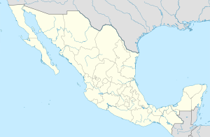
State Map Position | ||
Content
General information
The name Casas Grandes can be translated from Spanish as large houses . The great houses of Francisco de Ibarra called the pyramids in the nearby city of the Indians of Pacima when he explored these lands in 1565 .
The area of the municipality is 3755 km², which is 1.52% of the state’s total area [3] , and the highest point is 2500 meters, located in the settlement of Ejido las Playas [1] .
It borders with other municipalities of the state of Chihuahua: in the north of Hanos , in the east with Nuevo Casas Grandes , Galeana and Ignacio Zaragoza , in the south with Madera , and in the west with another state of Mexico - Sonora [4] .
The municipality has the Pakime Archaeological Zone - the remains of the ancient city of the Indians.
Institution and composition
The municipality was formed in 1825, it includes 149 settlements, the largest of which are:
| Code INEGI | Locality | Number of the population (2005) [5] | Number of the population (2010) [1] |
|---|---|---|---|
| 034 | Total | 8413 | 10587 |
| 0001 | Casas Grandes ( Spanish: Casas Grandes ) | 3835 | 5256 |
| 0018 | Juan Mata Ortiz ( Spanish: Juan Mata Ortíz (Pearson) ) | 955 | 1182 |
| 0017 | Colonia Juarez ( Spanish: Colonia Juárez ) | 1046 | 1035 |
| 0311 | Henriques [6] ( Spanish: Sección Enríquez ) | 522 | 609 |
| 0014 | Guadalupe victoria ( Spanish: Guadalupe Victoria ) | 358 | 394 |
| 0007 | Colony of Quautemock ( Spanish Colonia Cuauhtémoc ) | 291 | 327 |
Economics
According to statistics from 2000, the working population is employed by sectors of the economy in the following proportions: agriculture, livestock and fishing - 42.6%, industry and construction - 29.3%, services and tourism - 26%, other - 2, 1% [3] .
Infrastructure
According to 2010 statistics, the infrastructure is developed as follows [3] :
- electrification: 96.4%;
- water supply: 96.6%;
- water disposal: 85.8%.
Photos
Stella with the name
Archaeological Zone of Pakime
Municipality nature
Notes
- ↑ 1 2 3 INEGI. 2010 Mexico Census (Spanish)
- ↑ Postal codes of Casas Grandes
- ↑ 1 2 3 National Municipal Information System (Spanish)
- ↑ Encyclopedia of the Municipalities of Mexico. Casas Grandes (Spanish)
- ↑ INEGI. 2005 Mexico Census Archived July 22, 2011. (Spanish)
- ↑ On the map of the General Staff
Links
- Official Page (Spanish)
See also
- Municipalities of Chihuahua
- Portal: Mexico

