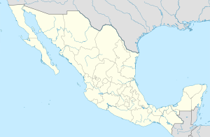
Apastla ( Spanish: Apaxtla ) is a municipality in Mexico , the state of Guerrero , with the administrative center in the city of Apastla de Castrejón . The population according to the 2010 census was 12,389.
| Municipality of Mexico (AE Level 2) | ||
| Apastla | ||
|---|---|---|
| Apaxtla | ||
| ||
| A country | ||
| State | Guerrero | |
| Adm. Centre | Apastla de Castrejón (7037 people, 57%) | |
| Number n.p. | 39 | |
| Population ( ▲ 2010 , census) | 12 389 people [one] | |
| Density | 19.8 people / km² | |
| Language composition | Spanish | |
| Square | 627 km² | |
| Heights • highest point | Los Torres (1684 m ) | |
| Coordinates of the administrative center | ||
| Coordinates extreme points | 17 ° 57 '- 18 ° 54' s. w. 99 ° 53 '- 100 ° 51' s. d. | |
| Educated | 1924 year | |
| Chairman (2012—2015) | Efrain Peña Damasio ( PRD ) | |
| Timezone | UTC − 7 , summer UTC-6 | |
| Telephone code | +52 736 | |
| Postcode | 40531-40553 [2] | |
| INEGI Code | 12006 | |
| http://www.apaxtla.gob.mx/ (Spanish) | ||
State Map Position | ||
Content
General information
The name Apaxtla from the Nahuatl language can be translated as: a place in the form of a large bowl [3] .
The area of the municipality is 627 km², which is 0.99% of the state’s area [4] . It borders with other municipalities of Guerrero : in the north with Teloloapan , in the east with Cuezal del Progreso , in the south with General-Eliodoro-Castillo , in the south-west with San Miguel Totolapan , and in the west with Arcelia [5] .
Institution and composition
The municipality was formed on April 30, 1924 [3] , it consists of 39 settlements, the largest of which are:
| Code INEGI | Locality | Number of the population (2005) [6] | Number of the population (2010) [1] |
| 006 | Total | 12 381 | 12 389 |
| 0001 | Apastla de castrejon ( Spanish: Apaxtla de Castrejón ) (administrative center) | 6,819 | 7 037 |
| 0030 | Want ( Spanish: Xochitepec ) | 1,188 | 1,064 |
| 0027 | Tlatsala ( Spanish: Tlatzala ) | 480 | 467 |
| 0020 | San felipe del okote ( Spanish: San Felipe del Ocote ) | 466 | 456 |
| 0025 | Heatstep ( Spanish: Tepoxtepec ) | 406 | 451 |
| 0014 | Liberaltepec ( Spanish Liberaltepec ) | 450 | 434 |
| 0031 | Sacapostepec ( Spanish: Zacapostepec ) | 392 | 418 |
| 0005 | Kakalotepek ( Spanish: Cacalotepec ) | 408 | 405 |
Economic activity
According to statistics from 2000, the working population is employed by sectors of the economy in the following proportions: agriculture, livestock and fishing - 36%, industry and construction - 21.4%, services and tourism - 40.7% [4] .
Infrastructure
According to 2010 statistics, the infrastructure is developed as follows [4] :
- electrification: 97.7%;
- water supply: 75.2%;
- water disposal: 77.2%.
Tourism
The main attractions are [3] :
- archaeological area near the Karakol dam, where a blind man was found;
- Etla-2 archaeological site where the pyramid was discovered;
- A small exhibition of dinosaur remains at a local school.
Sources
- ↑ 1 2 INEGI. 2010 Mexico Census (Spanish)
- ↑ Postal codes of Apastle
- ↑ 1 2 3 Encyclopedia of the municipalities of Mexico. Apastla Archived December 3, 2013.
- ↑ 1 2 3 National Municipal Information System (Spanish)
- ↑ Apastla on the state website (inaccessible link) (Spanish)
- ↑ INEGI. 2005 Mexico Census Archived July 22, 2011. (Spanish)
See also
- Municipalities of Guerrero
- Portal: Mexico

