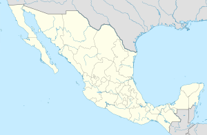
Amatlán de Cañas ( Spanish: Amatlán de Cañas ) is a municipality in Mexico , the state of Nayarit , with an administrative center in the city of the same name . The population according to the 2010 census was 11,188 people.
| Municipality of Mexico (AE Level 2) | ||
| Amatlan de Cañas | ||
|---|---|---|
| Amatlán de cañas | ||
| A country | ||
| State | Nayarit | |
| Adm. center | Amatlan de Cañas (3157 people, 28%) | |
| Population ( ▲ 2010 , census) | 11 188 people [one] | |
| Density | 14.6 people / km² | |
| Language composition | Spanish | |
| Square | 765 km² | |
| Heights • highest point | La Aguilla (1657 m ) | |
| Coordinates of the administrative center | ||
| Coordinates extreme points | 20 ° 36 '- 21 ° 00' N 104 ° 14 '- 104 ° 38' W | |
| Educated | 1918 year | |
| Chairman (2008–2011) | Arturo Beckerra Tapia | |
| Timezone | UTC − 7 , summer UTC-6 | |
| Telephone code | +52 324 | |
| Postcode | 63960—63990 [2] | |
| INEGI Code | 003 | |
| http://www.ayuntamientoamatlan.com/page2.aspx (Spanish) | ||
State Map Position | ||
Content
General information
The name Amatlán can be translated from the Nahuatl language as: a place with many Amate trees . Amate ( lat. Ficus glabrata ) ( es ) - the bark of this plant was used by the Indians as recording paper ( es ) . The word Cañas , from Spanish - reed , appeared in the name later, designating this territory as rich in sugar cane.
The area of the municipality is 765 km², which is 2.77% of the state. It borders with other municipalities of Nayarit : in the north-west with Auacatlan , and in the north-east with Istlan del Rio , and in the east, south and west with another state of Mexico - Jalisco [3] .
Institution and composition
The municipality was formed in 1918 [3] , it consists of 40 settlements, the largest of which are:
| Locality | Number of the population (2005) [4] | Number of the population (2010) [1] |
| Total | 10 392 | 11 188 |
| Amatlan de Cañas (Administrative center) | 3 012 | 3 157 |
| Estancia de los Lopez | 2 163 | 2,225 |
| El Rosario | 1 016 | 1,330 |
| Tepusuacan | 836 | 977 |
| Mesquite | 639 | 603 |
| San blasito | 470 | 500 |
| Jesus maria | 419 | 474 |
| Barranca del Oro | 343 | 390 |
| La yerbabuena | 304 | 297 |
Economic activity
The working population is employed by sectors of the economy in the following proportions [3] :
Agriculture and livestock - 59%
- The main crops grown are: corn , beans , peanuts , potatoes and sorghum . Fruit plantations have also been developed: bananas , papaya , plums , avocados and citrus fruits .
- Cattle breeding is represented by cattle , pigs , horses , sheep and goats , as well as apiaries .
- Fishing is not industrial in scope and exists only for personal needs.
Production and construction - 16.2%
- Logging of wood: pine and oak.
- The production is represented by flour mills, bakeries, peanut processing, the manufacture of mosaic ceramics, soap and ice.
- Minerals such as gold , silver , copper , lead and zinc are mined .
Trade, services and tourism - 21.3%
- In the municipality there are many trading enterprises, banks and other services.
Infrastructure
According to statistics from 2005, the infrastructure is developed as follows [3] :
- length of roads: 101.6 km;
- electrification: 97.6%;
- water supply: 97.5%;
- water disposal: 83.3%.
Tourism
In the municipality you can visit [3] :
Architectural Attractions:
- Church of Jesus of Nazareth , built in 1750 ,
- City Hall, built in 1899 .
Museums: several expositions of objects of the pre-Hispanic period.
Sources
- ↑ 1 2 INEGI. 2010 Mexico Census (Spanish)
- ↑ Postal codes of Amatlan de Cañasa
- ↑ 1 2 3 4 5 Encyclopedia of the municipalities of Mexico. Amatlan de Cañas (inaccessible link) (Spanish)
- ↑ INEGI. 2005 Mexico Census Archived July 22, 2011. (Spanish)
Links
- Official site (inaccessible link) (Spanish)
See also
- Municipalities of Nayarit
- Portal: Mexico
