Amatitlan ( Spanish: Amatitlán ) is a municipality in Mexico , Veracruz , located in the Papaloapan region. The administrative center is the city of Amatitlan .
| Municipality of Mexico (AE Level 2) | ||
| Amatitlan | ||
|---|---|---|
| Amatitlán | ||
| A country | ||
| State | Veracruz | |
| Adm. center | Amatitlan | |
| Population | 7155 people | |
| Density | 42.2 people / km² | |
| Language composition | Spanish | |
| Square | 169.44 km² | |
| Coordinates of the administrative center | ||
| Timezone | UTC − 6 , summer UTC-5 | |
| INEGI Code | 30012 | |
| https://web.archive.org/web/20081125092749/http://www.amatitlan.gob.mx/ (Spanish) | ||
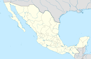
State Map Position | ||
Content
History
In 1831, the municipality of San Padro de Amatlan was formed. In 1938, it was renamed Amatitlan.
Composition
As of 2010, the municipality included 34 settlements. The largest of them:
| Russian name | Spanish name | Population, 2010 [1] |
| Total in the municipality | 7487 | |
| El corte | El corte | 2126 |
| Amatitlan | Amatitlán | 1251 |
| Dos Bokas | Dos bocas | 1091 |
| Ranch Nuevo | Rancho Nuevo (Los Cerros) | 483 |
| El mulato | El mulato | 304 |
Economics
Notes
- ↑ Municipio de Amatitlán . Secretaría de Desarrollo Social (SEDESOL).
