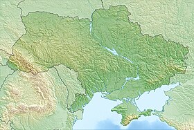
Burnas ( Ukrainian: Burnas ) is a lake [1] located in the south of the Tatarbunar district ( Odessa region ). The area of the water mirror is 26 km². The type of general mineralization is salty . The origin is estuary . The hydrological regime group is closed .
| Lake | |
| Burnas | |
|---|---|
| Ukrainian Burnas | |
 | |
| Morphometry | |
| Absolute height | -0.4 m |
| Dimensions | 7.5 × 4.3 km |
| Area | 26 km² |
| Location | |
| A country |
|
| Region | Odessa region |
| Area | Tatarbunar district |
Content
- 1 Geography
- 2 Nature
- 3 notes
- 4 Literature
Geography
Alibey is a member of the group of lakes Tuzlovsky estuaries . The lake is formed on the site of the former mouth of the Alkali river. Separated from the Black Sea in bulk. The lake basin of an irregular elongated body of water stretching from the northeast to the southwest. The shores in the north are winding and steep with and without beaches, 13 (western) and 7-11 (eastern) m high. The southern coast is gentle and repeats the line of the isthmus with the Black Sea. The lake has two branches Solyonoye (Bazaryan) (separated by an artificially fixed isthmus with a road, but communicated by the fairway) and Kurudiol (partially separated). Lake Kurudiol adjoins to the west, and Alibei to the west. Lakes Shagany, Alibey and Burnas form a system of not separated (isthmuses and scythes) lakes.
The lake is characterized by partial drying out and salinization due to a drop in water level. The bottom is covered with mud (black silt), in places - sand with shell. To the east of the lake is the village and resort of Lebedevka .
Nature
The shores of the lake are bird nesting sites. The Sasyk – Shagany – Alibey – Burnas system has received the status of international wetlands as a place of settlement for waterfowl and is included in the international list of the Ramsar Convention for the Protection of Wetlands [2] .
Notes
- ↑ Surface Water Resources of the USSR / Pod. ed. M.S. Kaganer. - Leningrad: Gidrometeoizdat, 1978. - T. 6: Ukraine and Moldova. Issue 1: Western Ukraine and Moldova. from. 489.
- ↑ Shagany-Alibei-Burnas Lakes System . - Information on wetlands on the official website of the Ramsar Convention : ramsar.org (English) (Spanish) (French) . Date of treatment January 26, 2018.
Literature
- Map sheet L-36-73 Tuzla . Scale: 1: 100,000. State of the terrain for 1975. 1978 edition
- Surface water resources of the USSR. Description of rivers and lakes and calculations of the main characteristics of their regime. - T. 6. Ukraine and Moldova. Vol. 1. Western Ukraine and Moldova (without the basin of the Dniester River). - L., Gidrometeoizdat, 1978.- 489 p.

