Dorokhnovo - a village in the Okulovsky municipal district of the Novgorod region , belongs to the Kulota urban settlement .
| Village | |
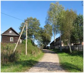
| Dorokhnovo | |
|---|---|
 | |
| A country | |
| Subject of the federation | Novgorod region |
| Municipal district | Okulovsky |
| Urban settlement | Kulota |
| History and geography | |
| First mention | 1495 |
| Center height | 93 [1] m |
| Timezone | UTC + 3 |
| Population | |
| Population | 11 [2] people ( 2010 ) |
| Digital identifiers | |
| Postcode | 174335 |
| OKATO code | |
| OKTMO code | |
Geography
The village is located on the river Krenichno , 4 km south-east of the village Kulotino and 17 km east of the station square Okulovka .
History
It was first mentioned in 1495 in the scribal books of Derevskaya Pyatina [3] . The village of Dorokhnovo was located in the Shegrin Pogost, belonged to the noble Novgorodian Dermaglazov in the middle of the XV century, in the 1470s - to his sons, in the 1480s - to Ivan III, in 1495 - " beyond Oleksandr after Mikulin’s son Saryhozin and behind his children ” [4 ] (p. 188) [5]
In 1773–1927, the village of Dorokhnovo was located in the Borovichsky district of the Novgorod province . From the beginning of the 19th century until 1924, it belonged to the Shegri volost of Borovichi district. [6]
Marked on the maps of 1812 [7] , 1816 [8] , 1829 [9] , 1826-1840 [10] years.
In 1911 in the village of Dorokhnovo there were 34 courtyards with 46 houses and a population of 179 people. There were a chapel and a private shop. [eleven]
The village of Dorokhnovo belonged to the Polischensky Village Council [12] ..
In 1930 the collective farm “Bolshevik” was created here, in 1956 it was renamed the “Bulganin Collective Farm” [12] .
Population
At the beginning of 1955 the population of the village was 132 people, including 81 women and 51 men. [12]
| Population |
|---|
| 2010 [2] |
| eleven |
Transportation
The nearest train station is located in Kulotino.
Notes
- ↑ Determination of latitude and longitude coordinates on the map
- ↑ 1 2 The 2010 All-Russian Population Census. 12. The population of municipal districts, settlements, urban and rural settlements of the Novgorod region . The date of circulation is February 2, 2014. Archived February 2, 2014.
- The first mention of the village Dorokhnovo \\ "village DOROHNOVO"
- ↑ Na Okulovskoy Zemle (3)
- ↑ Novgorod scribal books published by the Archaeographic Commission. Volume II. The census book of Derevskoy Pyatina, circa 1495. Second half. St. Petersburg, 1862.
- ↑ http://xram-v-yazvichax.ru/data/documents/Spravochnik-po-administrativno-territorialnomu-deleniyu.PDF
- ↑ Large map of the Russian Empire of 1812 for Napoleon
- Detailed map of the Russian Empire and nearby overseas possessions. Stolist card
- ↑ Military road map of a part of Russia and border lands
- ↑ Special Map of the Western Part of Russia by Schubert of 1826-1840
- ↑ Lists of populated places of Novgorod province - KartoYug
- ↑ 1 2 3 Dorokhnovo village in 1955 \ "DOROHNOVO village"