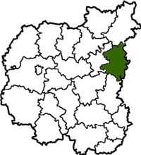
Koropsky district ( Ukrainian: Koropsky district ) is an administrative unit in the east of the Chernihiv region of Ukraine . The administrative center is the urban village of Korop . The area is located in the northeast of the area. It is divided into two geographical zones: southern - Chernihiv Polesie - sandy, in some places swampy plain with pine and mixed forests; and northern - Novgorod-Seversk Polesie - elevated, rugged terrain ravines. The area borders Sosnitsky , Novgorod-Seversky , Bakhmachsky , Borznyansky districts of the Chernihiv region and Krolevetsky , Konotopsky , Shostkinsky districts of the Sumy region . The district includes 2 village councils and 25 village councils.
| area | |||||
| Korop district | |||||
|---|---|---|---|---|---|
| Koropsky district | |||||
| |||||
| A country | Ukraine | ||||
| Included in | Chernihiv region | ||||
| Includes | 2 village councils, 25 village councils | ||||
| Adm. Centre | Korop | ||||
| History and Geography | |||||
| Square | 1312 km² | ||||
| Timezone | EET ( UTC + 2 , summer UTC + 3 ) | ||||
| Population | |||||
| Population | 22 788 [1] people ( 2017 ) | ||||
| Official language | Ukrainian | ||||
 | |||||
![Flag [d]](http://upload.wikimedia.org/wikipedia/commons/thumb/4/4e/Flag_of_Korop_raion.svg/160px-Flag_of_Korop_raion.svg.png)
![Coat of arms [d]](http://upload.wikimedia.org/wikipedia/commons/thumb/d/d7/Koropskiy_rayon_gerb.png/90px-Koropskiy_rayon_gerb.png)
Content
Geography
The area of the district is 1312 km². The Mezinsky National Natural Park is located in the district. The distance from the district center to the regional center on roads is 145 km.
History
Archaeological finds of the remains of primitive man indicate settlements dating from the 20th millennium BC. e. This is evidenced by the exhibits of the Mezinsky Archaeological Museum, created on the site of the world famous site of the Late Paleolithic man (about 15 thousand years ago).
Korop lands were part of Chernigov , and later in the Novgorod-Seversky principality. In the middle of the XIII century, Chernihiv-Seversky Krai fell under the domination of the Tatar-Mongols, and in the middle of the XIV century it became part of the State of Lithuania. From the beginning of the XVI century, he repeatedly passed to the Commonwealth, then to the Principality of Moscow.
Demographics
The population as of 01.01.2006 was 29100 inhabitants., Including about 8 thousand people living in urban conditions. In total there are 67 settlements.
Settlements
Atyusha , Willow, Cherry, Free, Fortification, Zhernovka, Karatsyubino, Karylskoye, Korop, Krasnopole, Kriski, Kurilovka, Kuchi, Nekhaevka, Obolonya, Podolyaki, Pokoshichi, Ponornitsa, Prydesnyanskoye, Proletarskoye, Radichev, Razletskoye, Rozhanyok, Ryaganok, Ryaganok Rybotin, Ryzhki, Ryehly, Sverdlovka, Bruise, Bold, Bold, Sohachi, Stanovoy, Tarasovka, Chervona Glade, Chervona, Chervony Lan, Chereshenki, Chornyavka, Shabalinov, Mezin (Mezinsky parking), Gavrilovka, Chereshki
Famous Natives
- Brushko, Ivan Kuzmich (1907-1982) - Soviet military leader, major general ( 1953 ).
- Gritsenko, Efim Dmitrievich (1908-1945) Hero of the Soviet Union , guard lieutenant colonel , commander of the 117th GSP 39th GSD. Born May 1, 1908 in the village. Shabolinov. [2]
- Crow, Ivan Demyanovich (born 1930) - Soviet geologist, Hero of Socialist Labor (1971).
Notes
- ↑ Population (per estimate) per 1 lipnya 2017 rock (inaccessible link) // Head statistics department in Chernigiv region
- ↑ Gritsenko Efim Dmitrievich | Novosibirsk Book of Memory