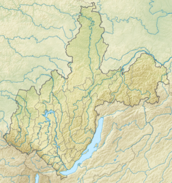
Unga is a river in the Baikal region ( Irkutsk region ), a tributary of the Angara . The length of the river is 85 km [2] . The catchment area is 1660 km² [2] .
| Unga | |
|---|---|
| Characteristic | |
| Length | 85 km |
| Pool | 1660 km² |
| Watercourse | |
| Source | |
| • Coordinates | |
| Mouth | Bratsk Reservoir |
| • Height | 401.7 m |
| • Coordinates | |
| Location | |
| Water system | Bratsk reservoir → Angara → Yenisei → Kara Sea |
| A country |
|
| Region | Irkutsk region |
| Areas | Zalarinsky district , Nukutsky district |
| HWR code | |
It starts north of the village of Moiseevka [3] . It flows in a northeast direction through the settlements of Khanzhinovo , Tyret 1 , Korsungay and Semenovskoye [4] [5] . It flows through the Balagan-Nukutskaya forest-steppe . It is characterized by low water content : in the area of the village of Semenovsky, the average annual runoff is 23 mm [6] . The height of the mouth is 401.7 m above sea level [5] .
Content
Toponymy
- in Yakut "Unga" - right
- in Buryatian "Unghe" - color
History
In the period from V to X - XI centuries , the Ungi valley was inhabited by the Kurykans , the Turkic people , considered the ancestors of the Yakuts [7] . Subsequently, the Kurykans were driven north by the Buryat ancestors, as a result, the Ungi Valley was occupied by a Bulagat tribe [8] . In the middle of the XVII century , the Balagan prison was laid at the mouth of the Unga, which served as the starting point of the Russian colonization of the Upper Angara. Currently, the old city of Balagansk, formed on the site of the same prison, is flooded by the waters of the Bratsk reservoir , and modern Balagansk is built away from the old [7] .
On both sides of the Unga River stood the settlement of Matagan , now abolished. Standing on the river, in the territory of the modern Khanzhinovsky municipality, was the abolished village of Agilmay .
Tributaries
The objects are listed in order from the mouth to the source [2] [5] [4] [3] .
- 7 km: Her (lv)
- 8 km: Tangutka (lv)
- 15 km: Kuita (lv)
- 28 km: Haytik (lv)
- 48 km: Tyret (lv)
- 61 km: Darkhan (lv)
- 68 km: Yandon (lv)
Water registry data
According to the state water register of Russia, it belongs to the Angara-Baikal basin district . The code of the water body is 16010100812116200005126 [2] .
Notes
- ↑ Surface Water Resources of the USSR: Hydrological Understanding. T. 16. Angara-Yenisei region. Vol. 2. Hangar / ed. T.S. Kirillova, N.N. Korchazhnikova. - L .: Gidrometeoizdat, 1965 .-- 224 p.
- ↑ 1 2 3 4 State Water Register . Unga . textual.ru . Ministry of Natural Resources of Russia (March 29, 2009). Date of treatment December 20, 2018. Archived March 29, 2009.
- ↑ 1 2 Map sheet N-48-85 Troitsk . Scale: 1: 100,000. 1986 edition.
- ↑ 1 2 Map sheet N-48-73 Winter . Scale: 1: 100,000. Status of the terrain for 1982. 1986 edition
- ↑ 1 2 3 Map sheet N-48-74 Novonukutsky . Scale: 1: 100,000. Status of the terrain for 1982. 1988 edition
- ↑ Flora of vascular plants of the Saying region within the Irkutsk region . bankrabot.com . Date of treatment December 5, 2018.
- ↑ 1 2 Ryabtsev V.V. Eagles of Baikal. Irkutsk, 2000. (inaccessible link) . www.baikalfoto.ru . Date of treatment December 5, 2018. Archived on April 10, 2010.
- ↑ Buryat tribes (inaccessible link - history ) . www.baikalfoto.ru . Date of treatment December 5, 2018.
Links
- On the geographical names of the Irkutsk region . ilin-yakutsk.narod.ru . Date of treatment December 5, 2018.
