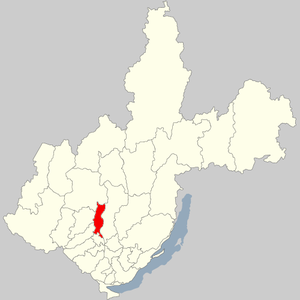
Balagansky district - a municipality in the Irkutsk region of the Russian Federation .
| metropolitan area | |||
| Balagansky district | |||
|---|---|---|---|
| |||
| A country | Russia | ||
| Enters into | Irkutsk region | ||
| Adm Centre | |||
| District head | Mikhail V. Kibanov | ||
| History and geography | |||
| Date of education | 1989 | ||
| Square | 6347.22 [1] km² (25th place ) | ||
| Timezone | MSK + 5 | ||
| Population | |||
| Population | ↘ 8608 [2] people ( 2017 ) (0.36%) | ||
| Density | 1.36 persons / km² | ||
| Nationalities | Russians , Buryats | ||
| Denominations | Orthodox, shamanists, Buddhists | ||
| Official language | Russian | ||
 | |||

The administrative center is Balagansk urban-type settlement .
Geography
The area of the district is 6347.22 square meters. km
Balagansky district borders with Ust-Uda , Bratsk , Kuytun , Zima and Nukutsky districts of the region.
- Resources
- Mineral and raw materials: Balaganskoe loamy deposit explored, balance reserves - 251 million tons.
- Forest resources: timber reserves are 91 million m³, of which valuable conifers - 69.6%.
History
In 1962, during the filling of the Bratsk reservoir, the Balagansky district was abolished, and its territory was transferred to the Ust-Uda district. Recreated in 1989. The basis of the regional economy is industry and agriculture.
Population
| Population | ||||||
|---|---|---|---|---|---|---|
| 2002 [4] | 2009 [5] | 2010 [6] | 2011 [7] | 2012 [7] | 2013 [8] | 2014 [9] |
| 9973 | ↘ 9655 | ↘ 9194 | ↗ 9197 | ↘ 9076 | ↘ 8979 | ↘ 8810 |
| 2015 [10] | 2016 [11] | 2017 [2] | ||||
| ↘ 8664 | ↗ 8690 | ↘ 8608 | ||||
- Urbanization
In urban areas (urban-type settlement Balagansk ) live 45.41% of the district.
Both natural decline and migration outflow are noted.
Municipal unit
Since 2004, in Balagansky municipal district there are 13 settlements consisting of one urban and six rural settlements [12] [13] :
| No | Urban and rural settlements | Administrative center | amount inhabited points | Population | Square, km 2 |
|---|---|---|---|---|---|
| one | Balagan municipality | town Balagansk | one | ↘ 3909 [2] | 82.89 [1] |
| 2 | Birita municipality | village of Birit | 2 | ↗ 528 [2] | 135.92 [1] |
| 3 | Zaslavl municipality | Zaslavskaya village | 3 | ↘ 936 [2] | 624.85 [1] |
| four | Konovalov municipality | village Konovalovo | 2 | ↘ 900 [2] | 363.45 [1] |
| five | Kumarei municipality | village Kumareika | one | ↗ 991 [2] | 4136.11 [1] |
| 6 | Tarnopolsky municipality | Tarnopol village | 3 | ↘ 822 [2] | 582.16 [1] |
| 7 | Sharagay municipality | Sharagay village | one | ↘ 522 [2] | 421.84 [1] |
| List of settlements of the district | ||||
|---|---|---|---|---|
| No | Locality | Type of | Population | Municipality |
| one | Anuchinsk | village | ↘ 114 [7] | Tarnopolsky municipality |
| 2 | Balagansk | settlement | ↘ 3909 [2] | Balagan municipality |
| 3 | Birit | village | ↘ 555 [7] | Birita municipality |
| four | Zaslavskaya | village | ↘ 874 [7] | Zaslavl municipality |
| five | Konovalovo | village | ↘ 751 [7] | Konovalov municipality |
| 6 | Kumareyka | village | ↗ 991 [2] | Kumarei municipality |
| 7 | Metlyaeva | village | ↗ 244 [7] | Tarnopolsky municipality |
| eight | Odis | village | → 25 [7] | Birita municipality |
| 9 | Seaside | village | ↘ 3 [7] | Zaslavl municipality |
| ten | Tarasovsk | village | ↘ 122 [7] | Zaslavl municipality |
| eleven | Tarnopol | village | ↘ 501 [7] | Tarnopolsky municipality |
| 12 | Tashlykova | village | ↘ 198 [7] | Konovalov municipality |
| 13 | Sharagay | village | ↘ 522 [2] | Sharagay municipality |
Abolished populated points: Gorny Kui village
Social Sector
- Education: 12 schools, 8 of them - secondary general education, 4 - primary, vocational school in the working village Balagansk.
- Health care: the central district hospital and 10 obstetric centers.
- Cultural institutions: 25 cultural institutions. Local history museum is located in the working village. Balagansk.
- Sports: in each settlement of the district rates of heads of sports sections are entered.
Attractions
On the territory of the district is Balaganskaya cave. The length of all cave passages available to the explorer is almost a kilometer. The height of the individual rooms ranges from 8 to 15 meters. It is located 10 km south-west of the old Balagansk and 3 km from the left bank of the Angara River . It was inhabited in the Iron Age . In the 1950s it was partially flooded [14] .
Notes
- ↑ 1 2 3 4 5 6 7 8 Irkutsk Region. Total land area of the municipality
- ↑ 1 2 3 4 5 6 7 8 9 10 11 12 The population of the Russian Federation by municipalities as of January 1, 2017 (July 31, 2017). The date of circulation is July 31, 2017. Archived July 31, 2017.
- ↑ OKTMO. 179/2016. Siberian Federal District - 2016.
- ↑ All-Russian census of 2002. Tom. 1, table 4. The population of Russia, federal districts, constituent entities of the Russian Federation, districts, urban settlements, rural settlements — regional centers and rural settlements with a population of 3,000 or more . Archived on February 3, 2012.
- ↑ The resident population of the Russian Federation by cities, urban-type settlements and districts as of January 1, 2009 . The date of circulation is January 2, 2014. Archived January 2, 2014.
- ↑ Results of the 2010 All-Russian Population Census in the Irkutsk Region . The appeal date is September 23, 2013. Archived September 23, 2013.
- ↑ 1 2 3 4 5 6 7 8 9 10 11 12 Population by municipalities as of January 1, 2012: stat. bullet Irkutskstat. - Irkutsk, 2012. - 81 p. Circulation date September 24, 2016. Archived September 24, 2016.
- ↑ Population of the Russian Federation by municipalities as of January 1, 2013. - M .: Federal State Statistics Service Rosstat, 2013. - 528 p. (Table 33. Population of urban districts, municipal districts, urban and rural settlements, urban settlements, rural settlements) . The appeal date is November 16, 2013. Archived November 16, 2013.
- ↑ Table 33. The population of the Russian Federation by municipalities as of January 1, 2014 . Circulation date August 2, 2014. Archived August 2, 2014.
- ↑ Population of the Russian Federation by municipalities as of January 1, 2015 . Circulation date August 6, 2015. Archived August 6, 2015.
- Population of the Russian Federation by municipalities as of January 1, 2016
- ↑ On the status and borders of municipalities of Balagansky District of the Irkutsk Region. Archived on September 18, 2007.
- ↑ Composition and Borders of Balagansky District
- ↑ Sergey Rodimov Balaganskaya Cave // Irkipedia : everything about Priangarya