La Iruela ( Spanish: La Hiruela ) - a municipality in Spain , part of the province of Madrid as part of the autonomous community of Madrid . It covers an area of 17.18 km². The population is 66 people (as of 2010 ).
| Municipality | |||||
| La Iruela | |||||
|---|---|---|---|---|---|
| La hiruela | |||||
| |||||
| A country | |||||
| Autonomous community | Madrid | ||||
| Provinces | Madrid | ||||
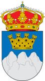
| Chapter | |||||
| History and Geography | |||||
| Square | 17.18 km² | ||||
| Timezone | UTC + 1 , in summer UTC + 2 | ||||
| Population | |||||
| Population | 66 people ( 2010 ) | ||||
| Digital identifiers | |||||
| Postcode | |||||
| Car code | |||||
| Other | |||||
| Position on the map provinces |  | ||||