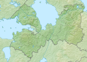
Michurinsky Lake (formerly White Lake , fin. Valkjärvi ) - a lake on the Karelian Isthmus . On the northern shore of the lake is the large village of Michurinskoye . The area is 5.9 km², the catchment area is 26.4 km² [2] .
| Lake Michurin | |
|---|---|
 | |
| Morphometry | |
| Absolute height | 94.1 m |
| Dimensions | 4.5 × 2.5 km |
| Square | 5.9 km² |
| Deepest | 16.5 m |
| Pool | |
| Pool area | 26.4 km² |
| Flowing river | White |
| Location | |
| A country |
|
| The subject of the Russian Federation | Leningrad region |
| Area | Priozersky District |
| Identifiers | |
| HWR : | |

The former name of the lake is due to the weak (compared with other lakes of the Karelian Isthmus) water coloration. Length - 4.5 km, width - 2.5 km. Depth - 16.5 m (eastern reach ). Food mainly from groundwater. Runoff on the Belaya River is negligible. The shores are high, sandy. Coastal shallow water in reed beds 10-20 (sometimes more) meters from the coast. There are vendace , roach , pike , burbot .
Located south of the Morozov Lakes group.
Gallery
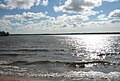
Lake Michurinsky from the side of the village of the same name.

Lake Michurin from the side of the Berezhok village
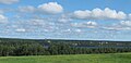
View of the lake from the village of Kucherovo


Notes
- ↑ Surface Water Resources of the USSR: Hydrological Understanding. T. 2. Karelia and the North-West / ed. E.N. Tarakanova. - L .: Gidrometeoizdat, 1965 .-- 700 p.
- ↑ State Water Register . Michurinskoye (Valk-yarvi) . textual.ru . Ministry of Natural Resources of Russia (March 29, 2009). Date of treatment December 20, 2018. Archived March 29, 2009.